Patagonia Lake
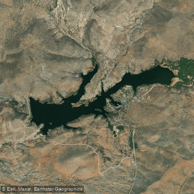
Patagonia Lake
- Boat Ramps
- 1
- Access Points
- 1
- Campsites
- 0
Patagonia Lake offers a 265-acre paddling destination in southern Arizona's Sky Island country at 5,400 feet elevation. The lake features two distinct sections: the east end is a no-wake zone ideal for paddling, while the west end allows motorized traffic. A marina serves as the primary launch point, where paddlers pass under a wooden rainbow bridge before accessing the main body of water.
Though relatively small - paddlers are never more than 300 meters from shore - the lake's numerous small canyons create an engaging 5-mile circumnavigation route. Red rock formations and desert vegetation line the shores, while the surrounding hills provide a scenic backdrop.
The lake is renowned for bird watching opportunities, with frequent sightings of great blue herons, kingfishers, vermilion flycatchers, and various hummingbird species. Wildlife viewing includes opportunities to spot peccaries (wild pigs) foraging along the shoreline. Early mornings provide optimal conditions for both wildlife viewing and calmer waters.
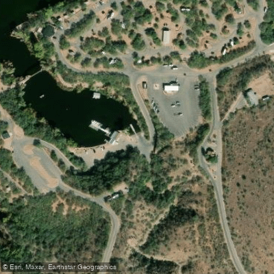
Facilities include a marina offering kayak and canoe rentals, boat ramps, and a campground with electric hookups and shower facilities. The nearby Lakeside Market provides supplies. Day use fees apply, and the park gates operate from 4 AM to 10 PM.
Notable regulations include the prohibition of personal watercraft (jet-skis), waterbikes, above-water exhaust boats, and V-8 jet boats. Water skiing is allowed on weekdays year-round but restricted on weekends and holidays from May through September due to congestion.
The lake was created in 1968 by damming Sonoita Creek, with remnants of the historic New Mexico/Arizona railroad lying beneath its waters. The area became a state park in 1975 and continues to serve as an important recreational resource in southern Arizona.
Water access, boat ramps & amenities
Learn how to get on Patagonia Lake. Uncover great paddling access points, boat ramps, and all the facilities you need for an unforgettable day on the water. Some locations shown may border or include private property. Always check property boundaries and applicable regulations before visiting. PaddleWays's Public & Private Land layer can help you plan your access with confidence.
Paddle smarter with real-time insights
Whether you're en route and conditions shift or you're looking for the best spot based on current flows, we enable you to make informed decisions on the fly.








Find Places to Paddle

Over 400,000 Places to Paddle
Every user gets free access to launch points, boat ramps, and public property parcels.


Water and weather conditions (10 day forecast)
See the best times to paddle Patagonia Lake and check the forecast before you go.
No forecast data available.
Explore Arizona waters
Top paddling waters
Popular Cities
Loading popular cities...
Explore near Patagonia Lake
Access points
Nearby waters
More in Arizona

Smarter Paddling Starts in the App.
Paddleways gives you everything you need to plan smarter, paddle better, and own every trip from first launch to takeout.