Curated by PaddleWays
RouteClass I–IV
- Distance
- 73.3 mi
- Paddle time
- Multi-day
- Put-in → take-out
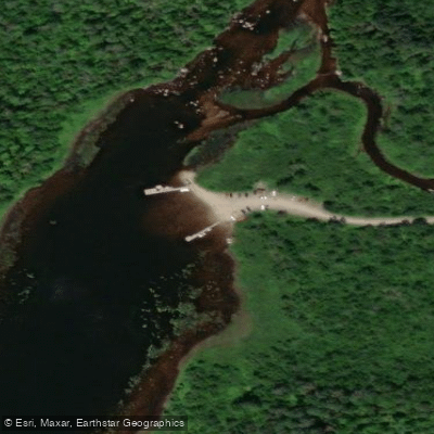
- Skinner Access → Brassua Lake Access
The Moose River, located in western Maine, is a picturesque waterway that offers paddlers a diverse and rewarding experience. This scenic river system is characterized by a mix of serene ponds, winding streams, and exciting rapids, all set against the backdrop of Maine's beautiful northern forest.
The most popular paddling route on the Moose River is the renowned Moose River Bow Trip, a 34-mile loop that begins and ends near Jackman, Maine. This classic journey takes paddlers through a series of interconnected waterways, including Holeb Pond, Attean Pond, and sections of the Moose River itself. The trip gets its name from the bow-shaped route, with the shuttle road forming the "string" of the bow.
Difficulty levels on the Moose River range from easy flatwater paddling to more challenging Class II-III rapids, making it suitable for a wide range of skill levels. Beginners and families can enjoy the calm waters of the ponds, while more experienced paddlers can test their skills in the river's whitewater sections. The Skinner to Brassua Lake section, in particular, offers some thrilling Class I-IV rapids for those seeking an adrenaline rush.
The best time to paddle the Moose River is typically from late spring through early fall, with summer offering the most reliable water levels and pleasant weather. However, spring can provide higher water levels for more exciting whitewater runs, while fall offers stunning foliage views.
Wildlife enthusiasts will appreciate the abundant opportunities for spotting moose, deer, and various bird species along the river's banks. The area is largely undeveloped, providing valuable habitat for native flora and fauna.
Notable landmarks along the Moose River include the Demo Road portage, a challenging 4-mile carry that leads to Little Brassua and Brassua Lakes. Brassua Lake itself is a significant feature, created in 1925 by damming the lower Moose River. The nearby Mount Kineo on Moosehead Lake is another point of interest for paddlers extending their journey.
The town of Jackman serves as the primary access point and base for most Moose River paddling trips. This small community offers essential services and outfitters for those planning river adventures.
Historically, the Moose River played a crucial role in the logging industry, with remnants of this heritage still visible along its banks. Today, it's a popular destination for outdoor enthusiasts, offering a perfect blend of wilderness experience and accessibility.
Safety considerations include being prepared for remote wilderness conditions, as cell phone coverage can be limited. Paddlers should also be aware of potential rapid classifications and portage requirements, especially when water levels are high.
For those seeking a multi-day adventure, the Moose River Bow Trip is an excellent option, typically completed in 3-4 days. More ambitious paddlers can extend their journey by continuing down the Moose River through Long Pond and Brassua Lake, eventually reaching Moosehead Lake for a more extended wilderness experience.
The Moose River is also part of the Northern Forest Canoe Trail, with Section 10 of this epic 740-mile water trail covering 69 miles from Spencer Stream to Moosehead Lake. This section offers paddlers a chance to experience the river in the context of a larger, historic paddling route.
Whether you're looking for a relaxing weekend getaway or a challenging whitewater adventure, the Moose River offers a quintessential Maine paddling experience that will leave you with lasting memories of its natural beauty and diverse waterways.
Curated routes
Hand-picked by the PaddleWays team, with put-ins, take-outs, paddle times and the hazards along the way.
RouteClass I–IV
Hazards
No paddler has reported a hazard here yet, so these are the dams, falls and big rapids on our map. Hazards change with flows and storms, so check them before you launch.
From the community
Nobody has shared a trip on Moose River yet. Paddle it, then tell the next paddler how it went.
See exactly where the public can get on and off the river. Launch points and boat ramps are paired with PaddleWays' public land data so you know where you can legally land.
Public shoreline
7%of the river's shoreline is public
Most of the riverbank is private. Launch, land and camp only at public access points.
Flows, weather and a route-by-route verdict, so you know which stretch of the Moose River is worth paddling today.
No forecast data available.
Scheduled releases and generation forecasts from the dams on Moose River.
Moose River · Below Brassua Dam · Brookfield Renewable
600 cfs now
Forecast updated today at 7:42 PM EST. Schedules can change, so check the operator's page before you go.
Live flows, marked hazards and fresh trip reports from paddlers who were just on the water, all in one place.





Every user gets free access to launch points, boat ramps, and public property parcels.
Loading popular cities...
PaddleWays gives you everything you need to plan smarter, paddle better, and own every trip from first launch to takeout.