Curated by PaddleWays
RouteClass II–III
- Distance
- 20.2 mi
- Paddle time
- 4–7 hrs
- Put-in → take-out
- Grand Pitch Trail Hand Launch → Lunksoos Boat Ramp
Challenging rapid at the end
The Seboeis River is a wild and scenic waterway in north-central Maine, originating near Seboeis Lake and flowing southward for approximately 40 miles before joining the East Branch of the Penobscot River. This pristine river system drains a remote watershed within Maine's North Woods, characterized by dense forests and rugged terrain. The Seboeis offers paddlers a quintessential Maine backcountry experience, with its 20-mile Paddling Trail being the most popular section.
This trail can be divided into two distinct segments: a more challenging 14-mile upper portion from Grand Lake Road to Philpott Snowmobile Bridge, featuring quicker water and Class II-III rapids, and a gentler 6-mile lower section to Lunksoos Camps, ideal for less experienced paddlers. The river's difficulty ranges from Class I to III, with Whetstone Falls presenting the most significant challenge as a solid Class III rapid. Paddlers should have intermediate whitewater skills for the upper section, while the lower portion is suitable for beginners with basic river reading abilities.
Spring snowmelt typically provides optimal water levels from late April through early June. Summer paddling is possible but may require higher skill levels to navigate lower water conditions. Fall colors offer a spectacular backdrop for late-season trips.
The Seboeis River corridor supports a diverse ecosystem, home to moose, black bears, and a variety of bird species including bald eagles. The surrounding forest is primarily composed of spruce, fir, and northern hardwoods.
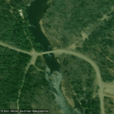
Key landmarks include the Grand Lake Road put-in, Philpott Snowmobile Bridge, and the confluence with the East Branch of the Penobscot. The river passes through Katahdin Woods and Waters National Monument, adding to its scenic and recreational value. Primary access points are located at Grand Lake Road (nearest town: Shin Pond), Philpott Snowmobile Bridge, and Lunksoos Camps. These remote locations require careful planning and self-sufficiency.
Historically, the Seboeis River played a role in Maine's logging industry, with remnants of this heritage still visible along its banks. Today, it represents a vital part of the region's outdoor recreation and conservation efforts.
Safety considerations include limited cell phone coverage, potential for rapidly changing water levels, and the presence of wildlife. Paddlers should be prepared for wilderness conditions and follow Leave No Trace principles. Multi-day trips are possible by combining the Seboeis with the East Branch of the Penobscot, offering an extended backcountry adventure through some of Maine's most pristine landscapes.
Curated routes
Hand-picked by the PaddleWays team, with put-ins, take-outs, paddle times and the hazards along the way.
RouteClass II–III
Hazards
No paddler has reported a hazard here yet, so these are the dams, falls and big rapids on our map. Hazards change with flows and storms, so check them before you launch.
From the community
Nobody has shared a trip on Seboeis River yet. Paddle it, then tell the next paddler how it went.
See exactly where the public can get on and off the river. Launch points and boat ramps are paired with PaddleWays' public land data so you know where you can legally land.
Public shoreline
25%of the river's shoreline is public
Most of the riverbank is private. Launch, land and camp only at public access points.
Flows, weather and a route-by-route verdict, so you know which stretch of the Seboeis River is worth paddling today.
Live flows, marked hazards and fresh trip reports from paddlers who were just on the water, all in one place.





Every user gets free access to launch points, boat ramps, and public property parcels.










Loading popular cities...
PaddleWays gives you everything you need to plan smarter, paddle better, and own every trip from first launch to takeout.