Paddling in Chattahoochee River National Recreation Area
- National Recreation Area

- Lakes
- 3
- Rivers
- 21
- Access
- 26
- Boat Ramps
- 18
- Shops
- 0
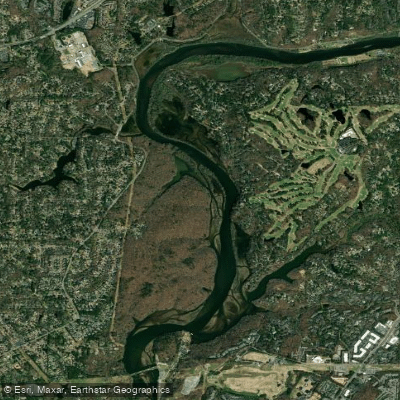
The Chattahoochee River National Recreation Area protects 48 miles of the Chattahoochee River as it flows through metro Atlanta, running from below Buford Dam at Lake Lanier south to the Palisades unit near Vinings.
The river sits along the Brevard Fault Zone, forming the boundary between the Appalachian Mountains and the Piedmont Plateau.
Nearly all of it is moving flatwater — calm enough for tubes and coolers — with occasional Class I shoals and a single Class II rapid in the northern section.
The character of the river changes with Buford Dam: when releases are running, currents strengthen; when the dam is quiet, the water flattens out considerably. The river rarely warms above 50°F year-round, so dress accordingly regardless of air temperature.
Blue mile markers tick off the river from mile 348 at Buford Dam down to mile 300 at the southern end, giving paddlers a reliable way to track progress. The river splits into two navigable sections at Morgan Falls Dam, near mile marker 312.
5 — you'll need to carry around it to continue downstream.
North of the dam, access points include Bowmans Island, Settles Bridge, McGinnis Ferry, Abbotts Bridge, Medlock Bridge, Jones Bridge, Garrard Landing, Island Ford, Don White Memorial Park, Azalea Park, and Overlook Park.
South of Morgan Falls Dam, the river is accessible at Morgan Falls Park, Johnson Ferry North, Powers Island, and Paces Mill — the last takeout point in the park.
Some access points have boat ramps; others, like Don White Memorial Park and Powers Island, are kayak and tube only with no ramp.
The river is open to rafts, canoes, kayaks, and motorboats year-round during daylight hours — from 30 minutes before sunrise to 30 minutes after sunset. Jet skis are not permitted at any time, and night boating is prohibited.
The park does not rent boats, but authorized outfitters operate inside the park boundaries; all rentals are required to include paddles and PFDs.
Currents around submerged rocks and tree snags can be deceptively strong even on calm days, and rubber-soled shoes matter more than they might seem — slippery rocks and occasional debris are real hazards.
Because Buford Dam controls the flow, checking release schedules before launching is standard practice, not optional. The 'Hooch rewards paddlers who pay attention to it.
Top waters to paddle near Chattahoochee River National Recreation Area

Water and weather conditions (10 day forecast)
See the best times to paddle Chattahoochee River National Recreation Area and check the forecast before you go.
No forecast data available.
Park alerts & road status
Closures and conditions Chattahoochee River National Recreation Area has posted, from the National Park Service.
Checking the park's alerts…
Hours & fees
When Chattahoochee River National Recreation Area is open and what it costs to get in, from the National Park Service.
Hours
The park lands and waters are open for visitation from 30 minutes before sunrise to 30 minutes after sunset seven days a week. The Island Ford Visitor Center located in historic Hewlett Lodge is open from 9 am to 5 pm seven days a week except Thanksgiving Day and December 25.
Entrance fees
- Entrance - Per Person$5
- Required for visitors age 16+ entering on foot or by bicycle. Valid for one day.
- Entrance - Private Vehicle$5
- Private vehicle pass admits one private vehicle and its occupants for one day.
- Entrance - Motorcycle$5
- Valid for 1 day. Admits up to 2 private, non-commercial motorcycles with up to 4 total passengers.
Parking & getting around
Where to leave the car in Chattahoochee River National Recreation Area. Lots fill early on busy days, so plan where you will park before you head for the water.
Abbotts Bridge Parking Lot
The parking lot is centrally located near the boat launch, picnic pavilion, and restroom facilities. There are restrictions on where different types of vehicles may be parked so please pay attention to the signage.
Accessibility: The entrance road and parking lot are not paved which may be a challenge for some visitors to negotiate. The boat ramp is paved and should be considered accessible.
Akers Drive Parking Lot
Allenbrook Parking Lot
Azalia Drive Parking Lots
Bowmans Island Parking Lot
ClosedThis parking lot is located just inside the park along the road leading to the U.S. Army Corps of Engineers Lower Pool West Parking Lot. The parking lot is not paved and therefore parking capacity is dictated by how close together vehicles are parked.
Chattahoochee Pointe
Chattahoochee River Environmental Education Center Parking Lot
Columns Drive Parking Lots
Accessibility: This parking lot is both paved and gravel with number of spaces evenly split between the lots.
Don White Gravel Parking Lot
ClosedDon White Parking Lots
Closed
Getting around
To find the Island Ford Visitor Center enter the physical address, 8800 Roberts Drive, Sandy Springs, GA 30350, into your GPS unit or your favorite map software. Once you have arrived at the park entrance turn onto Island Ford Parkway and follow the signs to the park headquarters.
Directions on nps.govPaddle smarter with real-time insights
Whether you're en route and conditions shift or you're looking for the best spot based on current flows, we enable you to make informed decisions on the fly.







Paddling near Chattahoochee River National Recreation Area
Loading...
Other parks in Georgia
Gateway towns
Where to base yourself for paddling in Chattahoochee River National Recreation Area.
Home to park headquarters and visitor center at Island Ford, plus outfitters offering kayak, paddleboard, and tube rentals on the river.
- RoswellGA
Borders the park at Vickery Creek and Gold Branch units, with lodging, dining, and river access serving the northern corridor.
Close to Jones Bridge and McGinnis Ferry units, with lodging options that serve visitors to the park's upper stretch.
- CummingGA
Gateway to the northernmost Bowmans Island unit near Buford Dam, the upstream end of the river corridor.
Chattahoochee River National Recreation Area paddling rules
The park's own rules, on top of Georgia licenses and regulations. Limits, fees and closures change, so check the park's page before you go.

No Jet Skis Allowed
Jet skis are not permitted on the river at any time. Rafts, canoes, kayaks, motor boats, and other small boats are welcome year round.

No Night Boating
The river is open for boating from 30 minutes before sunrise until 30 minutes after sunset. Night boating is not permitted in the park.

Wear a PFD in Designated Stretches
Anyone wading between Buford Dam and the Highway 20 Bridge or between Morgan Falls Dam and the Morgan Falls Boat Ramp must wear a PFD at all times.

Georgia Fishing License Required
Anglers 16 and older must carry a valid Georgia fishing license and trout stamp. Check the Georgia Department of Natural Resources for current requirements.

Outfitters Must Provide PFDs
All authorized outfitters are required to supply a paddle and a U.S. Coast Guard approved life jacket for every person in a rental vessel.
Explore Chattahoochee River National Recreation Area
Top paddling waters
Popular Cities
Loading popular cities...

Smarter Paddling Starts in the App.
Paddleways gives you everything you need to plan smarter, paddle better, and own every trip from first launch to takeout.