Paddling in Georgia
- Lakes
- 4,085
- Rivers
- 5,726
- Access
- 249
- Boat Ramps
- 845
- Shops
- 12
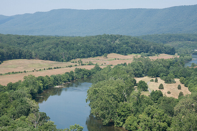
Georgia paddles in three completely different registers, sometimes within a single weekend. The Blue Ridge foothills in the north hold the state's whitewater — granite-bedded, often steep, mostly creek-sized.
The southern half goes flat and slow: blackwater swamps, big braided rivers, hundreds of miles of tidal marsh behind the barrier islands. Most paddlers here learn to move between those worlds.
The Chattooga is the gravitational center of southeastern whitewater and has been since the early 1970s. It's the state's only Wild and Scenic river, forming the South Carolina border, and its lower sections run year-round.
Section III is the introduction — Class II–IV, with Bull Sluice as the closer — and Section IV is the test, finishing with the Five Falls, five rapids stacked into roughly a quarter-mile of river.
Self-registration permits are free at the put-ins, and a 2023 rule change finally opened the upper river above Highway 28 to floating after a long ban.
North of there, the Cartecay near Ellijay and the Upper Chattahoochee are where Georgia Tech and UGA clubs have moved generations of paddlers from rolls in a pool to Class III water. Tallulah is the pilgrimage.
The Tallulah River trickles at 35–40 CFS most days through a thousand-foot granite gorge, but Georgia Power releases 500 CFS on Saturdays and 700 on Sundays — the first two weekends of April and the first three of November — and a small, screened group of expert kayakers runs 3.
4 miles of Class IV–V past Oceana, Tempesta, and L'Eau d'Or. Releases are paused through at least August 2026 for construction at Terrora, which is worth knowing before you make the drive. Columbus runs a different experiment: a 2.
5-mile urban course through downtown on the Chattahoochee, with morning flows around 800 CFS for family rafting and afternoon releases that can climb to 13,000 for serious Class IV–V.
It's the dam schedule that makes or breaks the day, and you check it before you put on. South of the fall line, the character changes entirely.
The Okefenokee's 120-mile trail system is the wilderness flagship — overnight trips sleep on platforms over open water among alligators, sandhill cranes, and cypress, and the permit system is genuinely hard: phone only, Tuesday through Thursday mornings, with March–April capped at one trip per group per year.
The Altamaha — TNC calls it one of its Last Great Places — is the long, quiet canoe-camping river, and the Etowah threads past Native American fish weirs and the Etowah Mounds on its way out of the high country.
On the coast, the Georgia leg of the Southeast Coast Saltwater Paddling Trail covers about 100 miles of marsh and ICW behind Cumberland, Sapelo, and Ossabaw; tides run the show, and landings can be far apart enough that a missed window means waiting six hours for the next one.
What ties it all together is the community infrastructure. Georgia Rivers runs the 50+ trail Water Trails Network and the Georgia River Guide app, which now pushes real-time gauge warnings, dam release schedules, and E.
coli alerts — a useful, slightly sobering tool that says a lot about how this state thinks about its water.
Every June, Paddle Georgia puts a few hundred boats on a different river for a week, and the conservation politics are never far from the paddling itself.

Paddle smarter with real-time insights
Whether you're en route and conditions shift or you're looking for the best spot based on current flows, we enable you to make informed decisions on the fly.







Georgia licenses and regulations
National parks in Georgia
Explore Georgia waters
Top paddling waters
Popular Cities
Loading popular cities...

Smarter Paddling Starts in the App.
Paddleways gives you everything you need to plan smarter, paddle better, and own every trip from first launch to takeout.