La Sal Vieja
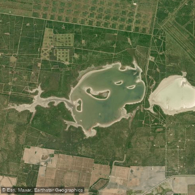
La Sal Vieja
- Boat Ramps
- 0
- Access Points
- 0
- Campsites
- 0
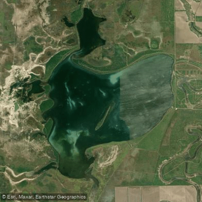
La Sal Vieja is a 720-acre salt lake located in Willacy County, Texas, approximately 6 miles northwest of Raymondville. The lake is part of a pair of salt lakes, with the larger western lake covering 2,475 acres. La Sal Vieja has no inlet or outlet and is fed by underground springs that pump saline water to the surface. As water evaporates, it leaves behind vast salt deposits, creating a unique geological feature.
The lake's normal pool elevation ranges from 14 to 28 feet, though a maximum of 94 feet has been recorded. Water levels and salinity fluctuate seasonally, with the lake sometimes drying completely, allowing a salt crust to form on the bottom. When water is present, salinity can reach extreme levels - over ten times saltier than seawater.
La Sal Vieja is part of the Lower Rio Grande Valley National Wildlife Refuge, managed by the U.S. Fish and Wildlife Service. The area provides important habitat for endangered species and serves as an archaeological site. Visitors may observe diverse wildlife, including migratory birds. American White Pelicans are often visible in winter and during migrations, while Wood Storks can be seen in fall.
Access to La Sal Vieja is limited. The refuge has multiple trailheads, but there are no facilities except restrooms. Visitors should be prepared for a significant hike to reach the lakeshore. The surrounding terrain is level to gently rolling, with fine sandy loam soil supporting saline-tolerant brush, grasses, mesquite, and prickly pear.
La Sal Vieja holds historical significance, having been used as a salt source by Native Americans and later by Spanish colonists. The lake played a role in trade and commerce from the 18th century through the early 20th century. Today, it stands as a protected natural area, offering opportunities for wildlife viewing and experiencing a unique salt lake ecosystem.
Water access, boat ramps & amenities
Learn how to get on La Sal Vieja. Uncover great paddling access points, boat ramps, and all the facilities you need for an unforgettable day on the water. Some locations shown may border or include private property. Always check property boundaries and applicable regulations before visiting. PaddleWays's Public & Private Land layer can help you plan your access with confidence.
Paddle smarter with real-time insights
Whether you're en route and conditions shift or you're looking for the best spot based on current flows, we enable you to make informed decisions on the fly.








Find Places to Paddle

Over 400,000 Places to Paddle
Every user gets free access to launch points, boat ramps, and public property parcels.


Water and weather conditions (10 day forecast)
See the best times to paddle La Sal Vieja and check the forecast before you go.
No forecast data available.

Explore Texas waters
Top paddling waters
Popular Cities
Loading popular cities...
Explore near La Sal Vieja

Smarter Paddling Starts in the App.
Paddleways gives you everything you need to plan smarter, paddle better, and own every trip from first launch to takeout.