North Bay
- Saltwater
- Bay
North Bay
- Saltwater
- Bay
- Sq. miles
- 32
- Boat Ramps
- 0
- Access Points
- 1
- Campsites
- 1
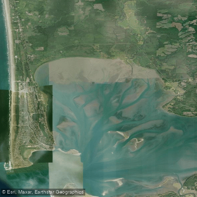
North Bay, specifically the Tivoli North Bay area along the Hudson River in Dutchess County, New York, is a tidal marsh ecosystem offering a unique flatwater paddling experience. The primary and clearly defined public access point for car-top boats is the canoe launch at the end of Kidd Lane, with coordinates at 42.046229°N, 73.906715°W. This launch is within the DEC Tivoli Bays Wildlife Management Area and the Hudson River National Estuarine Research Reserve. The parking area at the cul-de-sac is reserved strictly for loading and unloading, requiring paddlers to move their vehicles after preparing their craft. The bay is a fascinating tidal marsh characterized by winding tidal channels. Paddlers should be prepared for tidal influence; the launch itself requires wading in knee-deep water, necessitating old sneakers or sturdy water shoes, not flip-flops. The area is managed for conservation and education, with the NYSDEC offering free, reservation-required guided canoe trips that are appropriate for adults and youth over ten, with no prior experience needed. For safety and program integrity, private boats are not permitted to join these organized groups. The overall character is one of a protected, ecologically rich site where paddlers can observe spectacular plants and interesting wildlife while enjoying scenic views of the Catskill Mountains in the distance. The experience is defined by the sights, sounds, and smells of a healthy tidal wetland.
Water access, boat ramps & amenities
Learn how to get on North Bay. Uncover great paddling access points, boat ramps, and all the facilities you need for an unforgettable day on the water. Some locations shown may border or include private property. Always check property boundaries and applicable regulations before visiting. PaddleWays's Public & Private Land layer can help you plan your access with confidence.
Paddle smarter with real-time insights
Whether you're en route and conditions shift or you're looking for the best spot based on current flows, we enable you to make informed decisions on the fly.








Find Places to Paddle

Over 400,000 Places to Paddle
Every user gets free access to launch points, boat ramps, and public property parcels.


Tides, wind & water conditions (10 day forecast)
On open water, wind and tide matter as much as the weather. See the best times to paddle North Bay and check the marine forecast before you launch.
Loading tide predictions…
Paddling near North Bay

Explore Washington waters
Top paddling waters
Popular Cities
Loading popular cities...
Explore near North Bay
Access points
Nearby waters
More in Washington

Smarter Paddling Starts in the App.
Paddleways gives you everything you need to plan smarter, paddle better, and own every trip from first launch to takeout.