Paddling in Ku-ring-gai Chase National Park
- National Park
- Lakes
- 2
- Rivers
- 30
- Access
- 2
- Boat Ramps
- 3
- Shops
- 0
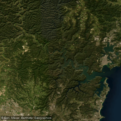
Ku-ring-gai Chase National Park sits on Sydney's northern edge, where tidal creeks cut through sandstone bush and drain toward the Hawkesbury River, Pittwater, and Broken Bay.
The paddling here is almost entirely flatwater — sheltered tidal creeks and bays rather than moving current — and the park's roughly 14,882 hectares hold enough waterway to keep a paddler busy across multiple visits.
Bobbin Head is the most accessible starting point and the one most paddlers use to build familiarity with the park. The creeks here are narrow and sheltered, which makes them forgiving — but tidal timing matters.
At high tide the water is deep enough to paddle cleanly; at low tide sections go shallow and muddy, and some routes become impractical.
Cowan Creek is the main artery from Bobbin Head, with the paddle from Bobbin Head to Kierans Creek among the most-traveled routes.
Apple Tree Bay, reachable from the same precinct, connects to Cockle Creek and gives a different character — more open, still tidal. Akuna Bay, accessed from McCarrs Creek Road via the Terrey Hills entrance, is a different proposition.
The bay is more exposed, and wind builds quickly on open water. When wind and tide run against each other, paddling becomes genuinely hard work.
The routes out of Akuna Bay are longer and more committing; experienced paddlers willing to read conditions carefully will find them rewarding. Smiths Creek is one destination from this side of the park.
McCarrs Creek itself is accessible from the same road corridor. The park's waterways also include Coal and Candle Creek and Jerusalem Creek. The park is managed by NSW National Parks and Wildlife Service, and paddling is permitted on these waters.
Whether a permit is required for your specific activity is worth confirming with the park before you go — rules can change.
The park can also close due to fire danger or weather, so checking current alerts before leaving home is standard practice here, not an afterthought.
What makes paddling inside a national park different from paddling a public waterway is mostly what surrounds you: red granite cliffs, mangroves, eucalypt bush, and the absence of development.
The water itself doesn't care about the park boundary — the tides run the same — but the context does.
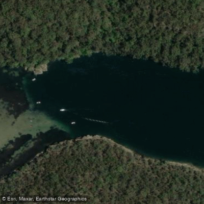
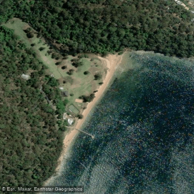
Top waters to paddle near Ku Ring Gai Chase National Park
Water and weather conditions (10 day forecast)
See the best times to paddle Ku-ring-gai Chase National Park and check the forecast before you go.
No forecast data available.
Paddle smarter with real-time insights
Whether you're en route and conditions shift or you're looking for the best spot based on current flows, we enable you to make informed decisions on the fly.







Paddling near Ku-ring-gai Chase National Park
Loading...
Gateway towns
Where to base yourself for paddling in Ku-ring-gai Chase National Park.
- HornsbyNSW
Main hub on the park's southern edge with shops for supplies and train access to park trailheads including the Great North Walk entry at Cowan.
- Palm BeachNSW
Eastern gateway giving access to Barrenjoey Headland, the lighthouse walk, and Pittwater waterway entry points into the park.
- BrooklynNSW
Northern gateway on the Hawkesbury River with boat access to the park's waterways and proximity to Aboriginal engraving sites along Cowan Creek.
- Bobbin HeadNSW
Central park hub with a marina, café, picnic areas, and kayak and boat hire for exploring the park's tidal inlets.
Explore Ku-ring-gai Chase National Park
Top paddling waters
Popular Cities
Loading popular cities...

Smarter Paddling Starts in the App.
Paddleways gives you everything you need to plan smarter, paddle better, and own every trip from first launch to takeout.