Franklin River
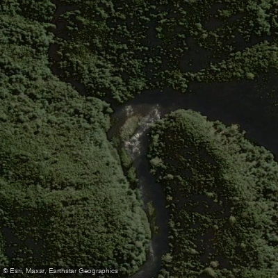
Franklin River
- Boat Ramps
- 0
- Access Points
- 0
- Campsites
- 0
The Franklin River flows through Tasmania's Franklin-Gordon Wild Rivers National Park, within the Tasmania Wilderness World Heritage Area. The full expedition runs approximately 125 km (72 miles) from the Collingwood River confluence to Sir John Falls, typically taking 6 to 10 days. A shorter 5-day lower river option covers the final 45 km of the river. The standard put-in is at the Collingwood River Bridge, where paddlers self-register at a kiosk and must purchase a parks pass. Takeout options include Heritage Landing on the Gordon River (adding 21 km of paddling) or Sir John Falls, where West Coast Charters can be arranged for pickup. A 4WD road via Mt. McCall provides an alternative river access point to the lower section, requiring a steep descent of approximately 350 meters on foot.
The river is rated Class IV+ (rising to Class V at high water), with recommended flows between 10 and 15 cumecs, measured in ML/day divided by 86.4. Flows above 200 cumecs are considered too high. Water levels can fluctuate rapidly at any time of year. The river contains numerous grade 2–5 rapids, with some grade 6 conditions at high water, along with significant hazards including log jams and strainers that require compulsory portages. The river is considered suitable only for experienced paddlers or those accompanied by a qualified guide.
Key features along the route include the Great Ravine, the narrowest section with towering cliffs on both sides; Rock Island Bend; Pig Trough (Class V), which has a portage route; Newlands Cascades; and Rafters Basin, a large camping area. The Cauldron is another significant portage point. The water has a distinctive tannin-rich, cola-colored appearance from the surrounding vegetation.
The primary paddling season runs from December to March. The river passes through remote temperate rainforest with no phone reception and no road access for most of its length. Kutikina Cave along the river contains Aboriginal artefacts of significant historical importance, representing one of the most southern indigenous settlements to survive the last ice age. The Franklin River was also the site of a major Australian conservation campaign in the early 1980s, which successfully prevented dam construction and preserved the river in its current wild state.
Water access, boat ramps & amenities
Learn how to get on Franklin River. Uncover great paddling access points, boat ramps, and all the facilities you need for an unforgettable day on the water. Some locations shown may border or include private property. Always check property boundaries and applicable regulations before visiting. PaddleWays's Public & Private Land layer can help you plan your access with confidence.
Paddle smarter with real-time insights
Whether you're en route and conditions shift or you're looking for the best spot based on current flows, we enable you to make informed decisions on the fly.








Find Places to Paddle

Over 400,000 Places to Paddle
Every user gets free access to launch points, boat ramps, and public property parcels.


Water and weather conditions (10 day forecast)
See the best times to paddle Franklin River and check the forecast before you go.
Franklin At Fincham - At Mt Fincham Track
All Flow Stations
Paddling near Franklin River
River Derwent
North West Bay River
Derwent River
Huon River
River Clyde
Frederick Henry Bay
Russell River
Lachlan River
D'Entrecasteaux Channel
Weld River
Explore Tasmania waters
Top paddling waters
No waters available right now.
Popular Cities
Loading popular cities...
Explore near Franklin River

Smarter Paddling Starts in the App.
Paddleways gives you everything you need to plan smarter, paddle better, and own every trip from first launch to takeout.