Waterton River
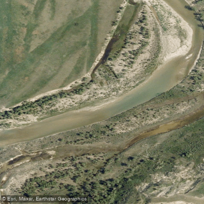
Waterton River
- Boat Ramps
- 0
- Access Points
- 0
- Campsites
- 0
The Waterton River in Alberta is typically divided into two paddling sections — the Upper Waterton and the Lower Waterton — each with distinct character. The Upper Waterton, accessed near Waterton Park, runs approximately 12 kilometres and is rated Class II/II+, with a mean sufficient flow around 18.2 m³/s. The Lower Waterton, accessed near Glenwood, covers roughly 25 kilometres at a Class II rating, with a mean sufficient flow around 26.7 m³/s.
Flow is a critical planning consideration on this river. Like other southern Alberta rivers, the Waterton is subject to significant seasonal diversions that can leave it with insufficient water for paddling through much of the summer. Paddlers report that flows around 50 m³/s make for a good run, while levels dropping to around 20 m³/s are generally considered the lower threshold for an enjoyable paddle. By late July in most years, flows have typically fallen below that threshold.
Within Waterton Lakes National Park, the river connects the lake system, flowing out of Middle Waterton Lake and through Lower Waterton Lake. The Hay Barn Day Use Area serves as a put-in point on the river between the lakes, and the Maskinonge Day Use Area beyond the park gates is used as a take-out. Wind is a significant factor when paddling in this area, and paddlers are advised to plan routes with the prevailing wind direction in mind rather than against it. Shuttles can be arranged with a second vehicle or bicycle.
The river passes through a scenic mountain and foothills landscape in southern Alberta. The upper reaches are situated near the Rocky Mountain front, offering views of the surrounding peaks. The river also supports a notable fishery, particularly for brown trout, though the optimal fishing window is described as relatively short. Paddlers planning trips should monitor gauge data carefully and target the spring and early summer period before diversions reduce flows to unworkable levels.
Water access, boat ramps & amenities
Learn how to get on Waterton River. Uncover great paddling access points, boat ramps, and all the facilities you need for an unforgettable day on the water. Some locations shown may border or include private property. Always check property boundaries and applicable regulations before visiting. PaddleWays's Public & Private Land layer can help you plan your access with confidence.
Paddle smarter with real-time insights
Whether you're en route and conditions shift or you're looking for the best spot based on current flows, we enable you to make informed decisions on the fly.







Ab licenses and regulations
No licenses or regulations available for Ab.
Find Places to Paddle

Over 400,000 Places to Paddle
Every user gets free access to launch points, boat ramps, and public property parcels.


Water and weather conditions (10 day forecast)
See the best times to paddle Waterton River and check the forecast before you go.
WATERTON RIVER NEAR WATERTON PARK
All Flow Stations
Explore Ab waters
Top paddling waters
No waters available right now.
Popular Cities
Loading popular cities...
Explore near Waterton River

Smarter Paddling Starts in the App.
Paddleways gives you everything you need to plan smarter, paddle better, and own every trip from first launch to takeout.