Knight Inlet
- Saltwater
- Inlet
Knight Inlet
- Saltwater
- Inlet
- Sq. miles
- 130
- Boat Ramps
- 0
- Access Points
- 0
- Campsites
- 0
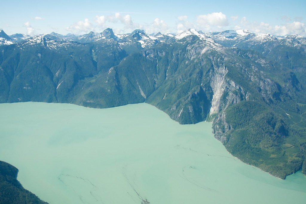
Knight Inlet is a major coastal inlet on the mainland of British Columbia, within the Regional District of Mount Waddington. It is a remote, deep-water fjord characterized by towering mountains rising directly from the sea, cascading waterfalls, and dense coastal rainforest. The inlet forms part of the Great Bear Rainforest and is situated near the mouth of the Klinaklini River. The area is known for its dramatic scenery, with significant vertical relief from sea level to nearby peaks like Mount Waddington. For paddlers, Knight Inlet itself is primarily a transit corridor or destination for extended expeditions due to its exposed nature and significant marine traffic. The adjacent Broughton Archipelago, a Provincial Marine Park located near the inlet's mouth, offers a more protected paddling environment among hundreds of islands and islets. Common launch points for accessing the broader region, including the approaches to Knight Inlet, are Telegraph Cove, Alder Bay, and Port McNeill on northern Vancouver Island. These put-ins require crossing busy shipping lanes in Johnstone Strait, which must be timed with extreme caution. Water taxis and floatplane charters from locations like Port Hardy or Campbell River are also used to reach remote areas, including lodges or cabins at the inlet's mouth. Paddling conditions are heavily influenced by marine weather. Winds can pick up quickly, creating rough water, and dense fog is common during summer months. Tides and currents are a critical safety consideration; boaters must be aware of tide changes and carry appropriate nautical charts. The area is home to a high concentration of wildlife, including grizzly bears, orcas, and other marine mammals. The best season for paddling is during the drier summer months, particularly July and August, though conditions remain variable. There are no specific paddling restrictions mentioned, but the region's remoteness demands self-sufficiency and thorough preparation.
Water access, boat ramps & amenities
Learn how to get on Knight Inlet. Uncover great paddling access points, boat ramps, and all the facilities you need for an unforgettable day on the water. Some locations shown may border or include private property. Always check property boundaries and applicable regulations before visiting. PaddleWays's Public & Private Land layer can help you plan your access with confidence.
Paddle smarter with real-time insights
Whether you're en route and conditions shift or you're looking for the best spot based on current flows, we enable you to make informed decisions on the fly.







Bc licenses and regulations
No licenses or regulations available for Bc.
Find Places to Paddle

Over 400,000 Places to Paddle
Every user gets free access to launch points, boat ramps, and public property parcels.


Tides, wind & water conditions (10 day forecast)
On open water, wind and tide matter as much as the weather. See the best times to paddle Knight Inlet and check the marine forecast before you launch.
Loading tide predictions…
Paddling near Knight Inlet

Fleuve Fraser
Capilano River

Burrard Inlet

Lynn Creek

Coquitlam River
Outer Vancouver Harbour

Pitt River

Serpentine River
Inner Vancouver Harbour

Alouette River
Explore Bc waters
Top paddling waters
No waters available right now.
Popular Cities
Loading popular cities...
Explore near Knight Inlet

Smarter Paddling Starts in the App.
Paddleways gives you everything you need to plan smarter, paddle better, and own every trip from first launch to takeout.