Fleuve Fraser
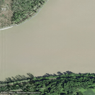
Fleuve Fraser
- Boat Ramps
- 3
- Access Points
- 1
- Campsites
- 1
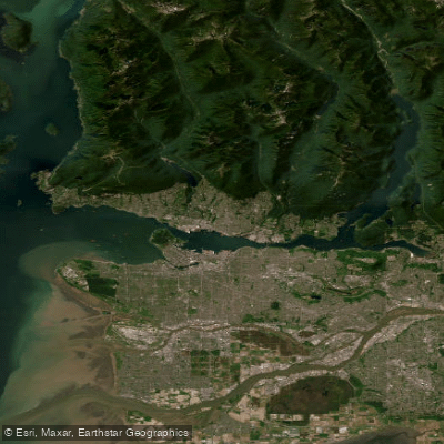
The Fraser River is one of British Columbia's most significant waterways, stretching from its headwaters near Mount Robson through the Rocky Mountains, across the Interior Plateau, and through the Coast Mountains before emptying into the Strait of Georgia near Vancouver. The river is notably brown in appearance due to its high silt and clay content, giving it a distinctly milky, turbid character throughout much of its length.
The river offers a wide range of paddling experiences depending on the section chosen. The upper reaches near the river's origin feature Class I waters with riffles and many turns, though Highway 16 parallels this stretch closely, reducing any sense of wilderness. Below the Rockies, the river widens considerably and travels between large mountain ranges. The middle sections through the canyon near Lillooet and Lytton include Class III and IV rapids, with particularly challenging features at Big Bar, Bridge River, and Hell's Gate. The lower Fraser, from Hope downstream through the Fraser Valley to the estuary near Ladner and Westham Island, is more accessible for recreational paddlers, though it carries its own significant hazards.
Safety considerations on the Fraser are serious and should not be underestimated. The current is consistently stronger than it appears and can carry paddlers farther than anticipated. During freshet — typically late spring and early summer — debris is common and conditions become considerably more dangerous. Tugboat wakes on the lower river are a documented hazard and can be large enough to be dangerous for novice paddlers. Tidal currents affect the lower reaches and must be accounted for when planning trips. The Harrison-Fraser confluence is known for whirlpool activity.
Late fall or early spring before the freshet are generally considered the better times to paddle the lower and middle sections, when flows are lower and debris less prevalent. River temperatures in the middle canyon sections reach roughly 14–18°C in July and August, particularly after the Thompson River confluence.
Access points on the lower river include a launch under the Highway 1 bridge in Hope at the corner of Rupert and Walker Streets, FH Barber Park, and the Telte-yet campground in Hope. In the Ladner area, the Ferry Road Boat Launch and the dock near Ladner Wharf provide access to the estuary and associated sloughs. The Barrowtown Boat Launch in Chilliwack, reached via No. 3 Road and North Parallel Road, serves the Chilliwack area. Overnight camping is possible on islands and sandbars along the lower river.
Water access, boat ramps & amenities
Learn how to get on Fleuve Fraser. Uncover great paddling access points, boat ramps, and all the facilities you need for an unforgettable day on the water. Some locations shown may border or include private property. Always check property boundaries and applicable regulations before visiting. PaddleWays's Public & Private Land layer can help you plan your access with confidence.
Paddle smarter with real-time insights
Whether you're en route and conditions shift or you're looking for the best spot based on current flows, we enable you to make informed decisions on the fly.







Bc licenses and regulations
No licenses or regulations available for Bc.
Find Places to Paddle

Over 400,000 Places to Paddle
Every user gets free access to launch points, boat ramps, and public property parcels.


Water and weather conditions (10 day forecast)
See the best times to paddle Fleuve Fraser and check the forecast before you go.
FRASER RIVER AT HOPE
All Flow Stations
Explore Bc waters
Top paddling waters
No waters available right now.
Popular Cities
Loading popular cities...
Explore near Fleuve Fraser
Access points
- British Columbia Boat Ramp
- British Columbia Coastal Boat Ramp
- McDonald Beach Boat Launch
- Dog Mountain Trail
- Andy Slobodian Memorial
- British Columbia Bridge
- British Columbia Bridge
- British Columbia Bridge
- British Columbia Bridge
- British Columbia Bridge
- British Columbia Bridge
- British Columbia Bridge
- All 23 spots
Nearby waters
More in Bc
Smarter Paddling Starts in the App.
Paddleways gives you everything you need to plan smarter, paddle better, and own every trip from first launch to takeout.