Alouette River

Alouette River
- Boat Ramps
- 1
- Access Points
- 0
- Campsites
- 0
The Alouette River is a popular flatwater paddling destination located near Vancouver in the Pitt Meadows area of British Columbia. The river is characterized by a slow current and meandering course, making it accessible to paddlers of most skill levels. Wind conditions can be variable, which is worth factoring into trip planning.
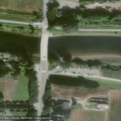
The primary access point is the Trail Pavilion off Harris Road, near the Harris Road bridge. This put-in features a muddy and pebbly beach, portable toilets, and a well-developed network of dyke trails suitable for walking or cycling. An alternative access point exists at the Neaves Road bridge, roughly an hour's paddle upstream from Harris Road, though this option offers limited roadside parking and no toilet facilities, making it a less practical launch site.
Motor boats are prohibited east of the Harris Road bridge, keeping that stretch of river quiet and well-suited to human-powered craft. Paddling upstream from Harris Road, the current remains manageable for at least 90 minutes of travel, with the current becoming noticeably stronger but still easily paddled against as you move further east past Neaves Road.
The river offers views of snow-capped peaks in Golden Ears and Pinecone Burke Provincial Parks when the channel points northward. Wildlife viewing opportunities are a notable feature of the experience. The river's constant bends mean the scenery shifts regularly, with changing sight lines and navigation decisions keeping the paddle engaging.
A straightforward day trip involves launching from the Harris Road Trail Pavilion and paddling upstream toward and beyond the Neaves Road bridge before returning downstream. The round trip to Neaves Road and back takes approximately two hours at a relaxed pace, with the option to continue further upstream if time allows.
Water access, boat ramps & amenities
Learn how to get on Alouette River. Uncover great paddling access points, boat ramps, and all the facilities you need for an unforgettable day on the water. Some locations shown may border or include private property. Always check property boundaries and applicable regulations before visiting. PaddleWays's Public & Private Land layer can help you plan your access with confidence.
Paddle smarter with real-time insights
Whether you're en route and conditions shift or you're looking for the best spot based on current flows, we enable you to make informed decisions on the fly.







Bc licenses and regulations
No licenses or regulations available for Bc.
Find Places to Paddle

Over 400,000 Places to Paddle
Every user gets free access to launch points, boat ramps, and public property parcels.


Water and weather conditions (10 day forecast)
See the best times to paddle Alouette River and check the forecast before you go.
ALOUETTE RIVER NEAR HANEY
All Flow Stations






Explore Bc waters
Top paddling waters
No waters available right now.
Popular Cities
Loading popular cities...
Explore near Alouette River

Smarter Paddling Starts in the App.
Paddleways gives you everything you need to plan smarter, paddle better, and own every trip from first launch to takeout.