Blackstrap Reservoir
Blackstrap Reservoir
- Boat Ramps
- 3
- Access Points
- 0
- Campsites
- 0
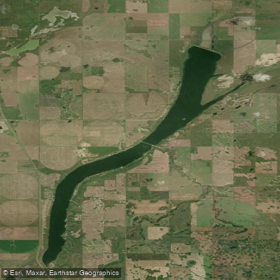
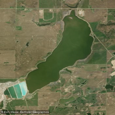
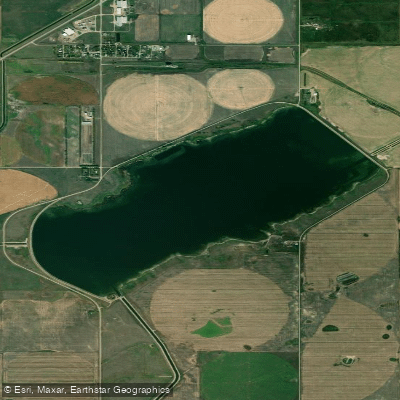
Blackstrap Reservoir, also known as Blackstrap Lake, is a man-made reservoir located approximately 41 kilometres south-southeast of Saskatoon in the Rural Municipality of Dundurn No. 314, accessible via Highway 11 and Highway 211. Created in 1967 as part of the Saskatoon South East Water Supply System, the reservoir has a surface area of 1,200 hectares and a distinctive long, narrow shape measuring 14.4 kilometres in length and 0.8 to 1.2 kilometres in width, with a depth of approximately 5.14 metres. This elongated north-to-south orientation is a defining characteristic for paddlers planning routes.
The surrounding terrain of coulees, hills, and trees creates variable wind conditions on the water. Depending on conditions, the landscape can provide meaningful shelter from prairie winds or channel them into a wind tunnel along the length of the lake — a factor paddlers should account for when planning trips, particularly on longer crossings. The reservoir is described as clear and clean.
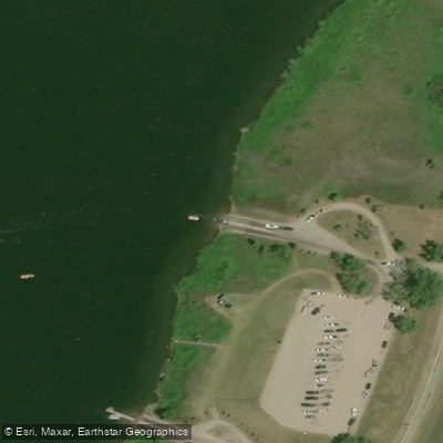
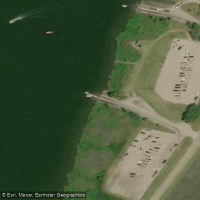
The primary access point for water activities is the boat launch on the east side of the lake within Blackstrap Provincial Park. The park covers most of the eastern shoreline and provides camping facilities, beaches, and amenities. There are also communities on the western shore at Thode and Shields, and residential subdivisions at Skyview Estates.
Canoeing is explicitly listed among the supported water activities at the park, alongside water-skiing and windsurfing. The lake is a popular multi-use recreational destination, so paddlers should expect motorized boat traffic, particularly during summer weekends. The park offers four campgrounds along the eastern shore, including sites near the Aspen Grove Beach on the north end and the Kevin Misfeldt Beach on the south end, making it practical to base a paddling trip from either end of the lake.
Wildlife in the reservoir includes walleye, northern pike, lake whitefish, and yellow perch. The reservoir also serves as an irrigation and municipal water source, managed by the Saskatchewan Water Security Agency. Paddlers should note that a central causeway and the 100 metres on either side of it are closed to angling year-round, which may affect route planning near that structure.
Water access, boat ramps & amenities
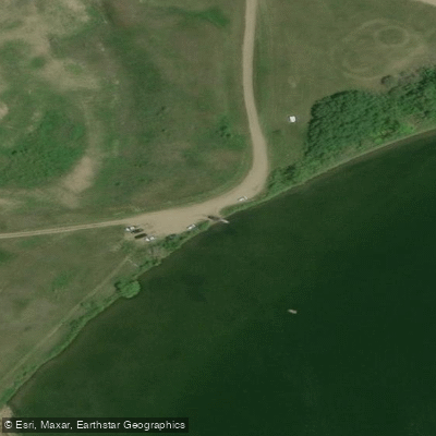
Learn how to get on Blackstrap Reservoir. Uncover great paddling access points, boat ramps, and all the facilities you need for an unforgettable day on the water. Some locations shown may border or include private property. Always check property boundaries and applicable regulations before visiting. PaddleWays's Public & Private Land layer can help you plan your access with confidence.
Paddle smarter with real-time insights
Whether you're en route and conditions shift or you're looking for the best spot based on current flows, we enable you to make informed decisions on the fly.








Find Places to Paddle

Over 400,000 Places to Paddle
Every user gets free access to launch points, boat ramps, and public property parcels.


Water and weather conditions (10 day forecast)
See the best times to paddle Blackstrap Reservoir and check the forecast before you go.
No forecast data available.
Paddling near Blackstrap Reservoir
Explore Sk waters
Top paddling waters
No waters available right now.
Popular Cities
Loading popular cities...
Explore near Blackstrap Reservoir

Smarter Paddling Starts in the App.
Paddleways gives you everything you need to plan smarter, paddle better, and own every trip from first launch to takeout.