Boggy Creek
Boggy Creek
- Boat Ramps
- 0
- Access Points
- 0
- Campsites
- 0
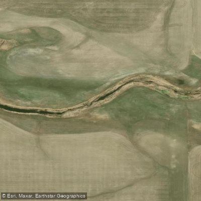
Boggy Creek is a river in Saskatchewan that originates northeast of Balgonie and flows generally westward through the Regina area before turning northwest to meet the Qu'Appelle River east of Lumsden. Along its course, the creek feeds Condie Reservoir, which serves as the primary paddling destination associated with the waterway.
Condie Reservoir sits within the Condie Nature Refuge Recreation Site, approximately 13 kilometres north-northwest of Regina, accessible via Condie Road off Highway 734. The reservoir is a small body of water covering 67.4 hectares with a maximum depth of 3.8 metres. Motors are prohibited, making it suitable for non-motorized paddling. A dedicated launch site is located near the north parking lot. The site has two parking areas — one on the north end and one on the south — each equipped with wheelchair-accessible pit toilets and picnic areas (charcoal briquettes only).
The reservoir was originally constructed in 1924 when CN Rail dammed Boggy Creek to supply water for steam engines passing through Regina. The park operates year-round and includes hiking trails in addition to water access. Wildlife interest is notable, with the area recognized as a nature refuge. Wildflowers including wild roses, gaillardia, and western red lily are present in the surrounding landscape.
Fish species in the reservoir include northern pike and yellow perch, with northern pike reported in the 510–1,170 gram range based on survey data. Paddlers should be aware that the reservoir is aerated during winter months, which can result in thin ice conditions in cold weather. The site's proximity to Regina makes it a practical destination for a short day outing, and its family-friendly character and no-motor policy contribute to a relatively quiet paddling environment.
Water access, boat ramps & amenities
Learn how to get on Boggy Creek. Uncover great paddling access points, boat ramps, and all the facilities you need for an unforgettable day on the water. Some locations shown may border or include private property. Always check property boundaries and applicable regulations before visiting. PaddleWays's Public & Private Land layer can help you plan your access with confidence.
Paddle smarter with real-time insights
Whether you're en route and conditions shift or you're looking for the best spot based on current flows, we enable you to make informed decisions on the fly.








Find Places to Paddle

Over 400,000 Places to Paddle
Every user gets free access to launch points, boat ramps, and public property parcels.


Water and weather conditions (10 day forecast)
See the best times to paddle Boggy Creek and check the forecast before you go.
BOGGY CREEK NEAR LUMSDEN
Paddling near Boggy Creek
Explore Sk waters
Top paddling waters
No waters available right now.
Popular Cities
Loading popular cities...
Explore near Boggy Creek

Smarter Paddling Starts in the App.
Paddleways gives you everything you need to plan smarter, paddle better, and own every trip from first launch to takeout.