Pasqua Lake
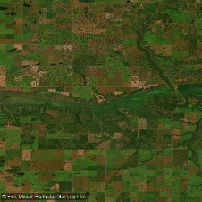
Pasqua Lake
- Boat Ramps
- 2
- Access Points
- 0
- Campsites
- 0
Pasqua Lake is a large recreational lake located approximately 58 kilometres northeast of Regina in the Qu'Appelle Valley of Saskatchewan. It is the westernmost and most upstream of the four Fishing Lakes — Pasqua, Echo, Mission, and Katepwa — which sit along the course of the Qu'Appelle River. The valley itself was carved roughly 14,000 years ago by glacial meltwater, and the alluvial deposits left behind created the natural separations between the lakes. The lake reaches a maximum depth of approximately 60 feet (18 metres), though sandbars are present and paddlers should be aware of shallow areas, particularly when moving between Pasqua and Echo lakes through Sioux Crossing.
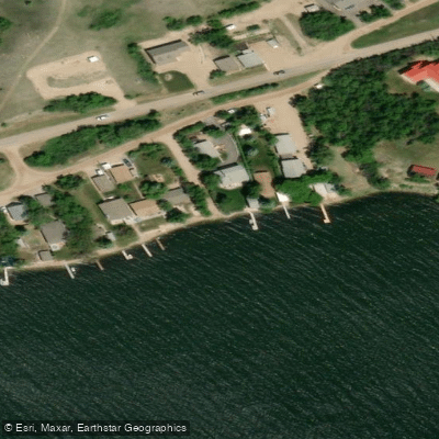
The Qu'Appelle River enters Pasqua Lake at its far western end and exits at the eastern end through Sioux Crossing, a short channel cut through the isthmus separating Pasqua from Echo Lake. Jumping Deer Creek is the only other named inflow, entering the lake at the northeast corner near the Pasqua Indian Reserve. The lake's shores are lined with numerous coulees, and the valley walls give the surrounding landscape a distinctly cut, elevated character. The north shore is developed with residential homes and cottages, while the south side retains a more natural aspect.
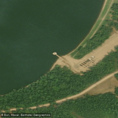
Access to the lake is available via Highways 210 and 727, with Pasqua Lake Road running along the north shore. Echo Valley Provincial Park, situated on the isthmus between Pasqua and Echo lakes, provides two boat launches with ample parking on the Pasqua Lake side, though an entry fee applies. Two additional launch sites exist on Pasqua Lake itself, though parking at these locations is minimal and they are oriented primarily toward local residents.
The lake supports a diverse fish population including walleye, northern pike, yellow perch, bigmouth buffalo, common carp, channel catfish, cisco, lake whitefish, burbot, and white sucker. The lake has been stocked with walleye in the past, though stocking has not occurred since 2017. The Qu'Appelle River corridor through this section is known for its pronounced meanders, which paddlers travelling the river route should factor into trip planning, as a short straight-line distance can translate into considerably longer paddling time. Three First Nation reserves — Standing Buffalo 74, Pasqua 79, and Muscowpetung 80 — border the lake, and paddlers should be respectful of reserve lands along the shoreline.
Water access, boat ramps & amenities
Learn how to get on Pasqua Lake. Uncover great paddling access points, boat ramps, and all the facilities you need for an unforgettable day on the water. Some locations shown may border or include private property. Always check property boundaries and applicable regulations before visiting. PaddleWays's Public & Private Land layer can help you plan your access with confidence.
Paddle smarter with real-time insights
Whether you're en route and conditions shift or you're looking for the best spot based on current flows, we enable you to make informed decisions on the fly.








Find Places to Paddle

Over 400,000 Places to Paddle
Every user gets free access to launch points, boat ramps, and public property parcels.


Water and weather conditions (10 day forecast)
See the best times to paddle Pasqua Lake and check the forecast before you go.
No forecast data available.
Paddling near Pasqua Lake
Explore Sk waters
Top paddling waters
No waters available right now.
Popular Cities
Loading popular cities...
Explore near Pasqua Lake

Smarter Paddling Starts in the App.
Paddleways gives you everything you need to plan smarter, paddle better, and own every trip from first launch to takeout.