Beaulieu River
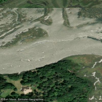
Beaulieu River
- Boat Ramps
- 0
- Access Points
- 2
- Campsites
- 0
The Beaulieu River is a tidal river in the New Forest, Hampshire, running approximately 12 miles from its source near Lyndhurst to its estuary at Needs Ore Point in the Solent. It holds the distinction of being the only privately owned tidal river in the United Kingdom, with the riverbed owned by Lord Montagu of Beaulieu. As a Site of Special Scientific Interest, the river and its banks support a wide variety of wildlife, and paddlers are expected to keep their distance from birds and proceed quietly, as sound carries readily over the water. Disturbing nesting birds can have serious consequences for chicks.
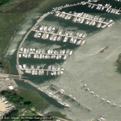
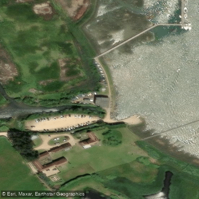
The sole permitted launch and recovery point is the concrete slipway at Buckler's Hard Yacht Harbour (SO42 7XB). Launching or landing anywhere else on the river is prohibited due to the protected status of the surrounding banks. Paddlers must obtain permission from the Harbour Master and pre-book their launch slot online. The launch fee is £5 per paddlecraft (canoe, kayak, or paddleboard), with car parking charged separately. The slipway dries out at low water and should not be used within two hours either side of low water due to a steep drop-off, though SUPs and kayaks may have some flexibility on this restriction. The Harbour Master can be reached on VHF Channel 68 ("Beaulieu River Radio") or by phone at 01590 616200.
From Buckler's Hard, paddlers can head upstream toward Beaulieu village or downstream along the estuary toward the Solent. The upstream route to Beaulieu covers roughly 2.5 miles one way, passing through reaches including Fiddlers Reach, Bailey's Hard Reach, Oxleys Reach, Carpenters Reach, and Spearhead Reach. Along the way, notable landmarks include the tall black chimney of Bailey's Hard Brick Works, first used in 1790, and views of properties lining the shore. Paddling is not permitted upstream of the road bridge at Beaulieu village. The full round trip from Buckler's Hard to Beaulieu and back is approximately 9 kilometres and typically takes two to three hours at a relaxed pace. Samphire grows along some of the riverbanks, and jellyfish have been observed in the water. Guided canoe trips are available through local operators, with family sessions running from April through October and sunset tours available from May through August.
Water access, boat ramps & amenities
Learn how to get on Beaulieu River. Uncover great paddling access points, boat ramps, and all the facilities you need for an unforgettable day on the water. Some locations shown may border or include private property. Always check property boundaries and applicable regulations before visiting. PaddleWays's Public & Private Land layer can help you plan your access with confidence.
Paddle smarter with real-time insights
Whether you're en route and conditions shift or you're looking for the best spot based on current flows, we enable you to make informed decisions on the fly.








Find Places to Paddle

Over 400,000 Places to Paddle
Every user gets free access to launch points, boat ramps, and public property parcels.


Water and weather conditions (10 day forecast)
See the best times to paddle Beaulieu River and check the forecast before you go.
Hartford
All Flow Stations
Paddling near Beaulieu River
River Frome
River Avon
Severn Lower
Land Yeo
River Chew

Bristol Channel
Afon Gwy
Congresbury Yeo
SEVERN MIDDLE
Afon Hafren
Explore England waters
Top paddling waters
No waters available right now.
Popular Cities
Loading popular cities...
Explore near Beaulieu River

Smarter Paddling Starts in the App.
Paddleways gives you everything you need to plan smarter, paddle better, and own every trip from first launch to takeout.