Records Pond
Records Pond
- Boat Ramps
- 1
- Access Points
- 2
- Campsites
- 2
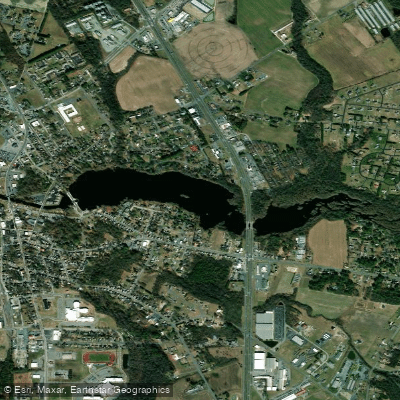
Records Pond, also known as Laurel Lake, is a 90-acre impoundment created in 1900 by the Records Pond Dam on Broad Creek in Sussex County. The relatively shallow pond has a maximum depth of 10 feet and sits almost at sea level.
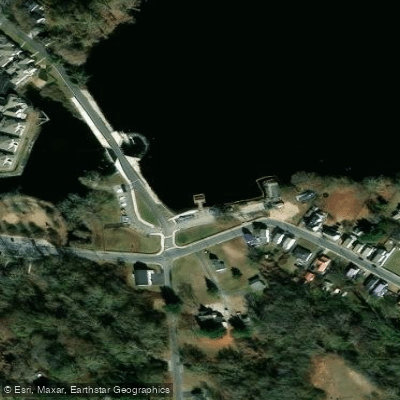
Two launch options serve different paddling needs. The newly constructed boat ramp on the west side features a courtesy dock and deeper water for consistent access regardless of water levels. The older ramp on the east side of US Route 13 has shallower waters better suited for canoes and kayaks. Ample parking is available at both locations - the main lot provides 8 boat trailer spaces and 10 car spaces, while an auxiliary lot across Willow Street adds 10 trailer spaces and 4 car spaces.
The pond connects to James Branch and Broad Creek, offering opportunities for extended paddling trips. However, paddlers attempting creek sections should be prepared for challenging conditions, including fallen trees and strainers that can require portaging.
Facilities include a recently renovated timber tidal fishing pier accessible to shoreline users. All boats must operate at "no wake" speed on the pond. The area has historically faced water quality challenges from agricultural and residential runoff, though extensive restoration efforts have improved conditions.
The pond is part of the larger Broad Creek watershed, which flows through Trussum Pond before reaching Records Pond and eventually joining the Nanticoke River. The Delaware Department of Natural Resources and Environmental Control manages the pond primarily for fishing and boating access, maintaining it as one of the larger public freshwater bodies in southern Delaware.
Water access, boat ramps & amenities
Learn how to get on Records Pond. Uncover great paddling access points, boat ramps, and all the facilities you need for an unforgettable day on the water. Some locations shown may border or include private property. Always check property boundaries and applicable regulations before visiting. PaddleWays's Public & Private Land layer can help you plan your access with confidence.
Paddle smarter with real-time insights
Whether you're en route and conditions shift or you're looking for the best spot based on current flows, we enable you to make informed decisions on the fly.








Find Places to Paddle

Over 400,000 Places to Paddle
Every user gets free access to launch points, boat ramps, and public property parcels.


Water and weather conditions (10 day forecast)
See the best times to paddle Records Pond and check the forecast before you go.
No forecast data available.
Paddling near Records Pond

Delaware River
Tangier Sound

Potomac River

Patuxent River
Chincoteague Bay
Saint Jones River
Fishing Bay
Trap Pond
Explore Delaware waters
Top paddling waters
Popular Cities
Loading popular cities...
Explore near Records Pond
Access points
Nearby waters
More in Delaware

Smarter Paddling Starts in the App.
Paddleways gives you everything you need to plan smarter, paddle better, and own every trip from first launch to takeout.