Summa Beach
- Saltwater
- Beach
Summa Beach
- Saltwater
- Beach
- Sq. miles
- 0
- Boat Ramps
- 0
- Access Points
- 0
- Campsites
- 2
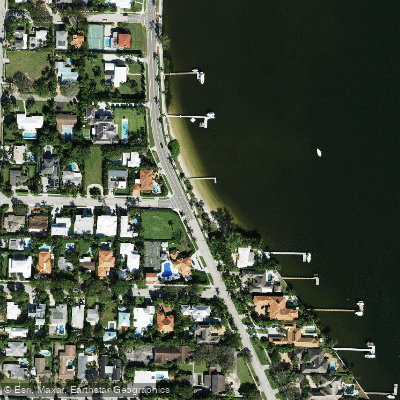
Summa Beach Park is a public beach on the Intracoastal Waterway, specifically the Lake Worth Lagoon, at 7422 S. Flagler Drive in West Palm Beach, Florida. The beach itself is a fairly long stretch of fine, white sand. Parking is available along the adjacent street, Seville Road. The park offers basic amenities for a day out, including a grassy area with a bench and shade trees. For paddlers launching from shore, the carry distance from the parking area to the water is short and straightforward across the sand. This is a beach launch directly into the Intracoastal Waterway, so paddlers should be prepared for potential boat wake and wind-driven waves along the shore. The waterway is a major corridor for powerboats, and a serious high-speed boating incident near the park underscores the need for constant vigilance for fast-moving vessel traffic. The area can experience significant wind and current, which were noted factors during that incident. The Intracoastal here is part of the 21-mile long Lake Worth Lagoon, a brackish waterway. The lagoon has experienced water quality issues, including algae blooms that have historically covered Summa Beach, though these are episodic events related to water management and stormwater runoff. Paddlers can explore the calm, intracoastal waters north and south along Flagler Drive. A notable nearby paddle destination reachable from this launch is Peanut Island, though it was temporarily closed during a past algae event. The overall character is a quiet, neighborhood beach away from airplane flight paths, but it is directly adjacent to a busy navigational channel.
Water access, boat ramps & amenities
Learn how to get on Summa Beach. Uncover great paddling access points, boat ramps, and all the facilities you need for an unforgettable day on the water. Some locations shown may border or include private property. Always check property boundaries and applicable regulations before visiting. PaddleWays's Public & Private Land layer can help you plan your access with confidence.
Paddle smarter with real-time insights
Whether you're en route and conditions shift or you're looking for the best spot based on current flows, we enable you to make informed decisions on the fly.








Find Places to Paddle

Over 400,000 Places to Paddle
Every user gets free access to launch points, boat ramps, and public property parcels.


Tides, wind & water conditions (10 day forecast)
On open water, wind and tide matter as much as the weather. See the best times to paddle Summa Beach and check the marine forecast before you launch.
Loading tide predictions…
Explore Florida waters
Top paddling waters
Popular Cities
Loading popular cities...
Explore near Summa Beach
Access points
Nearby waters
More in Florida

Smarter Paddling Starts in the App.
Paddleways gives you everything you need to plan smarter, paddle better, and own every trip from first launch to takeout.