Curated by PaddleWays
RouteFlatwater
- Distance
- 4.6 mi
- Paddle time
- ~1.5 hrs
- Put-in → take-out
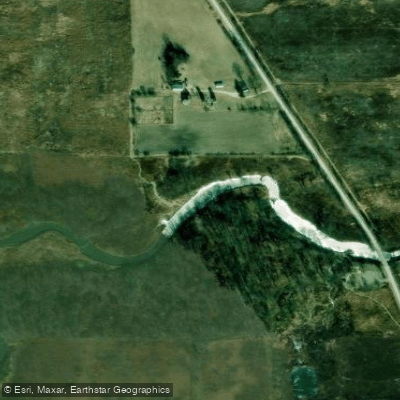
- Keystone Landing Access → Pioneer Landing Boat Ramp
Nippersink Creek, a vital waterway in northeastern Illinois, serves as the largest tributary to the Fox River. This shallow stream winds through the glacial moraines of McHenry County, offering paddlers a unique glimpse into the region's Ice Age legacy. While the exact origin point is not specified, the creek flows generally eastward through Glacial Park, a 3,439-acre conservation area managed by the McHenry County Conservation District.
The creek provides several paddling opportunities, with the most popular being the Nippersink Creek Canoe Trail. This 3-mile stretch from Keystone Road Landing to Pioneer Road Landing in Glacial Park offers a mix of narrow, shallow sections and deeper pools. The difficulty is primarily flatwater, making it suitable for novice paddlers, though some shallow areas may require maneuvering skills. For more experienced paddlers, an extended trip of nearly 7 miles is possible, continuing beyond the Pioneer Road Landing. This longer journey allows for a more comprehensive exploration of the creek's varied landscapes and ecosystems.
Canoe poling is a popular technique used on Nippersink Creek due to its shallow nature, though traditional kayak paddling is necessary in deeper sections. The creek's flow can vary significantly with precipitation, so paddlers should check water levels before embarking. Spring and early summer typically offer the best conditions, with ample water flow and opportunities to observe wildflowers and wildlife.
The surrounding Glacial Park provides a rich habitat for diverse flora and fauna. Paddlers may encounter various bird species, small mammals, and potentially glimpse larger wildlife drawn to the creek. The park's prairies and wetlands showcase native plant communities characteristic of the region.
Access points are primarily within Glacial Park, with Keystone Road Landing serving as the main put-in. The nearby town of Richmond, Illinois, is the closest urban center. For those seeking a flatwater alternative, the 22-acre Lake Atwood in The Hollows Conservation Area near Cary offers calm paddling and is notable for permitting paddle boarding.
Nippersink Creek holds cultural significance as a testament to the area's glacial history and ongoing conservation efforts. The McHenry County Conservation District has developed interpretive materials, including a mobile app guide, to enhance paddlers' understanding of the creek's ecological importance.
Safety considerations include being prepared for shallow water navigation and potential wind exposure in open areas. Paddlers should respect private property along the creek and use only designated access points. While primarily suitable for day trips, the extended 7-mile option could be stretched into a leisurely overnight adventure for those seeking a more immersive experience in this quintessential Illinois waterway.
Curated routes
Hand-picked by the PaddleWays team, with put-ins, take-outs, paddle times and the hazards along the way.
RouteFlatwater
RouteFlatwater
Hazards
No hazards are marked on Nippersink Creek yet. That is not the same as none being there: if you find one, report it for the next paddler.
From the community
Real trips from PaddleWays paddlers: which route they ran, how the flows were, and what to watch for.
Loading trip reports
Kathy O.
Kayak •
Beautiful.. be prepared to paddle.. flow is not strong.
See exactly where the public can get on and off the river. Launch points and boat ramps are paired with PaddleWays' public land data so you know where you can legally land.
Public shoreline
21%of the river's shoreline is public
Most of the riverbank is private. Launch, land and camp only at public access points.
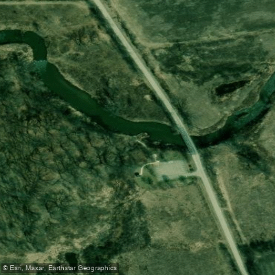
Boat Ramp
Boat Ramp
Boat Ramp
Flows, weather and a route-by-route verdict, so you know which stretch of the Nippersink Creek is worth paddling today.
Live flows, marked hazards and fresh trip reports from paddlers who were just on the water, all in one place.





Every user gets free access to launch points, boat ramps, and public property parcels.


Loading popular cities...
PaddleWays gives you everything you need to plan smarter, paddle better, and own every trip from first launch to takeout.