Curated by PaddleWays
RouteClass V
- Distance
- 13.3 mi
- Paddle time
- Multi-day
- Best for
- Experienced paddlers
- Put-in → take-out
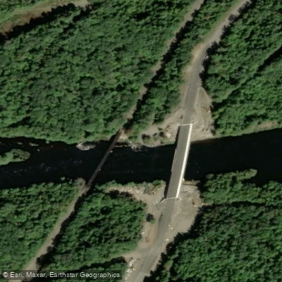
- Penobscot, Rip Gorge Put-in → WB Penobscot River Boat Ramp
Solid class IV and a bit of class V whitewater
The West Branch Penobscot River is a major waterway in north-central Maine, flowing approximately 117 miles from its headwaters near Seboomook Lake eastward to its confluence with the East Branch, forming the main stem of the Penobscot River. This scenic river system drains a vast watershed in the North Maine Woods region. The West Branch offers diverse paddling opportunities, from calm flatwater sections ideal for beginners to challenging whitewater rapids that test even expert paddlers.
The upper section from Seboomook Dam to Roll Dam provides a unique drop-pool character uncommon in New England, with Class III rapids interspersed with calm stretches. Below Roll Dam, the river flows gently for about 15 miles to Chesuncook Lake, offering an easy flatwater trip popular with families and novice paddlers. The lower section below McKay Station features the most technical whitewater, with continuous Class III-V rapids through the Ripogenus Gorge for about 17 miles. Notable rapids include Nesowadnehunk Falls (Class IV), Troublemaker (Class IV), and Big Eddy (Class III). This section is recommended only for experienced whitewater paddlers or guided rafting trips.
The best paddling season is typically May through October, with spring snowmelt providing higher water levels. Summer offers warmer temperatures but lower water levels. The river corridor supports diverse wildlife, including moose, black bears, and bald eagles. The surrounding forests feature a mix of spruce, fir, and northern hardwoods.
Key access points include Seboomook Dam, Roll Dam, the confluence of Lobster Stream, McKay Station, and takeouts near Chesuncook Lake and Big Eddy. The nearest towns are Millinocket and Greenville.
The West Branch holds great historical significance, having been used for centuries by the Penobscot people and later becoming crucial to Maine's logging industry. Today, it's a popular destination for outdoor recreation while still maintaining its wild character.
Multi-day canoe trips are common on the upper sections, with numerous campsites available along the shore. A typical leisurely trip from Lobster Stream to Chesuncook Lake takes 3-4 days. For whitewater enthusiasts, the lower gorge section can be run as a challenging day trip or extended multi-day adventure.
Paddlers should be aware of rapidly changing water levels due to dam releases, especially in the lower gorge. Proper safety equipment and wilderness camping skills are essential for overnight trips. Much of the river corridor is remote, with limited cell phone coverage, so thorough trip planning is crucial.
Curated routes
Hand-picked by the PaddleWays team, with put-ins, take-outs, paddle times and the hazards along the way.
RouteClass V
RouteClass III–V
RouteClass III–IV
RouteClass III–V
RouteFlatwater
RouteClass I–III
Hazards
No paddler has reported a hazard here yet, so these are the dams, falls and big rapids on our map. Hazards change with flows and storms, so check them before you launch.
From the community
Real trips from PaddleWays paddlers: which route they ran, how the flows were, and what to watch for.
Loading trip reports
Stephen L.
Kayak •
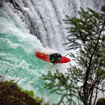
Made the drive up to Maine for this one. Totally worth it - Rip Gorge is incredible. Big water, continuous action. Camping at the gorge was perfect.
Stephen L. •
this is an awesome river
See exactly where the public can get on and off the river. Launch points and boat ramps are paired with PaddleWays' public land data so you know where you can legally land.
Public shoreline
4%of the river's shoreline is public
Most of the riverbank is private. Launch, land and camp only at public access points.
Flows, weather and a route-by-route verdict, so you know which stretch of the West Branch Penobscot River is worth paddling today.
No forecast data available.
Scheduled releases and generation forecasts from the dams on West Branch Penobscot River.
West Branch Penobscot River · Below North Twin Dam · Brookfield Renewable
1,000 cfs now
Forecast updated today at 8:23 PM EST. Schedules can change, so check the operator's page before you go.
West Branch Penobscot River · Ripogenus Gorge · Brookfield Renewable
900 cfs now
Forecast updated today at 8:23 PM EST. Schedules can change, so check the operator's page before you go.
West Branch Penobscot River · Below Seboomook Dam · Brookfield Renewable
126 cfs now
Forecast updated today at 8:23 PM EST. Schedules can change, so check the operator's page before you go.
Live flows, marked hazards and fresh trip reports from paddlers who were just on the water, all in one place.





Every user gets free access to launch points, boat ramps, and public property parcels.
What you need to float or boat West Branch Penobscot River, and when to apply.
Penobscot River Corridor
Registration · Overnight trips · Required year-round
Camping in the Penobscot River Corridor costs a fee per person per night, paid in cash or check at a North Maine Woods checkpoint.
Checked Nov 4, 2026 with North Maine Woods
McKay Station to Pockwockamus Falls
Registration · Private trips · Required year-round
Private whitewater trips from McKay Station to Pockwockamus Falls need a free trip registration filed online before launching.
Checked Nov 4, 2026 with Maine Department of Inland Fisheries and Wildlife










Loading popular cities...
PaddleWays gives you everything you need to plan smarter, paddle better, and own every trip from first launch to takeout.