Curated by PaddleWays
RouteClass IV
- Distance
- 2 mi
- Paddle time
- ~0.5 hrs
- Best for
- Experienced paddlers
- Put-in → take-out
- Glen Arm Road Access → St. Michaels Boat Ramp
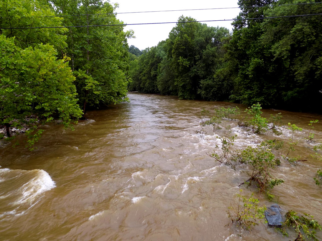
Continuous Class IV whitewater throughout
The Gunpowder Falls, located in Baltimore County, Maryland, is a river system that offers a wide range of paddling opportunities for enthusiasts of all skill levels. Stretching from Prettyboy Reservoir to the Chesapeake Bay, this river flows through picturesque countryside, wooded valleys, and historic sites, making it a popular destination for both recreation and nature appreciation.
The river is divided into several distinct sections, each with its own character and challenges. The upper reaches, known as the Gunpowder Gorge, provide a thrilling Class II-III whitewater experience for intermediate paddlers. This 2-mile stretch from Prettyboy Dam to Falls Road features continuous rapids and a narrow, technical run through a 100-foot deep canyon.
Downstream, the river mellows into a series of Class I-II sections, ideal for beginners and families. The Falls Road to Phoenix section offers a leisurely 15-mile paddle through gentle rapids and calm stretches, perfect for wildlife observation and scenic float trips.
For more experienced paddlers, the Lower Gunpowder section from Route 1 to US 40 provides a challenging 3.3-mile run with Class II-III rapids. This popular stretch offers a good mix of technical paddling and scenic views, attracting local kayakers and canoeists throughout the season.
The best time to paddle the Gunpowder Falls varies depending on the section and water levels. Spring and fall generally offer the most consistent flows, while summer can be ideal for leisurely trips on the calmer sections. Winter paddling is possible for experienced cold-water kayakers, but proper gear and precautions are essential.
The river corridor is home to a diverse ecosystem, with opportunities to spot wildlife such as great blue herons, bald eagles, and various fish species. The surrounding Gunpowder Falls State Park, established over 50 years ago, protects much of the watershed and provides additional recreational opportunities like hiking, fishing, and camping.
Several historic sites dot the river's course, including the Jerusalem Mill Village, which serves as the headquarters for Gunpowder Falls State Park. This preserved 18th and 19th-century Quaker settlement offers a glimpse into the area's rich cultural heritage.
Access points are numerous along the river, with popular put-ins and take-outs at Falls Road, Monkton Road, Glencoe Road, and Phoenix Road. Nearby towns like Monkton and Glen Arm provide services for paddlers, while Baltimore city is just a short drive away.
Safety is paramount on the Gunpowder Falls, especially in the more challenging sections. Paddlers should be aware of potential strainers, particularly near bridges, and always check water levels before embarking on a trip. Helmets are required for certain sections, and all paddlers should wear appropriate safety gear.
While most trips on the Gunpowder Falls are day excursions, multi-day adventures are possible by combining different sections or incorporating camping at designated sites within the state park. The variety of paddling options, from whitewater thrills to peaceful floats, makes the Gunpowder Falls a cherished resource for Maryland's paddling community and a must-visit destination for outdoor enthusiasts in the Mid-Atlantic region.
Curated routes
Hand-picked by the PaddleWays team, with put-ins, take-outs, paddle times and the hazards along the way.
RouteClass IV
RouteClass II–III
RouteClass II–III
RouteClass I–II
RouteClass I
RouteClass I
RouteClass I–II
RouteClass I–II
Hazards
No paddler has reported a hazard here yet, so these are the dams, falls and big rapids on our map. Hazards change with flows and storms, so check them before you launch.
From the community
Nobody has shared a trip on Gunpowder Falls yet. Paddle it, then tell the next paddler how it went.
See exactly where the public can get on and off the river. Launch points and boat ramps are paired with PaddleWays' public land data so you know where you can legally land.
Public shoreline
4%of the river's shoreline is public
Most of the riverbank is private. Launch, land and camp only at public access points.
Flows, weather and a route-by-route verdict, so you know which stretch of the Gunpowder Falls is worth paddling today.
All Flow Stations
Live flows, marked hazards and fresh trip reports from paddlers who were just on the water, all in one place.





Every user gets free access to launch points, boat ramps, and public property parcels.


Loading popular cities...
PaddleWays gives you everything you need to plan smarter, paddle better, and own every trip from first launch to takeout.