Magothy River
- Saltwater
- Tidal river
Magothy River
- Saltwater
- Tidal river
- Sq. miles
- 6.8
- Boat Ramps
- 3
- Access Points
- 0
- Campsites
- 2
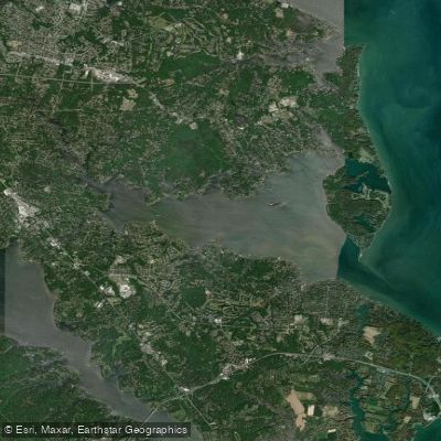
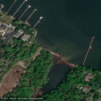
The Magothy River is a 12-mile tidal river in Anne Arundel County, Maryland, flowing into the Chesapeake Bay near Annapolis. It is characterized by a narrow entrance that opens into a broad, bay-like area around Sillery Bay, with numerous narrow, winding tributary creeks extending like fingers, creating approximately 65 to 67 miles of shoreline. For paddlers, public access is limited but available at key points. Beachwood Park on the upper river offers a soft launch with about a 600-foot carry from the parking area. Spriggs Farm Park on the south shore provides a launch, though it requires a 130-yard carry with a steep slope; a combination for the gate must be obtained from the county website. The Magothy River Association has created a detailed water trail map highlighting 30 points of interest and eight "hidden gems," which are secluded lakes, marshes, and wetlands often accessible only by kayak, SUP, or other shallow-draft craft. These include areas like Cooleys Pond on Gibson Island, Lake Placid, and a secluded pond behind an island on Broad Creek, many of which are invisible from the main channel and require navigating through reeds or over sandbars.
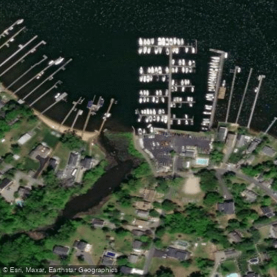
The river is popular with powerboats and sailors, especially around the well-known anchorage at Dobbins Island in Sillery Bay. Paddlers should expect significant boat traffic, particularly on weekends, and should be cautious when crossing channels or near marinas. The wind in the area most consistently comes from the west or northwest, which aligns with the river's orientation, making 6-8 mile downwind runs a favored local activity. Tides are a primary consideration for trip planning; one source suggests paddleboarding on the Magothy and visiting Annapolis would likely need to be separate trips unless tides are suspiciously helpful, indicating that timing trips with tidal currents is important. The creeks, such as Cornfield Creek, Gray's Creek, and Deep Creek, offer more protected paddling with natural shorelines, and some have marinas or restaurants like the Deep Creek Restaurant or The Point Crab House and Grill at Mill Creek accessible from the water. Hazards include shallow, narrow entrances to some creeks and potential sandbars.
Water access, boat ramps & amenities
Learn how to get on Magothy River. Uncover great paddling access points, boat ramps, and all the facilities you need for an unforgettable day on the water. Some locations shown may border or include private property. Always check property boundaries and applicable regulations before visiting. PaddleWays's Public & Private Land layer can help you plan your access with confidence.
Paddle smarter with real-time insights
Whether you're en route and conditions shift or you're looking for the best spot based on current flows, we enable you to make informed decisions on the fly.








Find Places to Paddle

Over 400,000 Places to Paddle
Every user gets free access to launch points, boat ramps, and public property parcels.


Tides, wind & water conditions (10 day forecast)
On open water, wind and tide matter as much as the weather. See the best times to paddle Magothy River and check the marine forecast before you launch.
Loading tide predictions…
Paddling near Magothy River

Patuxent River
South River
Patapsco River
Triadelphia Reservoir

Eastern Bay

Potomac River

Susquehanna River

Little Patuxent River
Explore Maryland waters
Top paddling waters
Popular Cities
Loading popular cities...
Explore near Magothy River
Access points
- Spriggs Farm Park Boat Ramp
- Cystal Beach Slipway Boat Ramp
- Oakleigh Forest Community Boat Ramp
- Magothy River Bridge
- Magothy Branch Bridge
- Branch Of Cattail Creek Bridge
- Branch Of Cypress Creek Bridge
- Trib. To Whitehall Creek Bridge
- Us 50/us 301 Bridge
- Rock Creek Bridge
- Mill Creek Bridge
- Tributary To Magothy Riv Bridge
- All 31 spots
Nearby waters
More in Maryland

Smarter Paddling Starts in the App.
Paddleways gives you everything you need to plan smarter, paddle better, and own every trip from first launch to takeout.