Curated by PaddleWays
RouteFlatwater
- Distance
- 7.3 mi
- Paddle time
- ~2.5 hrs
- Best for
- Canoe
- Put-in → take-out
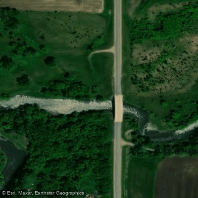
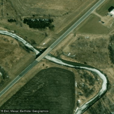
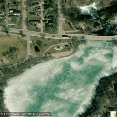
- Redwood River, Wabasso Public Water Access Site → Redwood Lake Public Water Access Site
The Redwood River is a scenic waterway in southwestern Minnesota, originating near Ruthton atop the Buffalo Ridge. It flows eastward through Lyon and Redwood counties before joining the Minnesota River near North Redwood. The river stretches approximately 75 miles and is part of the larger Minnesota River watershed. Paddling opportunities on the Redwood River are diverse, with the most popular sections running from Marshall to Redwood Falls. The river is designated as a State Water Trail, offering a mix of flatwater and gentle Class I rapids suitable for beginners to intermediate paddlers. The upper reaches near Ruthton are less frequently paddled due to inconsistent water levels.
The river's difficulty ranges from flatwater to Class I, with occasional Class II rapids during high water. Basic paddling skills are required, and the river's flashy nature demands awareness of changing conditions. The most canoeable portion begins near Marshall and ends at Lake Redwood in Redwood Falls. Spring and early summer typically offer the best paddling conditions, with water levels often too low later in the season. Paddlers should check water levels before trips, as the river can change rapidly with rainfall.
The Redwood River valley showcases a diverse ecosystem, including prairie grasslands, deciduous forests, and riparian habitats. Wildlife such as deer, various bird species, and occasionally river otters can be spotted along the banks. Key landmarks include Camden State Park, offering scenic views and hiking trails, and the Lake Redwood Dam in Redwood Falls, which requires a portage. The river passes through a cool, forested valley, providing picturesque paddling experiences.
Major access points include put-ins near Ruthton, Marshall, and Camden State Park, with popular take-outs at Lake Redwood and below the dam in Redwood Falls. These towns also serve as resupply points for longer trips. Historically, the river was important to Native American tribes and early settlers. Today, it plays a crucial role in local conservation efforts and recreational opportunities.
Safety considerations include checking water levels, being prepared for sudden changes in flow, and portaging around the Lake Redwood Dam. Paddlers should also be aware of potential logjams and strainers, especially in less frequently paddled sections. Multi-day trips are possible, with Camden State Park offering camping facilities. Paddlers can combine sections for longer adventures, potentially continuing past Redwood Falls to the Minnesota River confluence for extended journeys.
Curated routes
Hand-picked by the PaddleWays team, with put-ins, take-outs, paddle times and the hazards along the way.
RouteFlatwater
RouteFlatwater
RouteFlatwater
RouteFlatwater
Hazards
No paddler has reported a hazard here yet, so these are the dams, falls and big rapids on our map. Hazards change with flows and storms, so check them before you launch.
From the community
Nobody has shared a trip on Redwood River yet. Paddle it, then tell the next paddler how it went.
See exactly where the public can get on and off the river. Launch points and boat ramps are paired with PaddleWays' public land data so you know where you can legally land.
Public shoreline
5%of the river's shoreline is public
Most of the riverbank is private. Launch, land and camp only at public access points.
Flows, weather and a route-by-route verdict, so you know which stretch of the Redwood River is worth paddling today.
All Flow Stations
Live flows, marked hazards and fresh trip reports from paddlers who were just on the water, all in one place.





Every user gets free access to launch points, boat ramps, and public property parcels.
Loading popular cities...
PaddleWays gives you everything you need to plan smarter, paddle better, and own every trip from first launch to takeout.