Paddling in Saint Croix National Scenic Riverway
- National Wild & Scenic River
- Open 24 hours
- Lakes
- 8
- Rivers
- 78
- Access
- 11
- Boat Ramps
- 48
- Shops
- 0
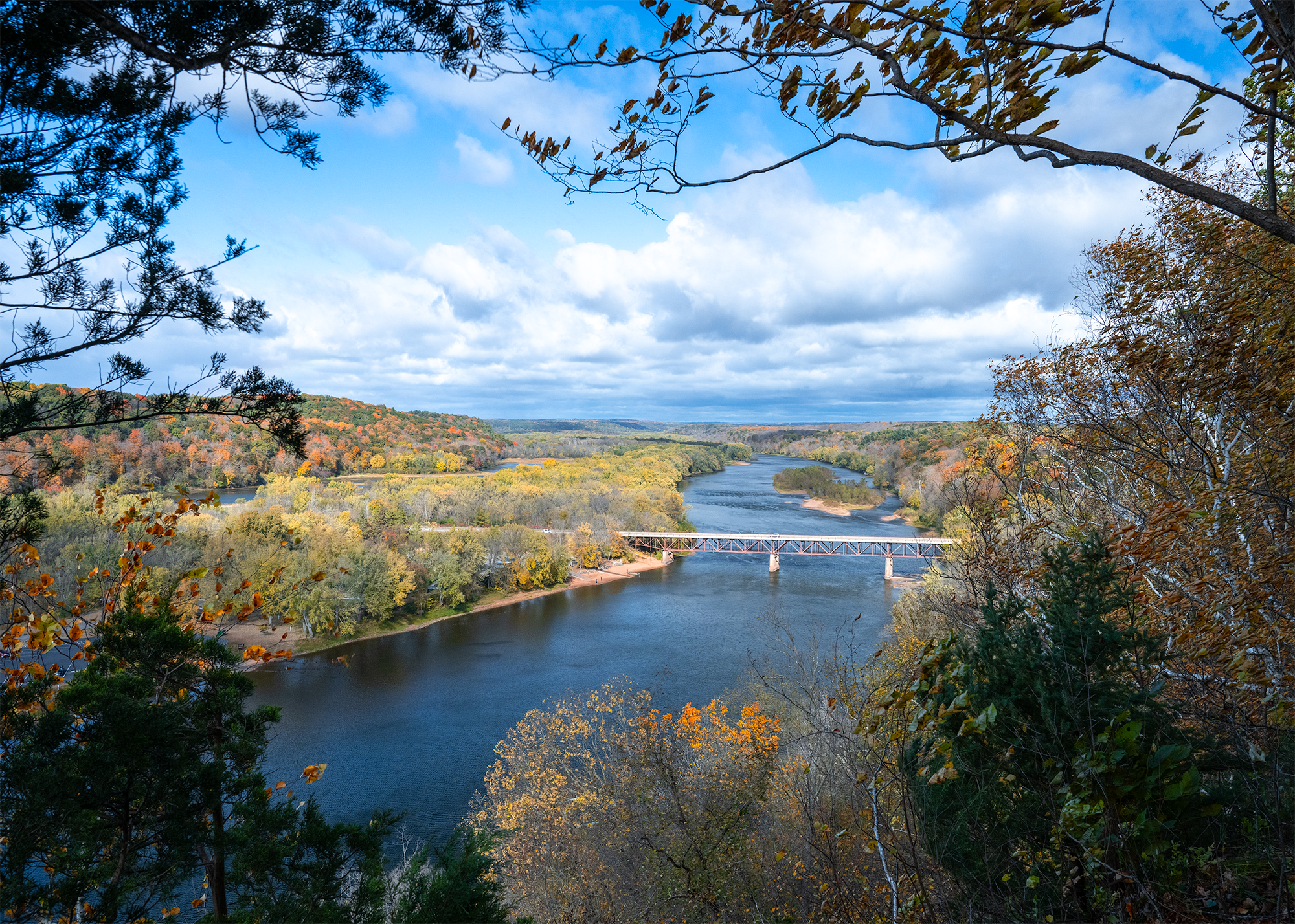
The St. Croix National Scenic Riverway is a federally protected river corridor straddling the Wisconsin-Minnesota border, built around two rivers: the St. Croix and its tributary the Namekagon.
Together they account for 252 miles of moving water, ranging from swift and rocky whitewater in the upper reaches to wide, placid flowages downstream.
This is one of the original eight rivers designated under the National Wild and Scenic Rivers Act of 1968, and the largest scenic riverway east of the Mississippi — which means the paddling here happens inside a managed landscape, not just near one.
The Namekagon runs entirely through Wisconsin, beginning near Namekagon Lake where it flows through the Chequamegon National Forest before joining the St. Croix.
It's a northwoods river — forested banks, primitive campsites along the shore and on islands, and the kind of quiet that makes multi-day trips worth planning. The upper St.
Croix picks up at Gordon Dam and moves south, with the character shifting as the river widens. The lower St. Croix, from roughly Highway 8 south, is broader and more developed in feel, with wooded bluffs and historic river towns marking the banks.
NPS divides the paddling into three named stretches — Namekagon, Upper St. Croix, and Lower St. Croix — each with its own river description and distance chart. Rangers at the St.
Croix River Visitor Center (715-483-2274) and the Namekagon River Visitor Center (715-496-5539) can match a stretch to your skill level and current conditions.
River levels matter here; check them before you go, and know that cell service is unreliable on some stretches. Overnight trips on the Lower St. Croix require a camping permit for stays between Highway 8 and the High Bridge — the NPS issues these.
If your put-in or take-out is at a Wisconsin state park landing, you'll need a state park entrance sticker unless you're launching through an outfitter.
Campfires are permitted only at designated campsites in the provided fire ring; below the Soo Line High Bridge, fires in rock rings on islands are also allowed.
Outfitters operate throughout the riverway and handle shuttles for paddlers with their own boats as well as rentals. Vehicles can be left overnight in Riverway parking lots. Children under 13 are required to wear a life jacket on the water. The St.
Croix corridor rewards the paddler who slows down — a river system old enough to have carried voyageurs, wide enough to lose yourself in for a week, and protected enough that it still feels like it.
Top waters to paddle near Saint Croix National Scenic Riverway
Water and weather conditions (10 day forecast)
See the best times to paddle Saint Croix National Scenic Riverway and check the forecast before you go.
No forecast data available.
Park alerts & road status
Closures and conditions Saint Croix National Scenic Riverway has posted, from the National Park Service.
Checking the park's alerts…
Hours & fees
When Saint Croix National Scenic Riverway is open and what it costs to get in, from the National Park Service.
Hours
Open 24 hoursThe St. Croix and Namekagon rivers are open all-day, year-round except for periods of dangerous water conditions. Access to landings and trails is seasonal.
Entrance fees
No entrance fee is listed for this park.
Paddle smarter with real-time insights
Whether you're en route and conditions shift or you're looking for the best spot based on current flows, we enable you to make informed decisions on the fly.







Paddling near Saint Croix National Scenic Riverway
Loading...
Other parks in Wisconsin
Gateway towns
Where to base yourself for paddling in Saint Croix National Scenic Riverway.
Home to the main NPS visitor center and the southern hub for launches, lodging, and outfitters on the lower riverway.
Sits directly across the river from St. Croix Falls and serves as a Minnesota-side base with access to the scenic gorge section.
A nearby town used as a base for the upper St. Croix river corridor with access to camping and paddling put-ins.
- CableWI
Gateway town near the Namekagon River headwaters, with outfitters and lodging for paddlers starting the upper Namekagon segment.
Saint Croix National Scenic Riverway paddling rules
The park's own rules, on top of Wisconsin licenses and regulations. Limits, fees and closures change, so check the park's page before you go.

Life Jackets Required on Board
A properly fitting US Coast Guard approved life jacket is required for every person on your vessel. Children under 13, including infants, must wear one at all times.

PWC and Airboats Prohibited
Personal watercraft and airboats are banned on the entire Namekagon River and on the St. Croix from Gordon Dam downstream to the Boom Site Landing near Stillwater.

Slow-No Wake Zones Apply
Slow-no wake rules apply within 100 feet of swimmers, shore, other vessels, and launch sites on the lower St. Croix. Additional slow-speed zones kick in when the Stillwater gauge hits a set level.

Camping Permit Required Overnight
If you plan to camp overnight between Highway 8 and the High Bridge, you must have a camping permit before you put in.

State Park Sticker at Some Landings
Using a landing inside a state park requires a state park entrance sticker unless you are launching through an authorized outfitter.
Explore Saint Croix National Scenic Riverway
Top paddling waters
Popular Cities
Loading popular cities...

Smarter Paddling Starts in the App.
Paddleways gives you everything you need to plan smarter, paddle better, and own every trip from first launch to takeout.