Curated by PaddleWays
RouteFlatwater
- Distance
- 2.6 mi
- Paddle time
- ~1 hr
- Put-in → take-out
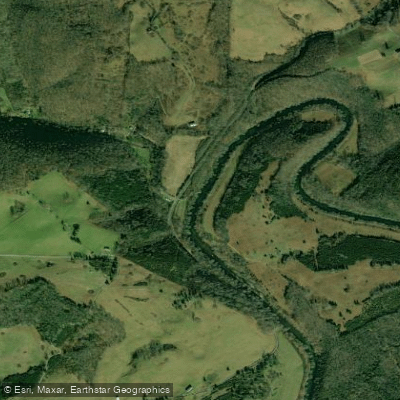
- Steep Rock (Estes) → Flannery Bridge
The Powell River is a 195-mile long waterway that originates in southwest Virginia and flows southwest into eastern Tennessee. It begins near Norton, Virginia and joins the Clinch River at Norris Lake in Tennessee to form a major tributary of the Tennessee River system. The river offers a diverse range of paddling opportunities across its length.
In Virginia, the upper sections near Norton and Appalachia provide thrilling class II-IV whitewater suitable for intermediate to advanced paddlers. The 3-mile Appalachia to Big Stone Gap run is particularly popular, featuring technical rapids alongside scenic mountain views. As the river flows into Tennessee, it transitions to mostly class I-II water ideal for canoes, recreational kayaks, and casual floats. Paddling difficulty ranges from challenging class IV rapids in the Virginia headwaters to calm flatwater sections in Tennessee. Most of the Tennessee portions are suitable for beginners, while the Virginia whitewater requires solid boat control and self-rescue skills.
Spring typically offers the most reliable water levels for whitewater. Summer and fall provide pleasant conditions for flatwater paddling in Tennessee, though water levels can drop during dry periods. The river valley showcases Appalachian flora and fauna, including diverse fish populations and occasional river otters.
Key access points include Norton, Appalachia, and Big Stone Gap in Virginia. In Tennessee, popular put-ins are at Well Being Retreat Center (mile 92) and Fugate Ford, with take-outs at places like Mulberry Creek access and Riverside Rentals. The river passes through rural landscapes and small towns, offering a glimpse into Appalachian culture. Multi-day trips are possible on the Tennessee sections, with numerous access points along the 114-mile Powell River Blueway Trail.
Paddlers should be aware of occasional low-head dams and should always wear life jackets. The river holds cultural significance as a transportation route for early settlers and played a role in the region's coal mining history. The Powell River provides a range of paddling experiences, from adrenaline-pumping whitewater to serene floats through picturesque Appalachian scenery, making it a valued recreational resource for both Virginia and Tennessee.
Curated routes
Hand-picked by the PaddleWays team, with put-ins, take-outs, paddle times and the hazards along the way.
RouteFlatwater
RouteFlatwater
RouteFlatwater
RouteFlatwater
Hazards
No paddler has reported a hazard here yet, so these are the dams, falls and big rapids on our map. Hazards change with flows and storms, so check them before you launch.
From the community
Real trips from PaddleWays paddlers: which route they ran, how the flows were, and what to watch for.
Loading trip reports
John M.
Kayak •
Mulberry Creek Boat Ramp to 99 Right- Buckhannon Ford• 248 cfs at Arthur
Nice float down the river! This section had a lot of cows in the river, most slow to still water. Some road noise but mostly peaceful and quiet.

Jenny P.
248 cfs at Arthur
Dropped Pin to End of Route
John M.
Canoe •
133L - Steep Rock (Estes) to 130R - Flannery Bridge• 429 cfs at Jonesville
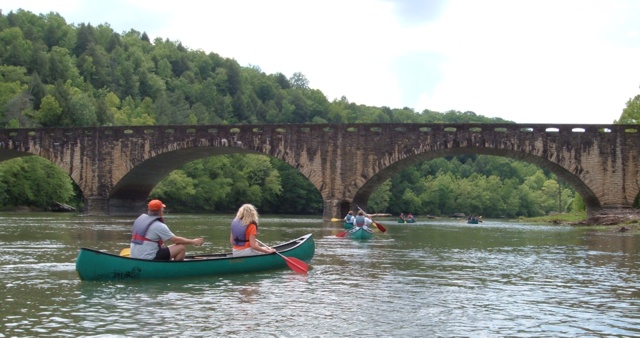
A nice short 3 mi float down the river. Mostly slack water with light current. There are three shallow shoals about the first mile that were a bit rough to get across with a canoe. The Kids in the kayaks did fine.
John M.
Kayak •
120L - Beech Grove River Access to Fletcher's Ford Access Point• 145 cfs at Jonesville
This is a nice 2.8 mi float. Lots of deep water, not very fast moving. There's a swing bridge but other than that this is a very remote part of the river. Very peaceful!
See exactly where the public can get on and off the river. Launch points and boat ramps are paired with PaddleWays' public land data so you know where you can legally land.
Public shoreline
2%of the river's shoreline is public
Most of the riverbank is private. Launch, land and camp only at public access points.
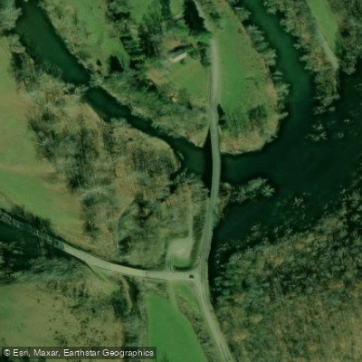
Boat Ramp
Boat Ramp
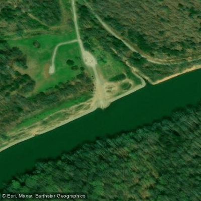
Boat Ramp
Flows, weather and a route-by-route verdict, so you know which stretch of the Powell River is worth paddling today.
All Flow Stations
Live flows, marked hazards and fresh trip reports from paddlers who were just on the water, all in one place.





Every user gets free access to launch points, boat ramps, and public property parcels.
Loading popular cities...
PaddleWays gives you everything you need to plan smarter, paddle better, and own every trip from first launch to takeout.





