Meyer Bayou
- Saltwater
- Bayou
Meyer Bayou
- Saltwater
- Bayou
- Sq. miles
- 0
- Boat Ramps
- 0
- Access Points
- 0
- Campsites
- 0
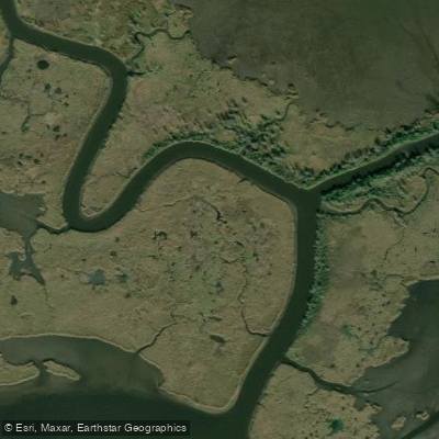
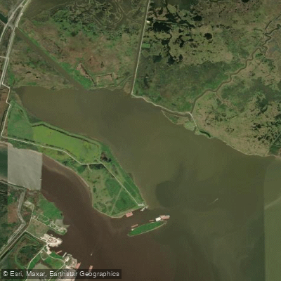
Meyer Bayou is a tidal, brackish water tributary of the Neches River in southeast Texas, located approximately 7.5 kilometers from Beaumont. It is a coastal saltwater feature, a bayou influenced by the tides of the nearby Gulf of Mexico. The bayou flows through a landscape lined with river cane, palmettos, and thick brush, with remnants of bald cypress trees along the shore that have been impacted by past saltwater surges from hurricanes. The overall aesthetic is that of a murky, slow-moving waterway within the Lower Neches Wildlife Management Area. For paddlers, access to Meyer Bayou is primarily from the Neches River itself, as no specific public launch points or take-outs for the bayou are detailed. The bayou is wide enough for motorboats to navigate, indicating sufficient width for paddling craft. Given its connection to the dredged and heavily industrialized Neches River ship channel, paddlers must be prepared for significant commercial boat traffic, including oil freighters, tugboats, and barges, when accessing the bayou. The tidal nature of the water means currents will fluctuate, and paddlers should plan their trip timing with the tide stages to assist with travel in and out of the bayou. Wind exposure can be significant on the open Neches River, and the bayou's fetch may be limited by its vegetated banks. Wildlife sightings can include alligators, ospreys, red-winged blackbirds, and various aquatic life like crabs. There are no facilities or amenities specifically for paddlers at Meyer Bayou. Water quality is brackish and murky.
Water access, boat ramps & amenities
Learn how to get on Meyer Bayou. Uncover great paddling access points, boat ramps, and all the facilities you need for an unforgettable day on the water. Some locations shown may border or include private property. Always check property boundaries and applicable regulations before visiting. PaddleWays's Public & Private Land layer can help you plan your access with confidence.
Paddle smarter with real-time insights
Whether you're en route and conditions shift or you're looking for the best spot based on current flows, we enable you to make informed decisions on the fly.








Find Places to Paddle

Over 400,000 Places to Paddle
Every user gets free access to launch points, boat ramps, and public property parcels.


Tides, wind & water conditions (10 day forecast)
On open water, wind and tide matter as much as the weather. See the best times to paddle Meyer Bayou and check the marine forecast before you launch.
Loading tide predictions…
Paddling near Meyer Bayou

Explore Texas waters
Top paddling waters
Popular Cities
Loading popular cities...
Explore near Meyer Bayou

Smarter Paddling Starts in the App.
Paddleways gives you everything you need to plan smarter, paddle better, and own every trip from first launch to takeout.