Oconto River
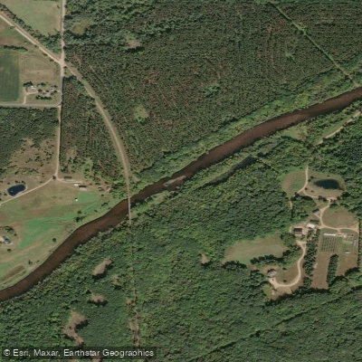
Oconto River
- Boat Ramps
- 11
- Access Points
- 11
- Campsites
- 1
The Oconto River is a scenic waterway in northeastern Wisconsin, originating in Forest County and flowing approximately 110 miles southeast before emptying into Green Bay. Its main tributaries include the North and South Branches, which join the main stem near the town of Oconto Falls. The river offers diverse paddling opportunities, from calm flatwater sections to challenging whitewater rapids. The upper reaches, particularly the North Branch, feature Class II-III rapids suitable for intermediate to advanced paddlers. Popular whitewater runs include the 7-mile Tar Dam Road section and the 1.1-mile Bagley Rapids stretch. Downstream, the river mellows, providing enjoyable trips for canoeists and kayakers of all skill levels.
Paddling is best from spring through fall, with higher water levels in spring offering more exciting whitewater. Summer and fall provide pleasant conditions for flatwater paddling and fishing. The river corridor supports a rich ecosystem, home to trout, smallmouth bass, and diverse wildlife including bald eagles and river otters. Key landmarks include Chute Pond, a scenic impoundment popular for camping and fishing, and several historic covered bridges. The river passes through the Nicolet National Forest, offering stunning views of northern hardwood forests.
Major access points include: - Tar Dam Road (Forest Service Road 2104) near Mountain - Kingston Road south of Bagley Rapids - Highway 32 Wayside near Suring - River Road Landing in Oconto
The Oconto River played a significant role in the region's logging history, with many communities developing along its banks. Today, it's a valued recreational resource, attracting anglers, paddlers, and nature enthusiasts.
Safety considerations include wearing life jackets, being aware of dam locations (especially near Oconto Falls), and checking water levels before paddling whitewater sections. Some boat landings in Oconto County require a fee. For multi-day adventures, paddlers can combine various sections, with camping available at Chute Pond County Park and Bagley Rapids Campground. The river's diverse character allows for trips tailored to different skill levels and interests, from exhilarating whitewater runs to leisurely floats through picturesque Wisconsin landscapes.
Water access, boat ramps & amenities
Learn how to get on Oconto River. Uncover great paddling access points, boat ramps, and all the facilities you need for an unforgettable day on the water. Some locations shown may border or include private property. Always check property boundaries and applicable regulations before visiting. PaddleWays's Public & Private Land layer can help you plan your access with confidence.
Paddle smarter with real-time insights
Whether you're en route and conditions shift or you're looking for the best spot based on current flows, we enable you to make informed decisions on the fly.








Find Places to Paddle

Over 400,000 Places to Paddle
Every user gets free access to launch points, boat ramps, and public property parcels.


Water and weather conditions (10 day forecast)
See the best times to paddle Oconto River and check the forecast before you go.
OCONTO RIVER NEAR GILLETT, WI
All Flow Stations
Paddling near Oconto River

Lake Michigan
Fox River

Lake Winnebago
Wolf River
Peshtigo River
Menominee River
Red River
Sheboygan River
Shawano Lake
Explore Wisconsin waters
Top paddling waters
Popular Cities
Loading popular cities...
Explore near Oconto River
Access points
- Patzer Park Boat Ramp
- Riverside County Park Boat Ramp
- Oconto River Boat Ramp
- Iron Bridge Public Boat Boat Ramp
- Oconto River Boat Ramp
- Oconto River Boat Ramp
- Oconto City Docks Boat Ramp
- North River Road Public Boat Boat Ramp
- Breakwater Park Boat Ramp
- West Side Beach Boat Ramp
- Machickanee Boat Ramp
- Holtwood Campground
Nearby waters
More in Wisconsin

Smarter Paddling Starts in the App.
Paddleways gives you everything you need to plan smarter, paddle better, and own every trip from first launch to takeout.