Kororoit Creek
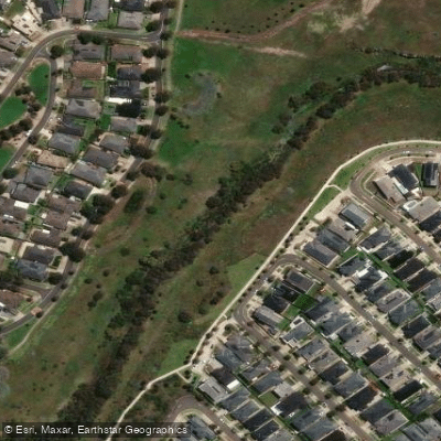
Kororoit Creek
- Boat Ramps
- 0
- Access Points
- 0
- Campsites
- 0
Kororoit Creek is a tidal waterway in Melbourne's western suburbs that flows into Port Phillip Bay, offering a short but interesting flatwater paddle through an area that blends industrial history with pockets of natural interest.
The recommended paddling section is the lower reach, downstream from the Racecourse Road bridge between Altona and Williamstown, running to the creek mouth at Port Phillip Bay. Other sections near Kororoit Creek Road are reportedly navigable but access is described as very difficult, making the lower tidal section the practical choice for most paddlers.
Tidal conditions are the dominant planning consideration here. The creek entrance goes dry at low tide, making entry and exit impossible at that stage. Paddlers should plan their trips around high or slack tide to ensure safe passage in and out of the creek. A kayak angler's forum note reinforces this: at low tide you may find yourself unable to exit the creek or unable to return. For boats with any meaningful draft, the sandbars at the mouth present an additional challenge, with the entrance reported as shallow over the bars and accessible only within a limited tidal window.
The area is sheltered from Port Phillip Bay wave action, so low to moderate winds combined with high tide represent the most favourable conditions. The creek passes by the historic remains of the Williamstown Racecourse and the still-active Kororoit Creek Fishing Village, providing some cultural and historical interest along the banks.
The overall character of the paddle is a calm, tidal estuary experience in an urban-industrial setting. While the surroundings include nearby industrial infrastructure, the creek itself offers a quieter corridor through the western suburbs. The experience is relatively short and straightforward, suited to recreational kayakers comfortable with tidal timing rather than those seeking a challenging or remote paddle.
Water access, boat ramps & amenities
Learn how to get on Kororoit Creek. Uncover great paddling access points, boat ramps, and all the facilities you need for an unforgettable day on the water. Some locations shown may border or include private property. Always check property boundaries and applicable regulations before visiting. PaddleWays's Public & Private Land layer can help you plan your access with confidence.
Paddle smarter with real-time insights
Whether you're en route and conditions shift or you're looking for the best spot based on current flows, we enable you to make informed decisions on the fly.








Find Places to Paddle

Over 400,000 Places to Paddle
Every user gets free access to launch points, boat ramps, and public property parcels.


Water and weather conditions (10 day forecast)
See the best times to paddle Kororoit Creek and check the forecast before you go.
Kororoit Creek At Millbank Drive Deer Park
All Flow Stations
Paddling near Kororoit Creek
Yarra River
Maribyrnong River

Port Phillip Bay

Werribee River

Port Phillip
Stony Creek
Murrindindi River
St Kilda Beach

Campaspe River
Explore Victoria waters
Top paddling waters
No waters available right now.
Popular Cities
Loading popular cities...
Explore near Kororoit Creek

Smarter Paddling Starts in the App.
Paddleways gives you everything you need to plan smarter, paddle better, and own every trip from first launch to takeout.