Mud Bay
- Saltwater
- Bay
Mud Bay
- Saltwater
- Bay
- Sq. miles
- 3.7
- Boat Ramps
- 0
- Access Points
- 0
- Campsites
- 0
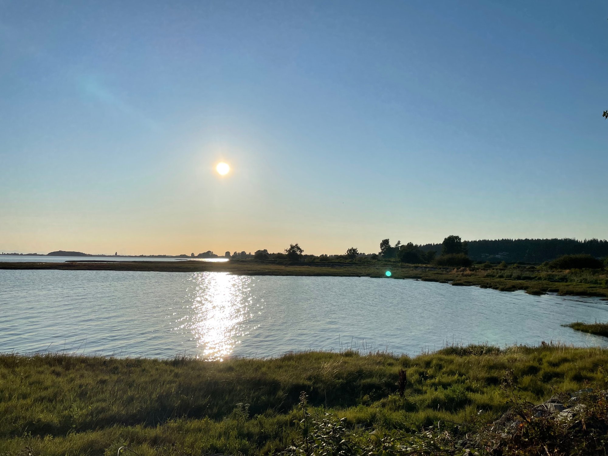
Mud Bay is a shallow coastal bay within the Boundary Bay region of Metro Vancouver, forming part of the larger Salish Sea. It is characterized by extensive mudflats that are exposed at low tide, creating a vast, flat landscape. The bay is a significant area for birdlife, located within an international flyway that hosts large populations of shorebirds and waterfowl. Paddlers can launch car-top boats such as kayaks and canoes to explore the coastline of Mud Bay and Boundary Bay. A primary access point for paddlers is Mud Bay Park in Surrey, which offers scenic walking trails along the dyke. The adjacent Boundary Bay Dyke Trail system provides connections for longer journeys. A notable paddling route is a one-way downwinder crossing from Boundary Bay near Centennial Beach to the dyke trail at 96th Street in Delta, a distance of approximately 9 kilometers. This route is heavily influenced by tides and wind. Tidal range in the area is significant, with highs exceeding 4 meters and lows around 1 meter. Currents include a flood (incoming) tide and an ebb (outgoing) tide, with slack water periods in between. Paddlers must carefully consult tide tables for White Rock or Tsawwassen, as the extensive mudflats become fully exposed at low tide, potentially stranding boats far from shore and requiring a muddy trek. The bottom is soft mud, which can be deep and challenging to walk through. Wind is a major factor, with southwesterly winds common; these can be used to advantage for downwind paddles but also create chop. The area is exposed, with a long fetch across Boundary Bay. There are no facilities directly on the water, but nearby regional greenways and parks like Mud Bay Park provide parking and land-based amenities. The overall paddling experience is one for those seeking a wild, coastal feel with big skies, mountain views, and abundant wildlife, but it requires careful planning around tides and weather.
Water access, boat ramps & amenities
Learn how to get on Mud Bay. Uncover great paddling access points, boat ramps, and all the facilities you need for an unforgettable day on the water. Some locations shown may border or include private property. Always check property boundaries and applicable regulations before visiting. PaddleWays's Public & Private Land layer can help you plan your access with confidence.
Paddle smarter with real-time insights
Whether you're en route and conditions shift or you're looking for the best spot based on current flows, we enable you to make informed decisions on the fly.







Bc licenses and regulations
No licenses or regulations available for Bc.
Find Places to Paddle

Over 400,000 Places to Paddle
Every user gets free access to launch points, boat ramps, and public property parcels.


Tides, wind & water conditions (10 day forecast)
On open water, wind and tide matter as much as the weather. See the best times to paddle Mud Bay and check the marine forecast before you launch.
Loading tide predictions…







Explore Bc waters
Top paddling waters
No waters available right now.
Popular Cities
Loading popular cities...
Explore near Mud Bay

Smarter Paddling Starts in the App.
Paddleways gives you everything you need to plan smarter, paddle better, and own every trip from first launch to takeout.