Stave Lake
Stave Lake
- Boat Ramps
- 0
- Access Points
- 1
- Campsites
- 5
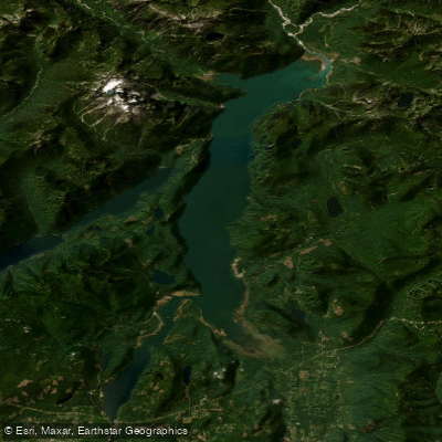
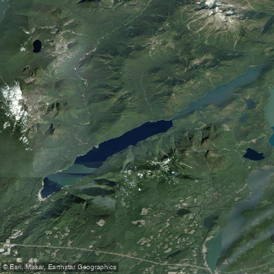
Stave Lake is a large reservoir located approximately 60 kilometres east of Vancouver in the north central Fraser Valley, near Mission, British Columbia. It sits on the traditional territory of the Kwantlen First Nation and was created by the Stave Lake Dam and Blind Slough Dam as part of BC Hydro's Stave River hydroelectric project. The lake is geographically divided into two distinct lobes at Rocky Point. The western lower lobe to the southwest measures roughly 21 kilometres in circumference and sees considerably more recreational traffic, as it contains the primary boat launch and most established recreation sites. The larger eastern upper lobe extends approximately 54 kilometres in circumference and is notably more remote and rugged, with the northern end offering views toward the glaciers of Mt. Robie Reid.
The main access point is the BC Hydro Stave Lake Boat Launch, which features a double-wide concrete ramp, floating docks, a sandy beach, day-use picnic area, and pit toilets. The launch is generally open year-round, subject to road and weather conditions. The ramp can become busy with motorized craft, particularly during peak seasons. A group campground area on the upper west side of the lake offers reservation-only camping for non-profit youth groups.
Wind is a significant consideration on Stave Lake. The surrounding mountains funnel wind through both the arm leading to the main lake and the lake itself, creating potentially hazardous conditions for paddlers. The upper lobe in particular is subject to shifting wind directions, including thermal winds similar to those experienced on other long, narrow mountain-flanked lakes in the region. Paddlers should plan accordingly and be prepared for conditions to change.
The northern end of the upper lobe contains numerous dead trees protruding from the water, a result of the lake level being raised when the reservoir was created. This area requires careful navigation. Paddling up the left shore of the arm near the launch, rock outcrops with painted pictographs are visible. A popular multi-day paddle camping destination is Glacier Bay near the northern end of the upper lobe, approximately 18 kilometres from the launch depending on starting point. The route through the upper lobe is long and narrow with mountain terrain on either side, ending with views of glacial features on Mt. Robie Reid.
Water access, boat ramps & amenities
Learn how to get on Stave Lake. Uncover great paddling access points, boat ramps, and all the facilities you need for an unforgettable day on the water. Some locations shown may border or include private property. Always check property boundaries and applicable regulations before visiting. PaddleWays's Public & Private Land layer can help you plan your access with confidence.
Paddle smarter with real-time insights
Whether you're en route and conditions shift or you're looking for the best spot based on current flows, we enable you to make informed decisions on the fly.







Bc licenses and regulations
No licenses or regulations available for Bc.
Find Places to Paddle

Over 400,000 Places to Paddle
Every user gets free access to launch points, boat ramps, and public property parcels.


Water and weather conditions (10 day forecast)
See the best times to paddle Stave Lake and check the forecast before you go.
No forecast data available.




Explore Bc waters
Top paddling waters
No waters available right now.
Popular Cities
Loading popular cities...
Explore near Stave Lake
Access points
Nearby waters
More in Bc

Smarter Paddling Starts in the App.
Paddleways gives you everything you need to plan smarter, paddle better, and own every trip from first launch to takeout.