Sturgeon Creek
Sturgeon Creek
- Boat Ramps
- 0
- Access Points
- 0
- Campsites
- 0
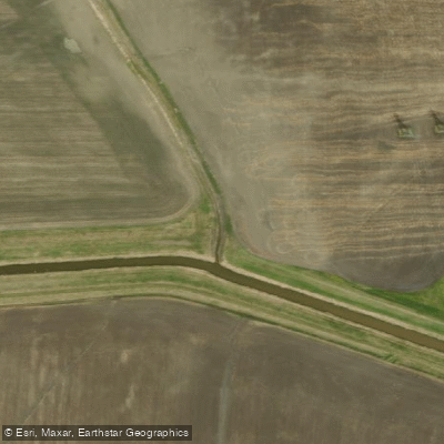
Sturgeon Creek flows through the St. James neighbourhood of Winnipeg, making it one of the larger creeks within the city. The creek runs through areas that were once tall grass prairie and supports notable ecological diversity, with at least 30 fish species identified, along with molluscs, crustaceans, amphibians, reptiles, birds, and mammals. In the 1990s, riffles and fish ladders were added to improve water quality and fish habitat, and a no-mow buffer strip was established along the banks to stabilize them and support biodiversity.
The creek is generally considered suitable for beginner paddlers under calm conditions, though water levels and character change significantly with the season. Paddling is most commonly done in spring and after heavy rainfall. When water is high, the creek can develop very swift currents and present dangerous obstacles, including low bridges and culverts, which require serious caution.
Access to the creek is possible from several points. One commonly used put-in is near Assiniboine Crescent, beside a pedestrian bridge over the creek, which also serves as a convenient drop-off and pick-up location for paddlers combining a Sturgeon Creek run with time on the Assiniboine River. Another access option is below the Moray Street bridge on the west side, though the Assiniboine Crescent location is generally considered easier and more pleasant. Smithdale Park, near Vialoux and Hendon Avenue, is another noted access point.
Paddling is feasible along portions of the creek for much of the summer, though it is most reliably navigable in spring and following significant rain events. The section north of Saskatchewan Avenue has not been as thoroughly documented, but access from near the Perimeter Highway may be possible. North of that point, the St. Charles Rifle Range restricts access and use, and paddlers should be aware of this boundary.
The Sturgeon Creek Greenway Trail runs alongside the creek from Woodhaven Park to Saskatchewan Avenue, meaning paddlers will travel through a corridor that also sees trail users, adding a degree of activity to the surrounding environment. The creek connects to the Assiniboine River, which some paddlers use as part of a combined route.
Water access, boat ramps & amenities
Learn how to get on Sturgeon Creek. Uncover great paddling access points, boat ramps, and all the facilities you need for an unforgettable day on the water. Some locations shown may border or include private property. Always check property boundaries and applicable regulations before visiting. PaddleWays's Public & Private Land layer can help you plan your access with confidence.
Paddle smarter with real-time insights
Whether you're en route and conditions shift or you're looking for the best spot based on current flows, we enable you to make informed decisions on the fly.







Mb licenses and regulations
No licenses or regulations available for Mb.
Find Places to Paddle

Over 400,000 Places to Paddle
Every user gets free access to launch points, boat ramps, and public property parcels.


Water and weather conditions (10 day forecast)
See the best times to paddle Sturgeon Creek and check the forecast before you go.
STURGEON CREEK AT ST. JAMES

Explore Mb waters
Top paddling waters
No waters available right now.
Popular Cities
Loading popular cities...
Explore near Sturgeon Creek

Smarter Paddling Starts in the App.
Paddleways gives you everything you need to plan smarter, paddle better, and own every trip from first launch to takeout.