South Arm
- Saltwater
- Bay
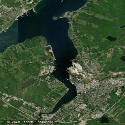
South Arm
- Saltwater
- Bay
- Sq. miles
- 4.3
- Boat Ramps
- 0
- Access Points
- 0
- Campsites
- 0
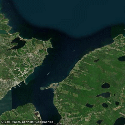
The South Arm is the southern branch of Sydney Harbour, a saltwater inlet on Cape Breton Island. It is a significant marine feature, separating the community of Westmount from the city of Sydney. The arm is formed where the Sydney River estuary meets the harbour, with the river's mouth located between Amelia Point on the Westmount shore and Battery Point on the Sydney shore. Petersfield Provincial Park, located off Route 239, provides a public shoreline access point overlooking the South Arm, featuring picnic tables and trails. On the western shore, the Dobson Yacht Club is situated at Dobson's Point (formerly Shingle Point) in Westmount, directly opposite the Sydney downtown area. This club has a basin protected by rock breakwaters, a wharf, a travelift, and a clubhouse; gasoline is available there. The harbour, including the South Arm, is having easy access. The area has historical significance, with Petersfield Provincial Park containing remnants of four cultural periods from the late 18th to mid 20th centuries. The low valley of the Sydney River, which feeds into the arm, was a traditional Mi'kmaq canoe portage route for travelling between Sydney Harbour and the East Bay of Bras d'Or Lake.
Water access, boat ramps & amenities
Learn how to get on South Arm. Uncover great paddling access points, boat ramps, and all the facilities you need for an unforgettable day on the water. Some locations shown may border or include private property. Always check property boundaries and applicable regulations before visiting. PaddleWays's Public & Private Land layer can help you plan your access with confidence.
Paddle smarter with real-time insights
Whether you're en route and conditions shift or you're looking for the best spot based on current flows, we enable you to make informed decisions on the fly.








Find Places to Paddle

Over 400,000 Places to Paddle
Every user gets free access to launch points, boat ramps, and public property parcels.


Tides, wind & water conditions (10 day forecast)
On open water, wind and tide matter as much as the weather. See the best times to paddle South Arm and check the marine forecast before you launch.
Loading tide predictions…
Paddling near South Arm
Explore Ns waters
Top paddling waters
No waters available right now.
Popular Cities
Loading popular cities...
Explore near South Arm

Smarter Paddling Starts in the App.
Paddleways gives you everything you need to plan smarter, paddle better, and own every trip from first launch to takeout.