Don River
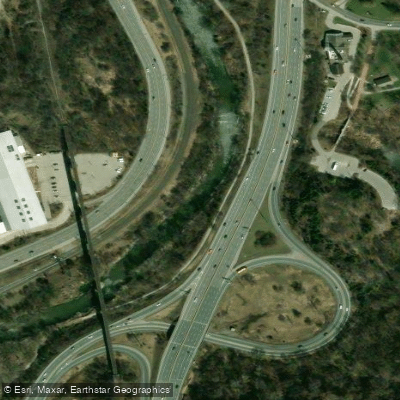
Don River
- Boat Ramps
- 0
- Access Points
- 0
- Campsites
- 0
The Don River is a 38-kilometre urban waterway in southern Ontario, draining a 360-square-kilometre basin from its headwaters on the Oak Ridges Moraine through the cities of Vaughan, Markham, Richmond Hill, and Toronto before emptying into Lake Ontario via the Keating Channel and Toronto Harbour. The river divides into eastern and western branches that converge before flowing south through the Don Valley.
The most commonly paddled section runs approximately 10.5 kilometres from Ernest Thompson Seton Park near the Ontario Science Centre, downstream to the Corktown Common at the West Don Lands near the base of Bayview Avenue. This stretch combines slow, meandering sections with occasional rapids and shallow areas, and requires attention to rocks and other obstacles. There are two portages around small dams. The lower Don, from the mouth at the Keating Channel northward, can be accessed from Lake Ontario — one paddler reached as far north as the Bloor/Danforth (Prince Edward Viaduct) bridge before the river became too shallow to continue, covering roughly 15 kilometres round trip from Cherry Beach.
Water levels are a significant planning consideration. Outside of spring or following heavy rainfall, much of the upper river can be too shallow to paddle without walking sections. The annual Paddle the Don event, which ran from 1993 to 2020 and is being considered for revival in 2027, addressed this by having the TRCA release water from an upstream dam to raise levels. Three weirs on the main paddling route are notable hazards; during the organized event, safety monitors are stationed at each. The first sharp turn after launch is a common spot for capsizing, though the river is generally shallow enough to wade to the banks.
The route passes through Crothers Woods and the Don Valley, offering views of the CN Tower and urban landmarks alongside naturalized riverbank habitat. Painted turtles, American toads, white-tailed deer, red fox, and numerous bird species have been documented in the valley. The Evergreen Brick Works, a restored heritage site, is visible along the lower section. The Port Lands area near the mouth has undergone significant restoration since 2017, reshaping the lower river into a more naturalized channel with new wetlands and native plantings. Spring is the most reliable season for adequate water levels on the upper sections, while the lower tidal-influenced reach near Lake Ontario is more consistently navigable.
Water access, boat ramps & amenities
Learn how to get on Don River. Uncover great paddling access points, boat ramps, and all the facilities you need for an unforgettable day on the water. Some locations shown may border or include private property. Always check property boundaries and applicable regulations before visiting. PaddleWays's Public & Private Land layer can help you plan your access with confidence.
Paddle smarter with real-time insights
Whether you're en route and conditions shift or you're looking for the best spot based on current flows, we enable you to make informed decisions on the fly.








Find Places to Paddle

Over 400,000 Places to Paddle
Every user gets free access to launch points, boat ramps, and public property parcels.


Water and weather conditions (10 day forecast)
See the best times to paddle Don River and check the forecast before you go.
DON RIVER AT TODMORDEN
Paddling near Don River
Explore On waters
Top paddling waters
No waters available right now.
Popular Cities
Loading popular cities...
Explore near Don River

Smarter Paddling Starts in the App.
Paddleways gives you everything you need to plan smarter, paddle better, and own every trip from first launch to takeout.