Egmont Bay
- Saltwater
- Bay
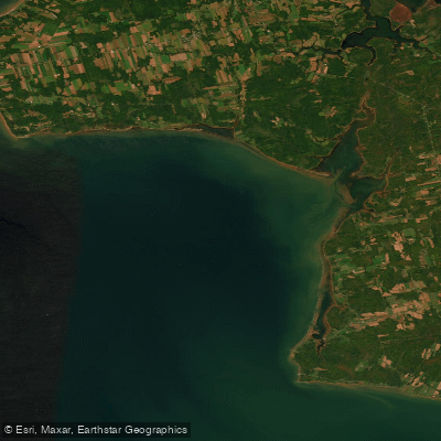
Egmont Bay
- Saltwater
- Bay
- Sq. miles
- 108
- Boat Ramps
- 0
- Access Points
- 0
- Campsites
- 0
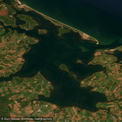
Egmont Bay is a large, open bay on the western coast of Prince Edward Island. It is characterized by significant tidal influence and exposure, creating conditions that can range from placid to extremely challenging for paddlers. The bay's entrance, near Cape Egmont and Rocky Point, is noted for powerful tidal rips and extensive lines of breaking surf that can stretch for miles across the opening during certain tidal stages. Paddlers describe needing strong skills to navigate against the tide here and sometimes having to time their passage through surf lines marked by navigation buoys. Once inside the bay, conditions can become calm, allowing for long open-water crossings, such as the 14-kilometer route from Rocky Point to Brae Harbour. The northern shore features sandy beaches and the prominent black and white striped West Point lighthouse. The western shore of the bay transitions to vertical red sandstone cliffs as one rounds West Point into the Northumberland Strait.
Access points for launching and landing include the harbor at Maximeville, which provides a calm put-in, and Brae Harbour. Rocky Point is also mentioned as a key landmark. The area is exposed to the Gulf of St. Lawrence, resulting in considerable fetch for wave generation. Wind and tide are the primary factors determining conditions, with paddlers advised to be prepared for sudden changes and to plan routes carefully with respect to tidal currents. The best paddling conditions are typically during calm weather, and the area sees more tourist activity during July and August. Wildlife sightings include seals and colonies of cormorants nesting on the cliffs. Facilities are limited, though paddlers have obtained water from a fish plant in Maximeville and found accommodation near West Point.
Water access, boat ramps & amenities
Learn how to get on Egmont Bay. Uncover great paddling access points, boat ramps, and all the facilities you need for an unforgettable day on the water. Some locations shown may border or include private property. Always check property boundaries and applicable regulations before visiting. PaddleWays's Public & Private Land layer can help you plan your access with confidence.
Paddle smarter with real-time insights
Whether you're en route and conditions shift or you're looking for the best spot based on current flows, we enable you to make informed decisions on the fly.







Pe licenses and regulations
No licenses or regulations available for Pe.
Find Places to Paddle

Over 400,000 Places to Paddle
Every user gets free access to launch points, boat ramps, and public property parcels.


Tides, wind & water conditions (10 day forecast)
On open water, wind and tide matter as much as the weather. See the best times to paddle Egmont Bay and check the marine forecast before you launch.
Loading tide predictions…
Paddling near Egmont Bay
Explore Pe waters
Top paddling waters
No waters available right now.
Popular Cities
Loading popular cities...
Explore near Egmont Bay

Smarter Paddling Starts in the App.
Paddleways gives you everything you need to plan smarter, paddle better, and own every trip from first launch to takeout.