Rivière Blanche
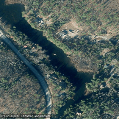
Rivière Blanche
- Boat Ramps
- 0
- Access Points
- 0
- Campsites
- 0
The Rivière Blanche in the Outaouais region of Quebec runs approximately 30 kilometres between Lac Blanche and the Ottawa River. It is classified as a sporty river with rapids and multiple portages, and paddlers should expect significant time on land navigating around obstacles — one account notes that a two-day paddle requires an additional day or two for portaging through the bush.
The river is best suited for spring paddling, when snowmelt provides adequate water levels. The watershed is relatively small, meaning water levels drop quickly outside of peak runoff periods. A paddler who attempted the run in late August following several days of rain found the river marginally navigable but still very demanding, covering only about 6.4 kilometres in six hours due to the portaging required. Summer attempts without recent rainfall are generally not recommended.
Put-in is at the bridge at Lac Blanche, accessible via Route 315. Shortly downstream from the put-in there is a dam that paddlers will need to navigate around. The river's character involves numerous rapids interspersed with portages through forested terrain.
Canot Kayak Québec has produced a digital map of the route, available through the Avenza Maps app, which marks launch points, rapids, portages, camping sites, and other points of interest along the river corridor. The map is free to download and covers the full route. Paddlers planning a trip should obtain this map in advance, as the river does not appear in the standard printed guide to Quebec's canoe routes, making independent navigation resources particularly important.
Water access, boat ramps & amenities
Learn how to get on Rivière Blanche. Uncover great paddling access points, boat ramps, and all the facilities you need for an unforgettable day on the water. Some locations shown may border or include private property. Always check property boundaries and applicable regulations before visiting. PaddleWays's Public & Private Land layer can help you plan your access with confidence.
Paddle smarter with real-time insights
Whether you're en route and conditions shift or you're looking for the best spot based on current flows, we enable you to make informed decisions on the fly.







Qc licenses and regulations
No licenses or regulations available for Qc.
Find Places to Paddle

Over 400,000 Places to Paddle
Every user gets free access to launch points, boat ramps, and public property parcels.


Water and weather conditions (10 day forecast)
See the best times to paddle Rivière Blanche and check the forecast before you go.
No forecast data available.
Paddling near Rivière Blanche

Explore Qc waters
Top paddling waters
No waters available right now.
Popular Cities
Loading popular cities...
Explore near Rivière Blanche

Smarter Paddling Starts in the App.
Paddleways gives you everything you need to plan smarter, paddle better, and own every trip from first launch to takeout.