NENE
- Saltwater
- Estuary
NENE
- Saltwater
- Estuary
- Sq. miles
- 0.7
- Boat Ramps
- 0
- Access Points
- 0
- Campsites
- 0
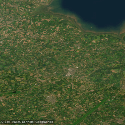
The River Nene in Cambridgeshire is a major, navigable waterway, part of an extensive network of drains and rivers in The Fens. It is pronounced 'Nen' or 'Nin' and flows approximately 100 miles from its source to the Wash, with the navigable section beginning from the Northampton Arm of the Grand Union Canal. The river's character in this region is largely influenced by the surrounding fenland, featuring long, straight, and embanked manmade drains that connect to it. These drains are ideal for beginners and for training. A specific access point for paddlers is at Ramsey Forty Foot, where steps have been built by the Middle Level Commissioners on Hollow Road, making for an easier launch from the bank. From here, paddlers can explore a network of waterways that connect towns including Whittlesey, Ramsey, March, Benwick, Upwell, and Outwell, and link the River Nene to the River Great Ouse. The Middle Level Commissioners manage 99 miles of navigable waterways in this network. A waterways licence is required to paddle on these managed waterways, which can be obtained through membership in organisations like Paddle UK. The vision of the commissioners includes better connecting Peterborough and Whittlesey for paddling, with potential for a paddle sports hub at Stanground Lock. Wildlife such as swans, ducks, and kingfishers can be seen along the routes. For a multi-day adventure, the river can be followed all the way from Northampton to the Wash.
Water access, boat ramps & amenities
Learn how to get on NENE. Uncover great paddling access points, boat ramps, and all the facilities you need for an unforgettable day on the water. Some locations shown may border or include private property. Always check property boundaries and applicable regulations before visiting. PaddleWays's Public & Private Land layer can help you plan your access with confidence.
Paddle smarter with real-time insights
Whether you're en route and conditions shift or you're looking for the best spot based on current flows, we enable you to make informed decisions on the fly.








Find Places to Paddle

Over 400,000 Places to Paddle
Every user gets free access to launch points, boat ramps, and public property parcels.


Tides, wind & water conditions (10 day forecast)
On open water, wind and tide matter as much as the weather. See the best times to paddle NENE and check the marine forecast before you launch.
Loading tide predictions…
Paddling near NENE
Explore England waters
Top paddling waters
No waters available right now.
Popular Cities
Loading popular cities...
Explore near NENE
Nearby waters
More in England

Smarter Paddling Starts in the App.
Paddleways gives you everything you need to plan smarter, paddle better, and own every trip from first launch to takeout.