Curated by PaddleWays

Ringgold Recreational Complex (South Chick Creek) Boat Ramp to Ringgold HS

3.1 mi flatwater route on South Chickamauga Creek in Georgia


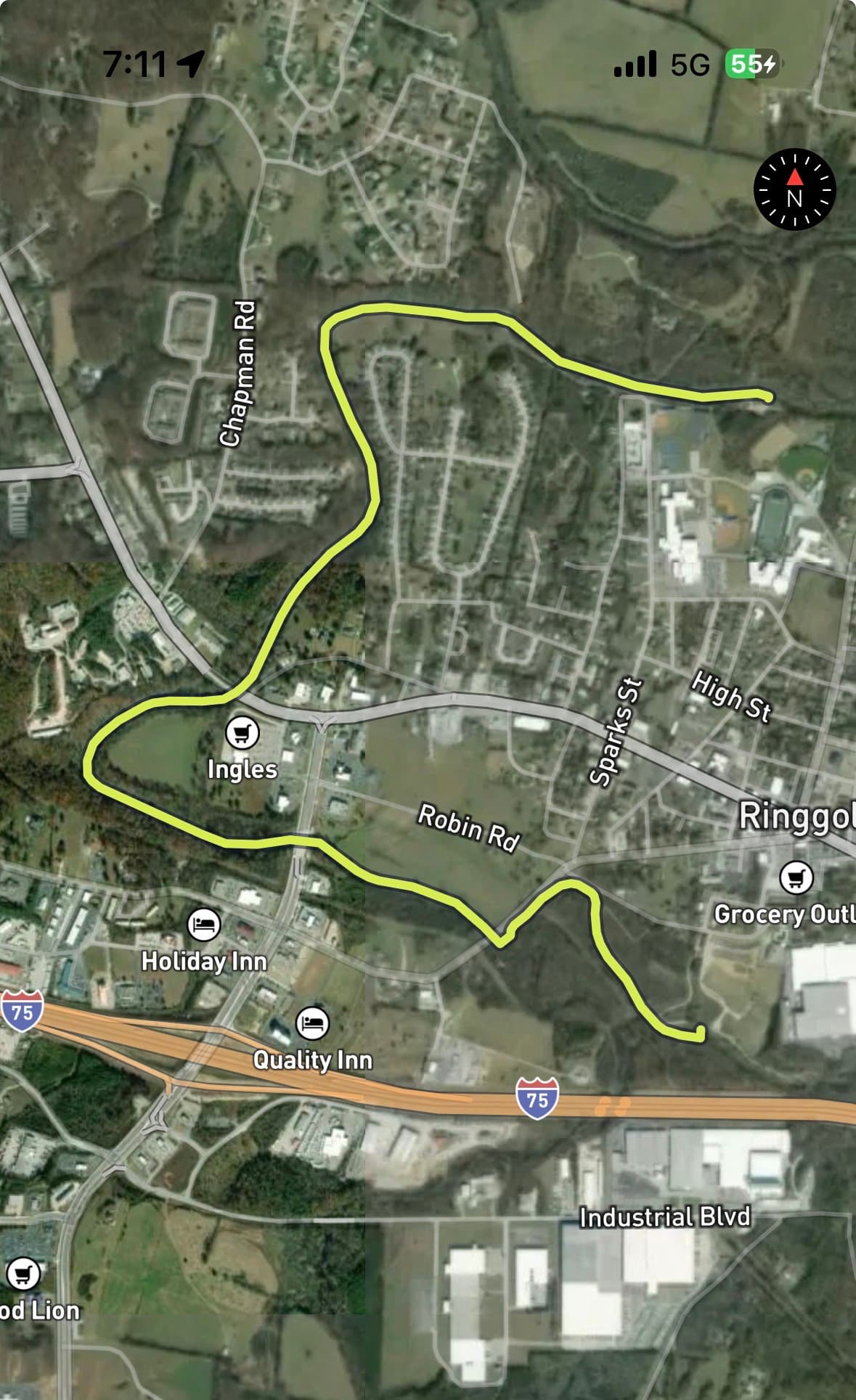
Map of the Ringgold Recreational Complex (South Chick Creek) Boat Ramp to Ringgold HS route, from Ringgold Recreational Complex (South Chick Creek) Boat Ramp to South Chickamauga Creek Access
  • Route
  • Put-in
  • Take-out
  • Hazards

Level right now

How Ringgold Recreational Complex (South Chick Creek) Boat Ramp to Ringgold HS is running today

Route facts

Ringgold Recreational Complex (South Chick Creek) Boat Ramp to Ringgold HS at a glance

Distance
3.1 mi
Paddle time
~1 hr
Type
Flatwater

About this route

Paddling this route

A 3.1-mile flatwater route on South Chickamauga Creek in Catoosa County, Georgia.

Put-in and take-out

  • Put-in

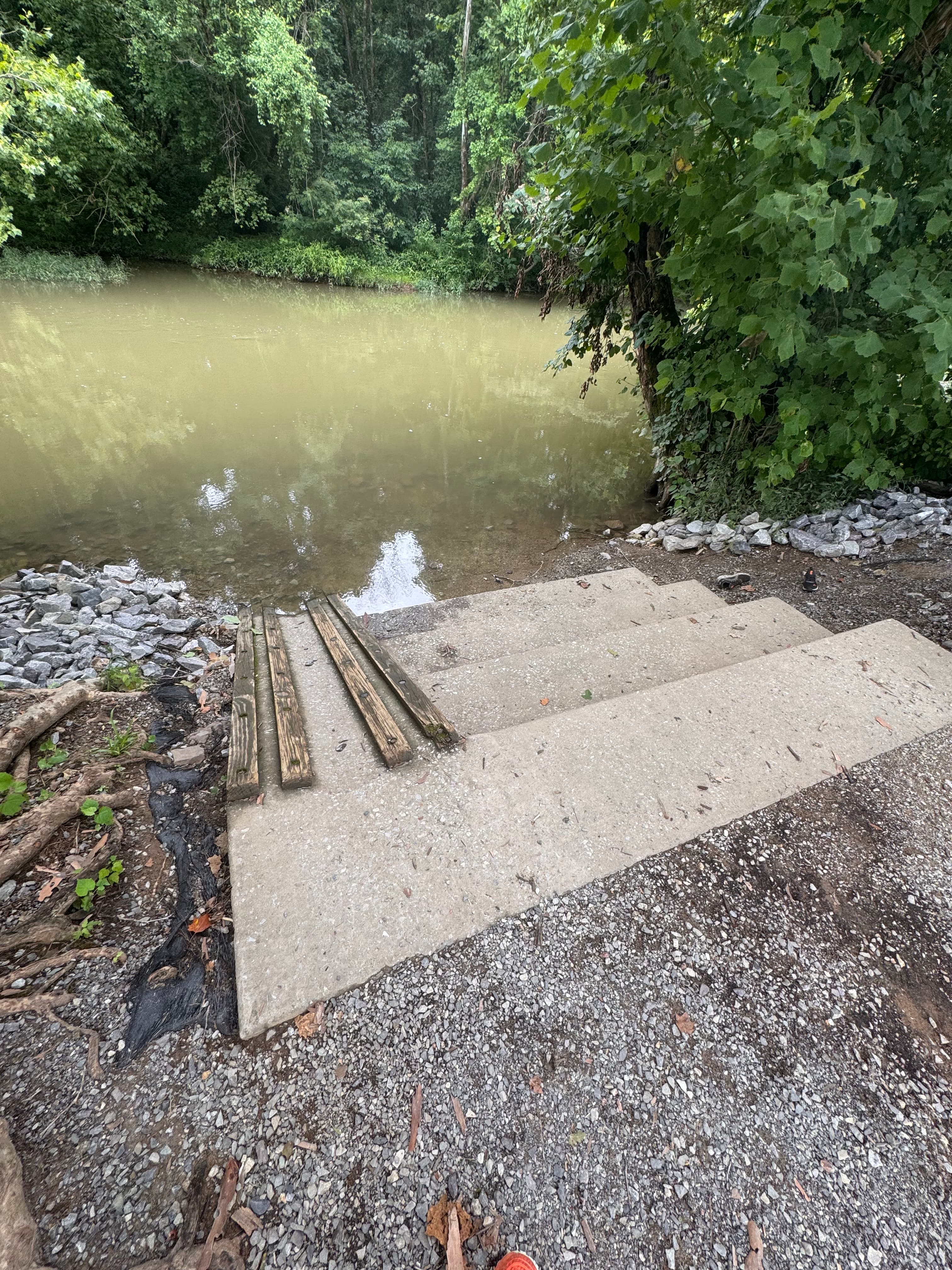
    Ringgold Recreational Complex (South Chick Creek) Boat Ramp

  • Take-out

    South Chickamauga Creek Access

Hazards

Hazards on this route

No paddler has reported a hazard here yet, so these are the dams, falls and big rapids on our map. Hazards change with flows and storms, so check them before you launch.

  1. Hazard

    From our map

    Hazard

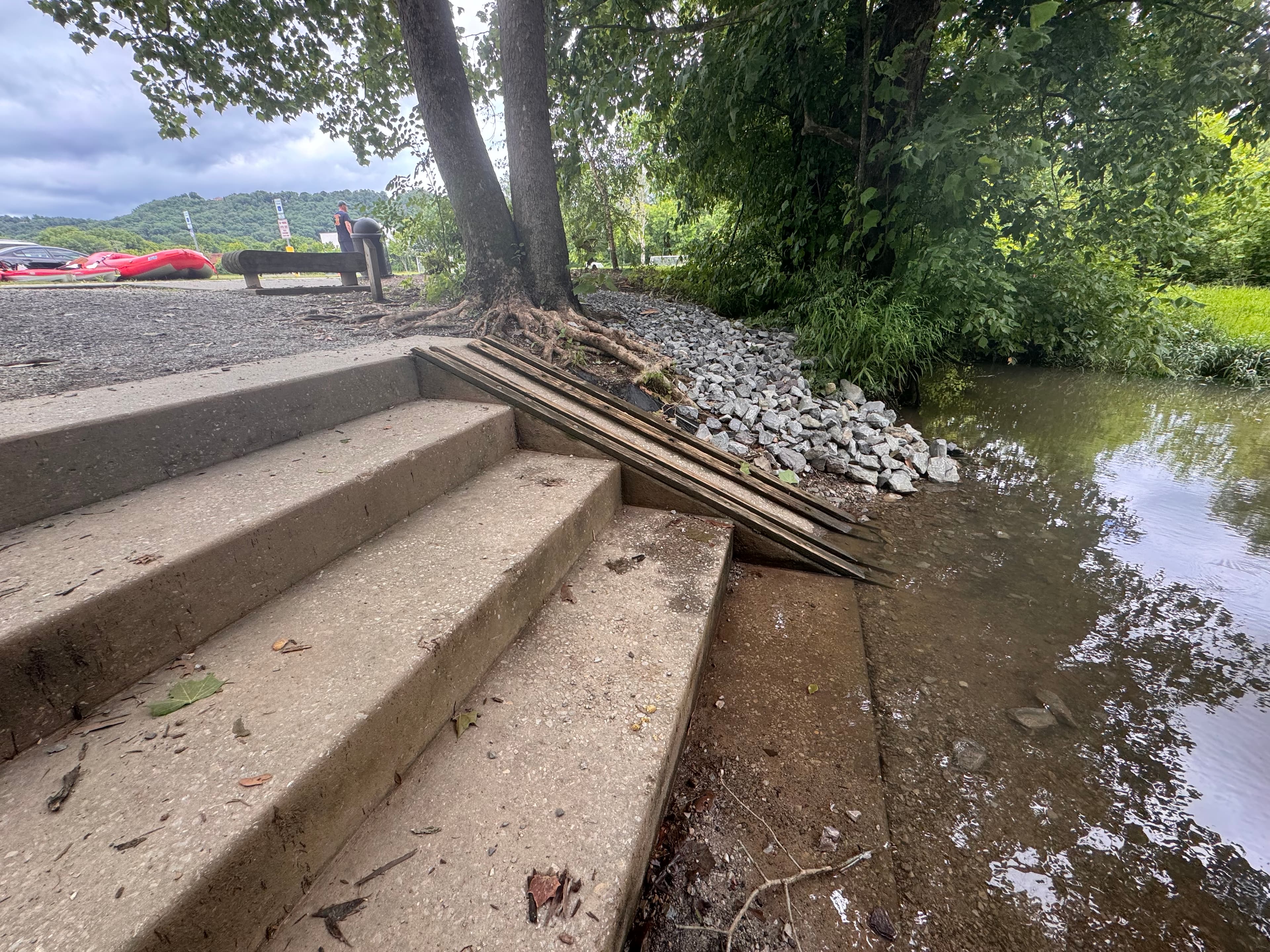
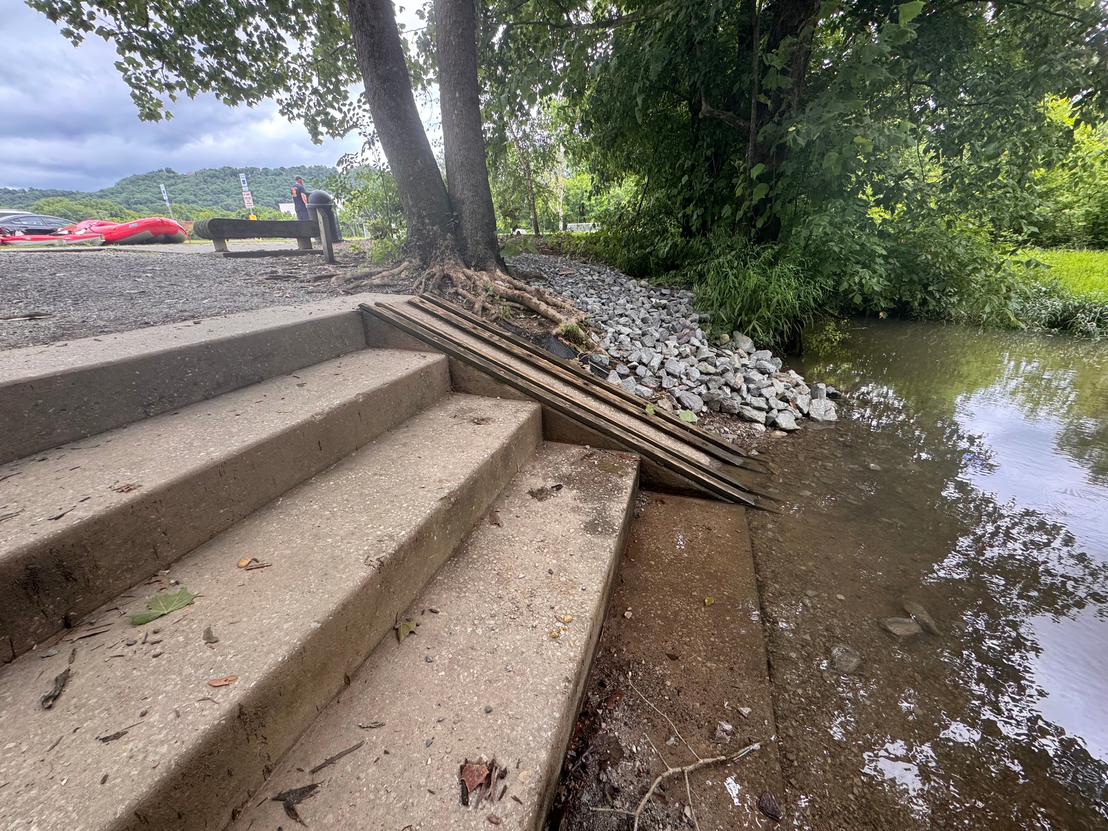
    Pipe that cuts across whole creek. There are stairs to the right to get over.

From the community

Trip reports on this route

Real trips from PaddleWays paddlers who ran this route: how the flows were, and what to watch for.

Loading trip reports

  • chuck W.

    SUP •

    59 cfs at Ringgold

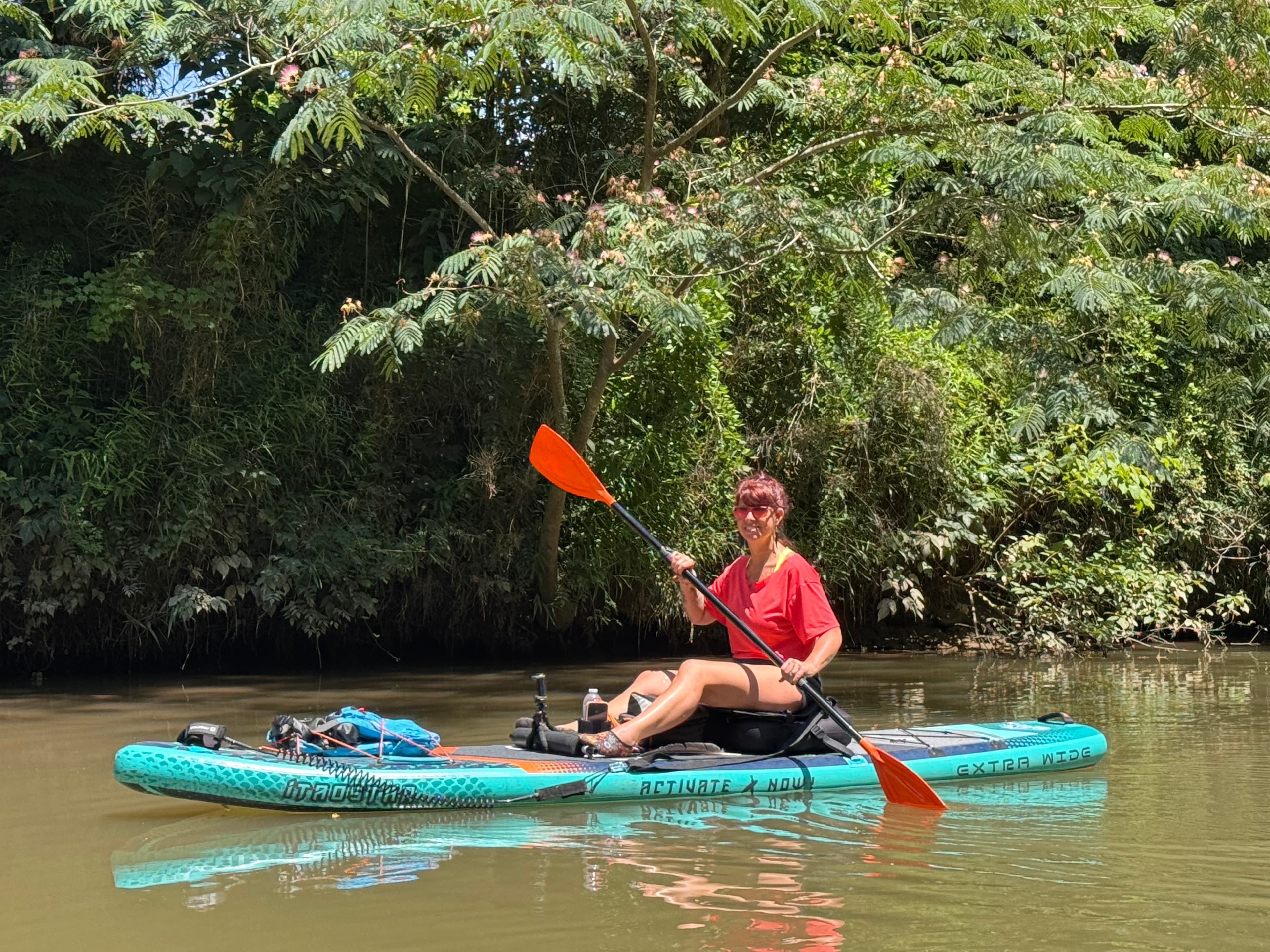
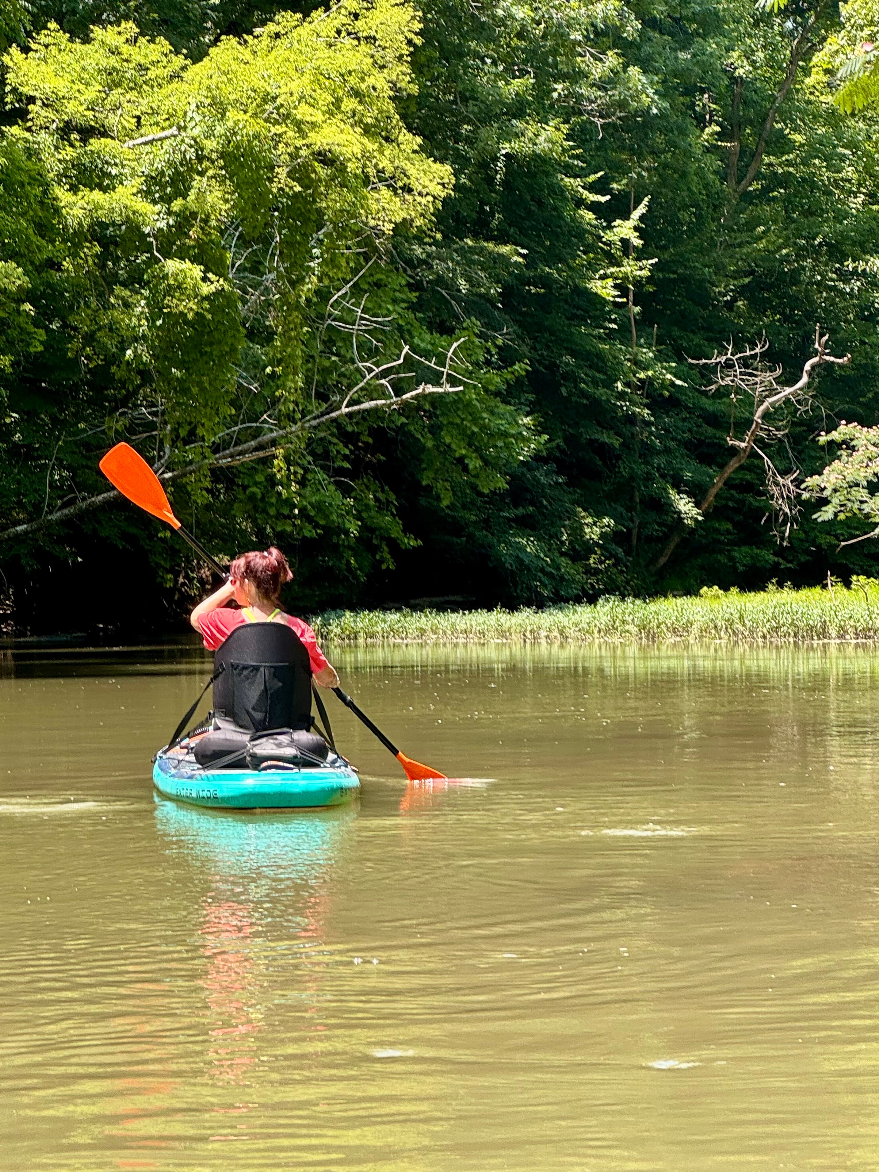
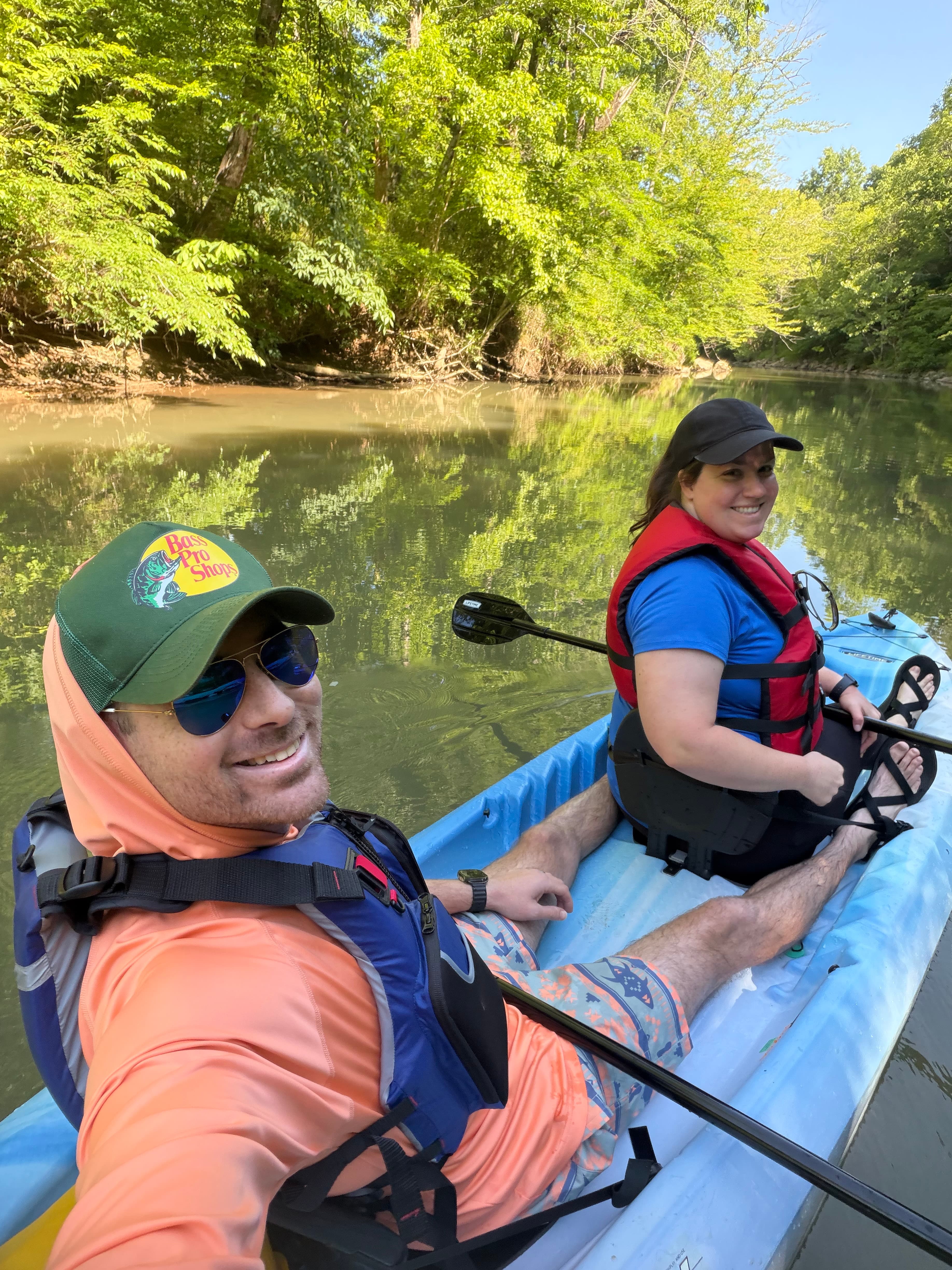
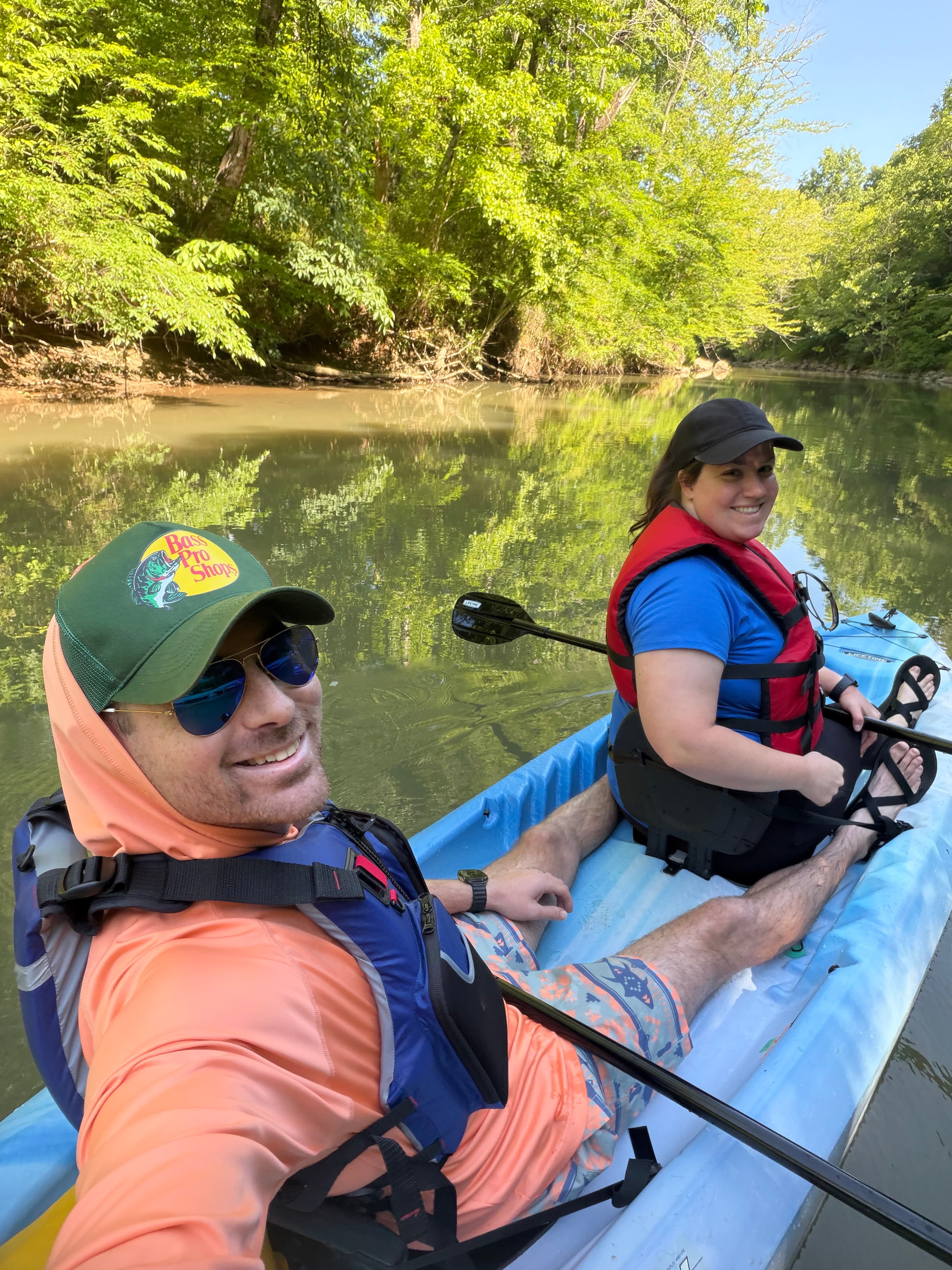
    We just couldn’t leave North Georgia without one last adventure! Neda and I tackled the 3.1-mile stretch of South Chickamauga Creek, starting from the recreation center and paddling to the takeout behind the high school. The creek was gorgeous, with calm waters and beautiful scenery all around. We enjoyed spotting turtles and birds as we paddled, soaking in the peaceful vibe of the area. Ringgold is such a welcoming town, and the friendly locals made our experience even better! After finishing our paddle, Neda stayed with the paddleboards while I jogged back for the car. It was about a mile, and once I found the shortest path, I made it back in about 10 minutes. A great way to wrap up our day! We can't wait to share some pictures and videos from our adventure!
    • Photo 1 from chuck W.'s trip
    • Photo 2 from chuck W.'s trip
    • Photo 3 from chuck W.'s trip+12
  • chuck W.

    SUP •

    59 cfs at Ringgold

    Very nice 2 1/2 hour paddle and a mile walk back to the car.

    • Photo 1 from chuck W.'s trip
    • Photo 2 from chuck W.'s trip
    • Photo 3 from chuck W.'s trip+15
  • PaddleWays paddler

    Kayak •

    49 cfs at Ringgold

    Not too shallow but did get stuck a couple of times.

    • Photo 1 from PaddleWays paddler's trip
    • Photo 2 from PaddleWays paddler's trip

Flows & weather (10 day forecast)

The gauges near this route and the forecast where it starts, so you can pick your day.

No forecast data available.

Same water

More routes on South Chickamauga Creek

The other curated routes on South Chickamauga Creek, each with how it is running now.

Curated by PaddleWays

RouteFlatwater

Distance
10.6 mi
Paddle time
~3.5 hrs
Put-in → take-out
Camp Jordan (South Chick) Boat Ramp → Sterchi Farm Kayak Ramp (South Chickamauga Creek)
Curated by PaddleWays

RouteFlatwater

Distance
5.2 mi
Paddle time
2 hrs
Best for
Kayak, canoe
Put-in → take-out
Camp Jordan (South Chick) Boat Ramp → Shallowford Road Access
Pipeline portage after Brainerd Road Bridge

Close by

Routes near this one

Curated routes on other waters within an hour or so, nearest first.

Curated by PaddleWays

RouteFlatwater

Distance
11.9 mi
Paddle time
~4 hrs
Put-in → take-out
TN Riverpark Boat Ramp → Brown's Ferry Landing Marina
Curated by PaddleWays

RouteFlatwater

Distance
45.9 mi
Paddle time
Multi-day
Put-in → take-out
TN Riverpark Boat Ramp → Macedonia Church (Cole City Creek) Boat Ramp
Fallen trees and built structures
Curated by PaddleWays

RouteClass III–IV

Distance
7.4 mi
Paddle time
~2 hrs
Best for
Experienced paddlers
Put-in → take-out
Chicken Coop Gap Access → Old Highway 2 Access
Curated by PaddleWays

RouteFlatwater

Distance
17 mi
Paddle time
~5.5 hrs
Best for
All skill levels
Put-in → take-out
Highway 225 Boat Ramp → GA 156 Access

Smarter Paddling Starts in the App.

PaddleWays gives you everything you need to plan smarter, paddle better, and own every trip from first launch to takeout.