Christmas Bay
- Saltwater
- Bay
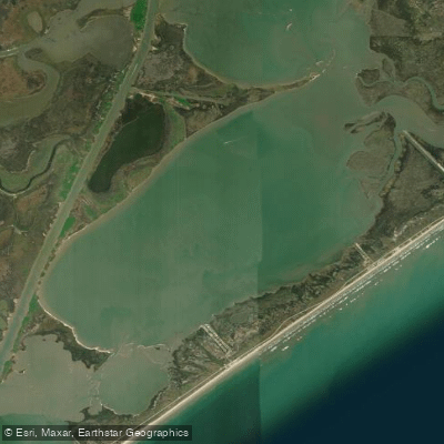
Christmas Bay
- Saltwater
- Bay
- Sq. miles
- 7.9
- Boat Ramps
- 0
- Access Points
- 0
- Campsites
- 0
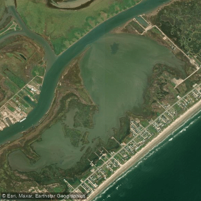
Christmas Bay is a shallow 4,173-acre saltwater embayment on the southwestern end of the Galveston Bay system, easily accessible from the Houston metropolitan area. The bay is characterized by extensive oyster reefs and fringing salt marsh habitat, with the northern shore bordering the 42,000-acre Brazoria National Wildlife Refuge. The water is generally shallow enough that a paddler can stand in most areas, and power boat traffic is minimal. Primary public access points are along Bluewater Highway (County Road 257). Specific launches include a site at 515 Amigo Lane, the former location of Ernie’s Too Bait Camp, and San Luis County Park at 14001 CR 257, which has a boat dock. Another launch is indicated on Google Maps just off Bluewater Highway. There are no bathroom facilities or fresh water for washing gear at these launches.
The official Christmas Bay Paddling Trail is a 19.1-mile circumnavigation marked by 29 numbered GPS markers, with popular shorter loops of 3.8 and 10.3 miles that follow sequences of these markers through areas like Churchill Bayou and Titlum Tatlum Bayou. Paddlers must be mindful of tidal changes; checking tidal forecasts is advised as low tide could require dragging a kayak in some areas. The bay is very exposed to wind, which can create challenging conditions, and one local guide service will not launch if winds are above 15 mph. Hazards include sharp oyster reefs that can scratch boats and stingrays in the shallows, so shuffling feet when wading is recommended. Insect repellent is necessary due to significant mosquitoes along the shorelines.
The area offers outstanding bird watching opportunities, with migratory and resident waterfowl and shorebirds prevalent. The water quality is good, and the bay has not been greatly altered by human activity. For trip planning, the best paddling months are generally from October through May when winds are more favorable. The bay is connected to larger waterways, and paddlers are cautioned to avoid the strong currents of nearby San Luis Pass.
Water access, boat ramps & amenities
Learn how to get on Christmas Bay. Uncover great paddling access points, boat ramps, and all the facilities you need for an unforgettable day on the water. Some locations shown may border or include private property. Always check property boundaries and applicable regulations before visiting. PaddleWays's Public & Private Land layer can help you plan your access with confidence.
Paddle smarter with real-time insights
Whether you're en route and conditions shift or you're looking for the best spot based on current flows, we enable you to make informed decisions on the fly.








Find Places to Paddle

Over 400,000 Places to Paddle
Every user gets free access to launch points, boat ramps, and public property parcels.


Tides, wind & water conditions (10 day forecast)
On open water, wind and tide matter as much as the weather. See the best times to paddle Christmas Bay and check the marine forecast before you launch.
Loading tide predictions…
Paddling near Christmas Bay

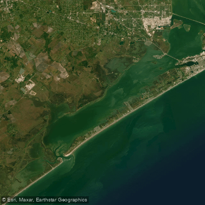
Explore Texas waters
Top paddling waters
Popular Cities
Loading popular cities...
Explore near Christmas Bay

Smarter Paddling Starts in the App.
Paddleways gives you everything you need to plan smarter, paddle better, and own every trip from first launch to takeout.