Freeport Harbor
- Saltwater
- Harbor
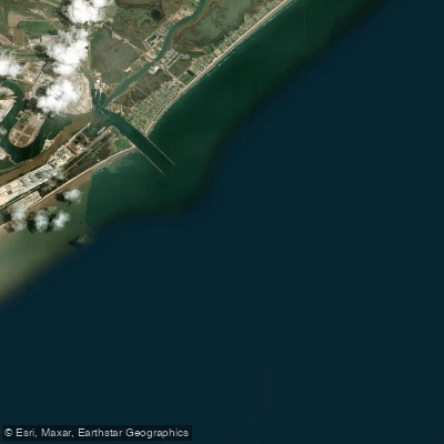
Freeport Harbor
- Saltwater
- Harbor
- Sq. miles
- 13
- Boat Ramps
- 0
- Access Points
- 0
- Campsites
- 0
Freeport Harbor, specifically South Freeport Harbor, is a coastal saltwater harbor on Casco Bay in Maine. The primary public access point for paddlers is Winslow Park and Campground, which offers a boat launch area suitable for canoes and kayaks. This launch provides direct access to the harbor and the broader Casco Bay. The harbor's waters are calm, making them suitable for both beginner and expert paddlers. A key consideration for trip planning is the tidal range, as access to certain areas like Mast Landing on the Harraseeket River is only practical at high tide. Paddlers should consult tide charts to coordinate their trips.
The harbor and its surroundings offer a mix of natural and developed sights. Paddlers can circle Googins Island, a protected osprey habitat, and may see bald eagles, great blue heron, harbor seals, and occasional porpoises. The shoreline features Wolf Neck Woods State Park across the harbor, though it is only accessible by road. The area near the Village Store in South Freeport serves as a local hub. The harbor itself has numerous nooks and crannies to explore from a small boat, extending from Stockbridge Point at Winslow Park to Mast Landing. Winslow Park itself includes a tidal beach, picnic facilities, and trails with views of the harbor.
For paddlers looking for a specific route, one option is to launch from Winslow Park and kayak along the coast to the entry of South Freeport Harbor. The harbor is part of a larger, active coastal area with significant boat traffic, including commercial tours and lobster boats operating from early June through mid-October. Paddlers should be prepared for potential wakes and should exercise caution when crossing channels or near marinas. The season for rental equipment and guided tours typically runs from June through September or October.
Water access, boat ramps & amenities
Learn how to get on Freeport Harbor. Uncover great paddling access points, boat ramps, and all the facilities you need for an unforgettable day on the water. Some locations shown may border or include private property. Always check property boundaries and applicable regulations before visiting. PaddleWays's Public & Private Land layer can help you plan your access with confidence.
Paddle smarter with real-time insights
Whether you're en route and conditions shift or you're looking for the best spot based on current flows, we enable you to make informed decisions on the fly.








Find Places to Paddle

Over 400,000 Places to Paddle
Every user gets free access to launch points, boat ramps, and public property parcels.


Tides, wind & water conditions (10 day forecast)
On open water, wind and tide matter as much as the weather. See the best times to paddle Freeport Harbor and check the marine forecast before you launch.
Loading tide predictions…
Paddling near Freeport Harbor

Explore Texas waters
Top paddling waters
Popular Cities
Loading popular cities...
Explore near Freeport Harbor

Smarter Paddling Starts in the App.
Paddleways gives you everything you need to plan smarter, paddle better, and own every trip from first launch to takeout.