Rosebud River
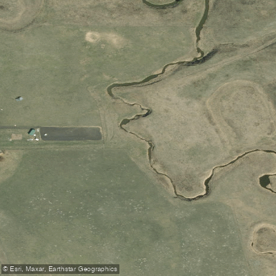
Rosebud River
- Boat Ramps
- 0
- Access Points
- 0
- Campsites
- 2
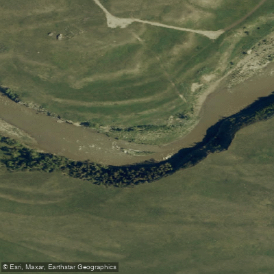
The Rosebud River is a small prairie river in Alberta's Canadian Badlands, flowing through rolling hills near the village of Rosebud and the Drumheller Valley. It is a manageable waterway suitable for canoes and kayaks, with a character shaped by the semi-arid landscape around it.
A documented paddling route runs from the village of Rosebud downstream to Beynon, requiring a car shuttle between the two points. This stretch takes approximately six hours to complete, including short breaks and a lunch stop. At the time of one recorded trip in July, the river was running at roughly 3.17 to 3.28 cubic metres per second, and paddlers reported scraping the bottom of their boats toward the end of the run, suggesting that water levels can become marginal for paddling even within a single outing. Paddlers should monitor flow conditions carefully before launching, as low water is a real consideration on this river.
The water runs warm in summer, making swimming and wading alongside boats a comfortable option when water levels drop. The take-out at Beynon is on river left. Along the route near Wayne, the river passes beneath eleven one-lane bridges along a scenic road, a distinctive geographical feature of the area.
Spring is noted as a viable paddling season, likely offering higher and more reliable water levels than summer. The High Eagle RV Park, located on the south shore of the river near Rosebud, provides access for kayakers and canoeists and offers camping facilities. A restaurant is reportedly located very close to the Beynon take-out, providing a convenient post-trip stop.
The surrounding landscape features rolling hills, badlands terrain, and abundant wildlife, consistent with the broader Drumheller Valley region.
Water access, boat ramps & amenities
Learn how to get on Rosebud River. Uncover great paddling access points, boat ramps, and all the facilities you need for an unforgettable day on the water. Some locations shown may border or include private property. Always check property boundaries and applicable regulations before visiting. PaddleWays's Public & Private Land layer can help you plan your access with confidence.
Paddle smarter with real-time insights
Whether you're en route and conditions shift or you're looking for the best spot based on current flows, we enable you to make informed decisions on the fly.







Ab licenses and regulations
No licenses or regulations available for Ab.
Find Places to Paddle

Over 400,000 Places to Paddle
Every user gets free access to launch points, boat ramps, and public property parcels.


Water and weather conditions (10 day forecast)
See the best times to paddle Rosebud River and check the forecast before you go.
ROSEBUD RIVER AT REDLAND
All Flow Stations
Paddling near Rosebud River
Explore Ab waters
Top paddling waters
No waters available right now.
Popular Cities
Loading popular cities...
Explore near Rosebud River

Smarter Paddling Starts in the App.
Paddleways gives you everything you need to plan smarter, paddle better, and own every trip from first launch to takeout.