Sheep River
Sheep River
- Boat Ramps
- 0
- Access Points
- 0
- Campsites
- 0
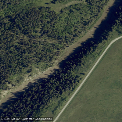
The Sheep River rises in the mountain valleys of Elbow-Sheep Wildland Provincial Park at an elevation of approximately 2,100 metres and flows east through Sheep River Provincial Park before joining the Highwood River about 8 km east of Okotoks. The river drops to roughly 983 metres at its mouth, carving through canyon walls of soft shale and sandstone that expose distinct geological layering, particularly in the upper reaches near Blue Rock.
The river offers a wide range of paddling experiences depending on the section chosen. The upper reach from Blue Rock to Gorge Creek is a demanding Class III–V+ run featuring named rapids in sequence: Blue Rock Ledge (III/IV), Sheep Falls (IV), Tiger Jaws (V), Indian Oils (IV), Triple Falls (V+), and Landslide (III/IV). The Class V rapids are considered portage-able, with the intervening water running at Class II/III. At higher flows the drops clean up but the river becomes pushy and boily. The Gorge Creek to Sandy McNabb section runs through a deep canyon at Class II/II+, with small ledges and wave-hole trains at normal levels; access to this section is typically gated until around May 15. The reach above Okotoks is a low-volume, winding Class I float better suited to kayaks than SUPs due to fast, shallow sections. The Okotoks urban reach offers small easy rapids, a couple of ledges, and flat-water float sections. The Highway 2 to Lynnwood Ranch reach passes through working ranch country and can become very shallow at low flows, with the navigable channel shifting to one edge or the other across wide gravel bars.
The best flows across the river generally occur from late spring through early summer. Flow data for the lower reaches can be referenced at Water Survey of Canada station 05BL012 (Sheep River at Okotoks). The Kananaskis Conservation Pass applies within Kananaskis Country for upper sections; the Parks Canada AIS permit does not apply on this river. Access to the Lynnwood Ranch take-out should be confirmed with the local paddling community before running a shuttle, as ranch-land access can change. Paddlers on the ranch-country reaches should remain on the water except at designated access points. The Alberta Parks map for the Sheep River and Bluerock area identifies designated kayak and canoe launch points within the provincial park.
Water access, boat ramps & amenities
Learn how to get on Sheep River. Uncover great paddling access points, boat ramps, and all the facilities you need for an unforgettable day on the water. Some locations shown may border or include private property. Always check property boundaries and applicable regulations before visiting. PaddleWays's Public & Private Land layer can help you plan your access with confidence.
Paddle smarter with real-time insights
Whether you're en route and conditions shift or you're looking for the best spot based on current flows, we enable you to make informed decisions on the fly.







Ab licenses and regulations
No licenses or regulations available for Ab.
Find Places to Paddle

Over 400,000 Places to Paddle
Every user gets free access to launch points, boat ramps, and public property parcels.


Water and weather conditions (10 day forecast)
See the best times to paddle Sheep River and check the forecast before you go.
SHEEP RIVER AT OKOTOKS
All Flow Stations
Paddling near Sheep River
Explore Ab waters
Top paddling waters
No waters available right now.
Popular Cities
Loading popular cities...
Explore near Sheep River

Smarter Paddling Starts in the App.
Paddleways gives you everything you need to plan smarter, paddle better, and own every trip from first launch to takeout.