Gaspereau Lake
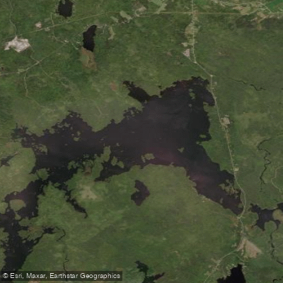
Gaspereau Lake
- Boat Ramps
- 0
- Access Points
- 0
- Campsites
- 0
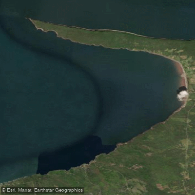
Gaspereau Lake sits in Kings County, Nova Scotia, approximately 10 kilometres south of Kentville on the South Mountain. It is the largest lake in Kings County and the fifth largest in Nova Scotia, with a surface area of 22 square kilometres, a maximum length of 12 kilometres, a maximum width of 7 kilometres, and a shoreline of roughly 55 kilometres. The lake is notably shallow and scattered with approximately 50 forested islands and hundreds of rocky islets (skerries), giving it a complex, island-dotted character that rewards exploration but demands attentiveness to submerged rocks.
Water levels are managed by Nova Scotia Power. At the natural outlet to the Gaspereau River in the northeast corner of the lake, there is a control dam and fish ladder. A second control dam at the southeast corner controls outflow to a canal that diverts water to hydroelectric stations downstream. The abundance of rocks throughout the lake significantly limits motorboat traffic, which makes conditions generally more pleasant for paddlers.
The primary access point is off Route 12, near the dam and fish ladder at the northeast end of the lake, where there is parking and a launch site near a monument to Henry Dorey. A second access point on the western end of the lake — at Two Mile and Four Mile Lakes — can be reached via North River Road and Granite Lane, where a short 50-metre path leads to the water and parking is available for four or five vehicles.
The north shore is largely undeveloped, and paddlers who travel away from the highway end of the lake tend to encounter fewer people and more quiet stretches. The eastern end near Route 12 sees more cottage development and associated activity. An extended route connects Gaspereau Lake westward to Two and Four Mile Lakes, accessible from Welton Landing on Route 12, though this is described as a long trip. Another route runs via a canal from the Forest Home area on Highway 12 through Little River Lake and onward to Black River Lake. The lake freezes for approximately three months of the year, and paddling is popular in both summer and, for those equipped for it, winter conditions.
Water access, boat ramps & amenities
Learn how to get on Gaspereau Lake. Uncover great paddling access points, boat ramps, and all the facilities you need for an unforgettable day on the water. Some locations shown may border or include private property. Always check property boundaries and applicable regulations before visiting. PaddleWays's Public & Private Land layer can help you plan your access with confidence.
Paddle smarter with real-time insights
Whether you're en route and conditions shift or you're looking for the best spot based on current flows, we enable you to make informed decisions on the fly.








Find Places to Paddle

Over 400,000 Places to Paddle
Every user gets free access to launch points, boat ramps, and public property parcels.


Water and weather conditions (10 day forecast)
See the best times to paddle Gaspereau Lake and check the forecast before you go.
No forecast data available.
Explore Ns waters
Top paddling waters
No waters available right now.
Popular Cities
Loading popular cities...
Explore near Gaspereau Lake

Smarter Paddling Starts in the App.
Paddleways gives you everything you need to plan smarter, paddle better, and own every trip from first launch to takeout.