Minas Basin
- Saltwater
- Bay
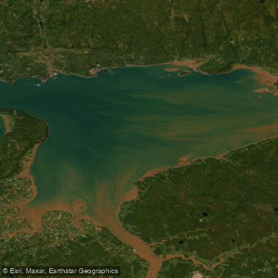
Minas Basin
- Saltwater
- Bay
- Sq. miles
- 325
- Boat Ramps
- 0
- Access Points
- 0
- Campsites
- 0
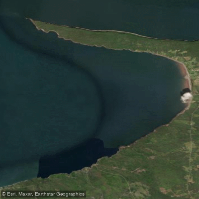
The Minas Basin is a large coastal inlet of the Bay of Fundy on the northwest shore of Nova Scotia, known for having the world's highest recorded tides. The tidal range can exceed 16 meters, or 50 feet, with an immense volume of water flowing in and out twice daily. This creates a dynamic and powerful paddling environment. The shoreline features dramatic sandstone cliffs, expansive mudflats that are exposed at low tide, and unique geological formations including deep red sea caves carved from ancient lava flows. The area is part of the Cliffs of Fundy UNESCO Global Geopark, known for its fossil record and exposures of the Central Atlantic Magmatic Province. Key access points for paddlers include the communities of Advocate Harbour, Parrsboro, and Maitland near the mouth of the Shubenacadie River. The water can appear placid on the surface but has significant churning currents below, and the tidal state drastically changes the landscape, revealing or covering vast beaches and caves. Paddlers must plan meticulously around the tides. Launching and landing are only possible at specific stages, and a beach used for lunch at low tide may be completely submerged hours later. The incoming tide generates a strong current, allowing paddlers to ride the flow with minimal effort, while the outgoing tide can leave extensive mudflats. The area is exposed, and conditions can shift rapidly from calm to a noticeable swell. Notable hazards include the powerful tidal currents, the potential for becoming stranded on mudflats, and the cold water. There is significant boat traffic, including larger vessels and tidal bore rafting zodiacs on the Shubenacadie River. The best seasons for paddling are not specified, but water temperatures are cold, and wetsuits are commonly used. Wildlife includes abundant waterfowl, and the area is historically significant as a place of early Mi'kmaq inhabitation and Acadian settlement.
Water access, boat ramps & amenities
Learn how to get on Minas Basin. Uncover great paddling access points, boat ramps, and all the facilities you need for an unforgettable day on the water. Some locations shown may border or include private property. Always check property boundaries and applicable regulations before visiting. PaddleWays's Public & Private Land layer can help you plan your access with confidence.
Paddle smarter with real-time insights
Whether you're en route and conditions shift or you're looking for the best spot based on current flows, we enable you to make informed decisions on the fly.








Find Places to Paddle

Over 400,000 Places to Paddle
Every user gets free access to launch points, boat ramps, and public property parcels.


Tides, wind & water conditions (10 day forecast)
On open water, wind and tide matter as much as the weather. See the best times to paddle Minas Basin and check the marine forecast before you launch.
Loading tide predictions…
Explore Ns waters
Top paddling waters
No waters available right now.
Popular Cities
Loading popular cities...
Explore near Minas Basin

Smarter Paddling Starts in the App.
Paddleways gives you everything you need to plan smarter, paddle better, and own every trip from first launch to takeout.