Minas Channel
- Saltwater
- Channel
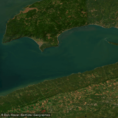
Minas Channel
- Saltwater
- Channel
- Sq. miles
- 265
- Boat Ramps
- 0
- Access Points
- 0
- Campsites
- 0
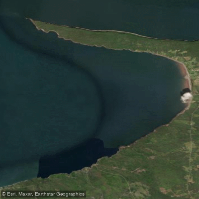
The Minas Channel is a significant coastal waterway located at the western end of the Minas Basin in Nova Scotia, Canada, where the Bay of Fundy funnels into the basin. This area is characterized by the world's highest tides, which create a powerful and dynamic marine environment. The channel is defined by dramatic geography, with Cape Chignecto to the north and Harbourville to the south, featuring some of the tallest cliffs on mainland Nova Scotia. The tidal flow through the channel is immense, with the mid-tide flow between Cape Split and the Parrsboro shore equaling the combined flow of every river and stream on Earth. This volume of water moves at speeds reported to reach 15 km/h, creating strong and potentially dangerous currents that are a primary safety consideration for paddlers. The water level raises and lowers dramatically with the tide cycle. The coastline offers notable geological sights, including narrow archways and the legendary Three Sisters rock formation. The area is part of the Cliffs of Fundy UNESCO Global Geopark. Guided commercial kayak tours operate from locations like Advocate Harbour, offering day trips, multi-day adventures to Seal Cove or around Cape Chignecto Park, and include meals, catering to beginners. These tours provide a way to experience the majestic cliffs and archways safely with local knowledge. Independent paddlers must plan meticulously around the extreme tides and currents, aiming to paddle with the tidal flow to avoid being overcome. The region offers panoramic viewing platforms, such as one high above the point where the Bay of Fundy meets the Minas Channel, useful for scouting conditions. Spencer's Island is a location on the north corner of the Basin of Minas. The presence of commercial boat tours, including Zodiac adventures, indicates shared water use and potential boat traffic.
Water access, boat ramps & amenities
Learn how to get on Minas Channel. Uncover great paddling access points, boat ramps, and all the facilities you need for an unforgettable day on the water. Some locations shown may border or include private property. Always check property boundaries and applicable regulations before visiting. PaddleWays's Public & Private Land layer can help you plan your access with confidence.
Paddle smarter with real-time insights
Whether you're en route and conditions shift or you're looking for the best spot based on current flows, we enable you to make informed decisions on the fly.








Find Places to Paddle

Over 400,000 Places to Paddle
Every user gets free access to launch points, boat ramps, and public property parcels.


Tides, wind & water conditions (10 day forecast)
On open water, wind and tide matter as much as the weather. See the best times to paddle Minas Channel and check the marine forecast before you launch.
Loading tide predictions…
Explore Ns waters
Top paddling waters
No waters available right now.
Popular Cities
Loading popular cities...
Explore near Minas Channel

Smarter Paddling Starts in the App.
Paddleways gives you everything you need to plan smarter, paddle better, and own every trip from first launch to takeout.