Scots Bay
- Saltwater
- Bay
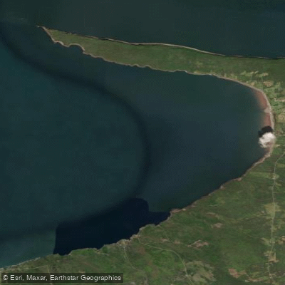
Scots Bay
- Saltwater
- Bay
- Sq. miles
- 20
- Boat Ramps
- 0
- Access Points
- 0
- Campsites
- 0
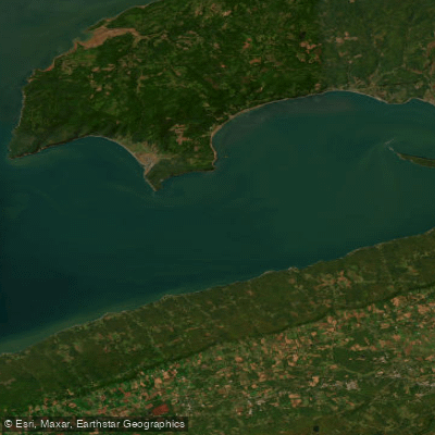
Scots Bay is a coastal bay on the Bay of Fundy in Nova Scotia, Canada, known for its dramatic tidal environment. The primary launch point for paddlers is the Scots Bay Wharf, located at 16 Wharf Road. Access to the water involves a semi-steep walk down a gravel path. This is the same location used by commercial tour operators for departures. The tidal range here is extreme, with water level fluctuations exceeding 10 meters (over 32 feet) daily. Paddlers must plan their trips meticulously around the tide cycle. Commercial tours from this wharf typically depart around high tide, with the first launch scheduled approximately one and a half hours before the peak. The bay is exposed to the open waters of the Minas Basin and the broader Bay of Fundy, leading to significant wind exposure and fetch. This exposure, combined with the powerful tidal currents, particularly near the iconic Cape Split peninsula which defines one side of the bay, creates conditions suitable only for experienced paddlers with appropriate skills and equipment. The area is a destination for guided sea kayaking tours, with operators offering trips to explore sea caves and the rugged shoreline. The water is cold year-round, characteristic of the Bay of Fundy. The surrounding landscape features rocky shores and high cliffs, offering a rugged and powerful aesthetic dominated by the forces of the tide. Beyond the wharf, facilities appear limited, and paddlers should be self-sufficient. The presence of a commercial tour operation indicates that the bay is a recognized paddling destination, but the emphasis on weather-dependent departures and the need for survival suits on guided motorboat tours underscores the challenging and changeable marine environment.
Water access, boat ramps & amenities
Learn how to get on Scots Bay. Uncover great paddling access points, boat ramps, and all the facilities you need for an unforgettable day on the water. Some locations shown may border or include private property. Always check property boundaries and applicable regulations before visiting. PaddleWays's Public & Private Land layer can help you plan your access with confidence.
Paddle smarter with real-time insights
Whether you're en route and conditions shift or you're looking for the best spot based on current flows, we enable you to make informed decisions on the fly.








Find Places to Paddle

Over 400,000 Places to Paddle
Every user gets free access to launch points, boat ramps, and public property parcels.


Tides, wind & water conditions (10 day forecast)
On open water, wind and tide matter as much as the weather. See the best times to paddle Scots Bay and check the marine forecast before you launch.
Loading tide predictions…
Explore Ns waters
Top paddling waters
No waters available right now.
Popular Cities
Loading popular cities...
Explore near Scots Bay

Smarter Paddling Starts in the App.
Paddleways gives you everything you need to plan smarter, paddle better, and own every trip from first launch to takeout.