Twenty Mile Creek
Twenty Mile Creek
- Boat Ramps
- 0
- Access Points
- 0
- Campsites
- 1
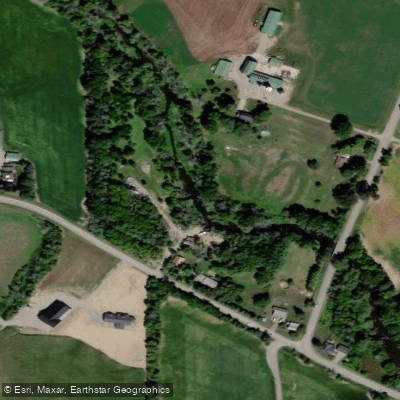
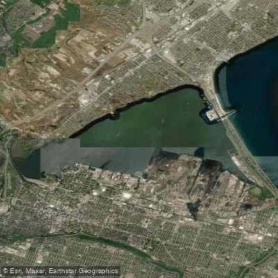
Twenty Mile Creek flows through the Niagara Peninsula in Ontario, draining from headwaters near Hamilton International Airport southward through agricultural land and the Town of Smithville before dropping over the Niagara Escarpment at Ball's Falls Conservation Area and entering Lake Ontario at Jordan Harbour, approximately 32 kilometres west of the Niagara River. The creek's Indigenous name, Kenachdaw, translates to "Lead River."
The creek offers two distinct paddling experiences. At the lower end, Jordan Harbour Conservation Area — managed by the Niagara Peninsula Conservation Authority — provides a public launch dock for non-motorized watercraft with dedicated parking and picnic facilities. From here, paddlers can follow the channel inland along Twenty Mile Creek through a provincially significant wetland corridor. The harbour itself is roughly a kilometre wide, and the creek winds through narrow channels lined with reeds. Water levels can produce shallow sections, and the paddling is flatwater and protected throughout, making it appropriate for all skill levels. The area is also used by rowers from the Niagara Rowing Club, so paddlers should be aware of rowing traffic near the launch.
Wildlife is a notable feature of this section, with turtles, mute swans, and various bird species regularly observed. A replica carrack known as La Grande Hermine is visible near the harbour entrance, and the stone supports of an old trestle bridge remain standing along the route.
Further upstream, above the Niagara Escarpment, the creek transitions to continuous whitewater. This section includes Upper Ball's Falls, a 30-foot drop, and the main cataract at Ball's Falls, which stands approximately 25 metres (83 feet) and has not been run. The rapids in this stretch range from Class II to Class V depending on water levels, with the recommended gauge reading between 6.2 and 6.6. A put-in on 7th Avenue just east of Victoria Avenue and a take-out at a park off King Street near Butterball's Restaurant provide a short shuttle of approximately six minutes.
The best window for this upper section is January through March following a thaw, or any time after significant rainfall, as base flow in the creek can drop to zero during summer months. Time on the water ranges from one to four hours depending on scouting and conditions. Scouting and portaging at the falls are described as straightforward.
Water access, boat ramps & amenities
Learn how to get on Twenty Mile Creek. Uncover great paddling access points, boat ramps, and all the facilities you need for an unforgettable day on the water. Some locations shown may border or include private property. Always check property boundaries and applicable regulations before visiting. PaddleWays's Public & Private Land layer can help you plan your access with confidence.
Paddle smarter with real-time insights
Whether you're en route and conditions shift or you're looking for the best spot based on current flows, we enable you to make informed decisions on the fly.








Find Places to Paddle

Over 400,000 Places to Paddle
Every user gets free access to launch points, boat ramps, and public property parcels.


Water and weather conditions (10 day forecast)
See the best times to paddle Twenty Mile Creek and check the forecast before you go.
TWENTY MILE CREEK AT BALLS FALLS
All Flow Stations
Paddling near Twenty Mile Creek
Explore On waters
Top paddling waters
No waters available right now.
Popular Cities
Loading popular cities...
Explore near Twenty Mile Creek

Smarter Paddling Starts in the App.
Paddleways gives you everything you need to plan smarter, paddle better, and own every trip from first launch to takeout.