ARUN
- Saltwater
- Estuary
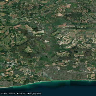
ARUN
- Saltwater
- Estuary
- Sq. miles
- 0.5
- Boat Ramps
- 0
- Access Points
- 0
- Campsites
- 0
The River Arun in West Sussex is a significant tidal river, navigable by paddlers from its mouth at Littlehampton inland to Pallingham Quay, a distance of over 25 miles. The character of the river changes dramatically along its length, offering varied experiences. The upper, non-tidal section around Pulborough and Stopham Bridge is slow, wide, and calm, winding through water meadows and tree-lined channels backed by the South Downs. This area is suitable for beginners, families, and self-led hire, with a peaceful, scenic vibe rich in wildlife like kingfishers and herons. In contrast, the tidal section from Littlehampton through Arundel is a powerful, fast-flowing environment with currents between 4-6 knots. This area is exposed to wind, features turbulent water around harbour bridge supports, and has significant boat traffic, making it suitable only for capable, experienced paddlers with proper safety equipment.
Critical trip planning revolves around the tide, which affects the river far inland. A common and recommended day trip is the one-way journey from Arundel to Pulborough, a distance of approximately 13 miles taking 3-5 hours, which requires careful timing with the tidal flow. Another popular circular route utilizes the tide for an upstream and downstream journey between the Black Rabbit pub in Arundel and Amberley, a round trip of about 9 miles. Paddlers are strongly advised to consult detailed tide tables, noting that high tide at inland points like Amberley occurs roughly two hours after high tide at Littlehampton. Launching and landing points are tide-dependent, with steps at sites like the Black Rabbit becoming more or less exposed.
Key access points include purpose-built facilities at Littlehampton (Surrey Street car park, BN17 5AW), the Black Rabbit pub steps in Arundel (BN18 9PB), various points around Pulborough and Stopham Bridge, and Pallingham Quay upstream. Commercial hire and launch services are available at Pulborough and Stopham Bridge. Hazards are concentrated in the lower, tidal reaches and include strong currents, turbulent overfalls, wind exposure, and boat traffic. The river mouth at Littlehampton can develop a surf zone and turbulent water on an outgoing tide. No paddling permits are required for the river itself, and the primary season for recreational paddling runs from March to October.
Water access, boat ramps & amenities
Learn how to get on ARUN. Uncover great paddling access points, boat ramps, and all the facilities you need for an unforgettable day on the water. Some locations shown may border or include private property. Always check property boundaries and applicable regulations before visiting. PaddleWays's Public & Private Land layer can help you plan your access with confidence.
Paddle smarter with real-time insights
Whether you're en route and conditions shift or you're looking for the best spot based on current flows, we enable you to make informed decisions on the fly.








Find Places to Paddle

Over 400,000 Places to Paddle
Every user gets free access to launch points, boat ramps, and public property parcels.


Tides, wind & water conditions (10 day forecast)
On open water, wind and tide matter as much as the weather. See the best times to paddle ARUN and check the marine forecast before you launch.
Loading tide predictions…
Paddling near ARUN
River Thames
River Lea

THAMES MIDDLE
River Brent
River Roding
THAMES LOWER
River Mole
River Darent
MEDWAY
River Colne
Explore England waters
Top paddling waters
No waters available right now.
Popular Cities
Loading popular cities...
Explore near ARUN

Smarter Paddling Starts in the App.
Paddleways gives you everything you need to plan smarter, paddle better, and own every trip from first launch to takeout.