OUSE
- Saltwater
- Estuary
OUSE
- Saltwater
- Estuary
- Sq. miles
- 0.4
- Boat Ramps
- 0
- Access Points
- 0
- Campsites
- 0
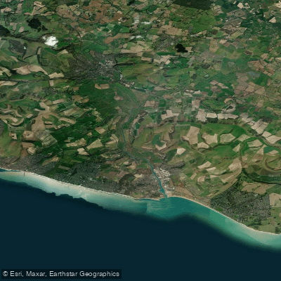
The River Ouse in East Sussex is a tidal estuary flowing into the English Channel at Newhaven. For paddlers, the key characteristic is the significant tidal influence below Barcombe Mills, which dictates trip planning. The river above Barcombe Mills is non-tidal, slow-moving, and picturesque, suitable for kayaks, canoes, and paddleboards. A popular and scenic day trip for all skill levels is the approximately 7km journey from Barcombe Mills upstream to Isfield Weir, passing the Anchor Inn pub which serves as a convenient rest stop. The section just below Barcombe Mills is very deep. Launching at Barcombe Mills involves a car park off the A26 near Lewes; from there, a track leads to a specific launching pool. For those venturing downstream on the tidal section, a common take-out point with a slipway and easy parking is at Southease Swing Bridge, approximately 9.5 miles from Barcombe. Continuing further to Newhaven Harbour is possible but the take-out there is difficult and the presence of large ships can be intimidating. Paddlers must carefully consult tide timetables for the Newhaven area, as the tide turns approximately three hours later at Barcombe. Paddling against the tidal flow on the lower river is quite hard work. Hazards are minimal but include anglers along the banks and a weir at Hamsey that requires portaging about 2.5 miles downstream from Barcombe. There is an access agreement with anglers stating canoeing should not occur above Hamsey on the first weekend after June 16th each year. The river environment is rich in wildlife, with frequent sightings of herons, swans, geese, and various insects. The overall experience offers a mix of peaceful, meandering countryside upstream and a faster, more exposed tidal journey downstream for those who time it correctly.
Water access, boat ramps & amenities
Learn how to get on OUSE. Uncover great paddling access points, boat ramps, and all the facilities you need for an unforgettable day on the water. Some locations shown may border or include private property. Always check property boundaries and applicable regulations before visiting. PaddleWays's Public & Private Land layer can help you plan your access with confidence.
Paddle smarter with real-time insights
Whether you're en route and conditions shift or you're looking for the best spot based on current flows, we enable you to make informed decisions on the fly.








Find Places to Paddle

Over 400,000 Places to Paddle
Every user gets free access to launch points, boat ramps, and public property parcels.


Tides, wind & water conditions (10 day forecast)
On open water, wind and tide matter as much as the weather. See the best times to paddle OUSE and check the marine forecast before you launch.
Loading tide predictions…
Paddling near OUSE
River Thames
River Lea
THAMES MIDDLE
River Brent
River Roding
THAMES LOWER
River Mole
River Darent
MEDWAY
River Colne
Explore England waters
Top paddling waters
No waters available right now.
Popular Cities
Loading popular cities...
Explore near OUSE

Smarter Paddling Starts in the App.
Paddleways gives you everything you need to plan smarter, paddle better, and own every trip from first launch to takeout.