Solent
- Saltwater
- Bay
Solent
- Saltwater
- Bay
- Sq. miles
- 100
- Boat Ramps
- 0
- Access Points
- 0
- Campsites
- 0
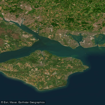
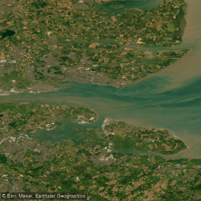
The Solent is a broad coastal channel separating the Isle of Wight from the mainland of southern England, varying in width from about one mile at its narrowest to several miles. It is a major marine thoroughfare, containing one of the busiest shipping channels in the United Kingdom. The paddling experience here is defined by significant tidal currents, considerable boat traffic, and open-water exposure, making it a serious environment suited primarily for experienced paddlers. The water is rarely still, often featuring chop and strong tides. Key hazards include navigating around container ships, ferries, and yachts, as well as the presence of several shingle banks. The area is exposed to wind, and conditions can change rapidly, requiring careful planning. A notable and popular challenge for skilled paddlers is the open-water crossing from locations like Hayling Island or Keyhaven to the Isle of Wight, specifically to Ryde. These crossings, which can be around 20 kilometers round trip, must be meticulously timed with the tides to assist the journey. There are no opportunities to land during the central portion of these crossings. Launches for such trips are made from specific points like West Beach Car Park on Hayling Island or the sea front at Lee-on-Solent, which offers free parking. For those circumnavigating the Isle of Wight, the north coast paddles along the edge of the Solent. The area is rich in maritime history, featuring Victorian sea forts situated in the middle of the channel. The regatta of Cowes Week, held in the Solent off Cowes each August, is one of the world's oldest and most respected sailing events, significantly increasing marine activity during that period. While the Solent itself is a demanding open-water area, the Isle of Wight coastline offers more sheltered family-friendly beaches suitable for paddleboarding, such as Colwell Bay, Bembridge Beach, and St Helens Beach, where equipment rentals are available.
Water access, boat ramps & amenities
Learn how to get on Solent. Uncover great paddling access points, boat ramps, and all the facilities you need for an unforgettable day on the water. Some locations shown may border or include private property. Always check property boundaries and applicable regulations before visiting. PaddleWays's Public & Private Land layer can help you plan your access with confidence.
Paddle smarter with real-time insights
Whether you're en route and conditions shift or you're looking for the best spot based on current flows, we enable you to make informed decisions on the fly.








Find Places to Paddle

Over 400,000 Places to Paddle
Every user gets free access to launch points, boat ramps, and public property parcels.


Tides, wind & water conditions (10 day forecast)
On open water, wind and tide matter as much as the weather. See the best times to paddle Solent and check the marine forecast before you launch.
Loading tide predictions…
Paddling near Solent
River Thames
River Lea
THAMES MIDDLE
River Brent
River Roding
THAMES LOWER
River Mole
River Darent
MEDWAY
River Colne
Explore England waters
Top paddling waters
No waters available right now.
Popular Cities
Loading popular cities...
Explore near Solent

Smarter Paddling Starts in the App.
Paddleways gives you everything you need to plan smarter, paddle better, and own every trip from first launch to takeout.